
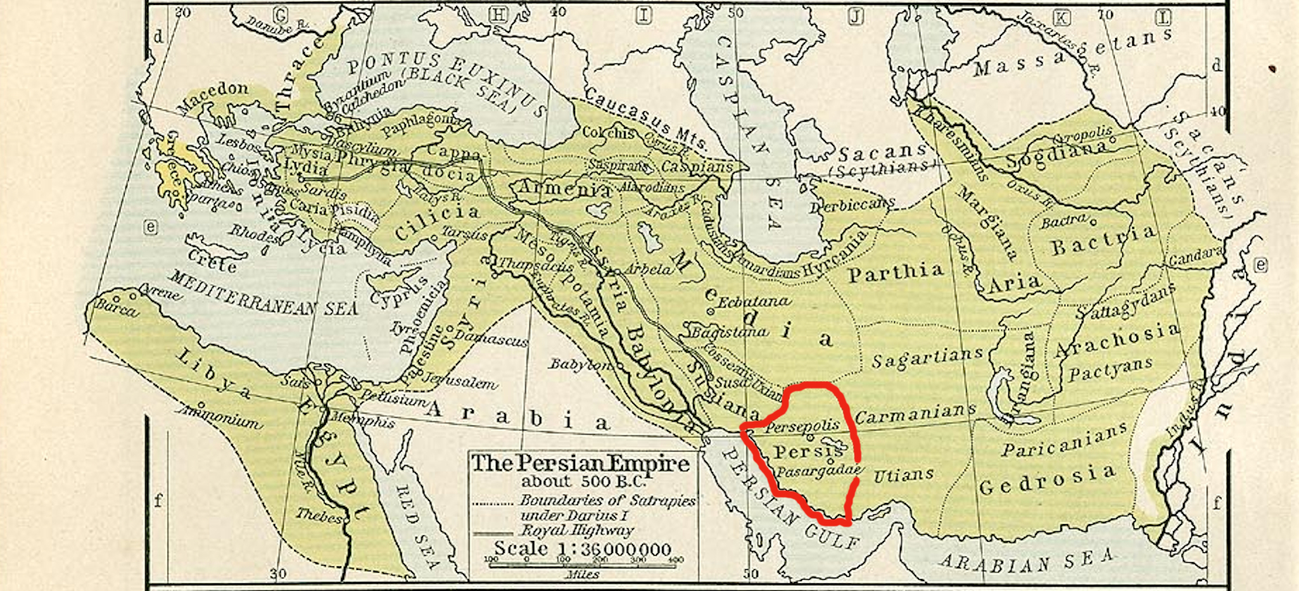
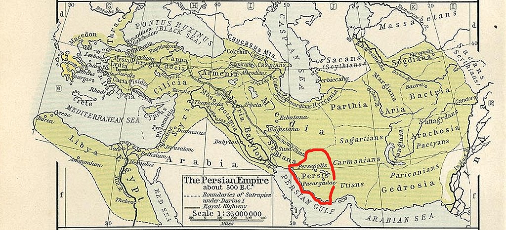
File:Persis map.jpg
Size of this preview: 800 × 364 pixels. Other resolutions: 320 × 146 pixels | 640 × 291 pixels | 1,024 × 466 pixels | 1,846 × 840 pixels.
Original file (1,846 × 840 pixels, file size: 1.48 MB, MIME type: image/jpeg)
| This is a file from the Wikimedia Commons. Information from its description page there is shown below. Commons is a freely licensed media file repository. You can help. |
Summary
| Description |
English: Persis map |
||||||||||||||||||||||
| Date | |||||||||||||||||||||||
| Source |
This file was derived from: The Persian Empire, about 500 BC - Historical Athlas - William R. Shepherd - Henry Holt and Company, 1911.png |
||||||||||||||||||||||
| Author |
|
||||||||||||||||||||||
Licensing
|
The author died in 1934, so this work is in the public domain in its country of origin and other countries and areas where the copyright term is the author's life plus 80 years or fewer. This work is in the public domain in the United States because it was published (or registered with the U.S. Copyright Office) before January 1, 1929. | |
| This file has been identified as being free of known restrictions under copyright law, including all related and neighboring rights. | |
File history
Click on a date/time to view the file as it appeared at that time.
| Date/Time | Thumbnail | Dimensions | User | Comment | |
|---|---|---|---|---|---|
| current | 06:57, 28 December 2018 | | 1,846 × 840 (1.48 MB) | पाटलिपुत्र | User created page with UploadWizard |
File usage
The following pages on the English Wikipedia use this file (pages on other projects are not listed):
Global file usage
The following other wikis use this file:
- Usage on bg.wikipedia.org
- Usage on ckb.wikipedia.org
- Usage on cs.wikipedia.org
- Usage on es.wikipedia.org
- Usage on fa.wikipedia.org
- Usage on id.wikipedia.org
- Usage on ru.wikipedia.org
- Usage on sk.wikipedia.org
- Usage on sl.wikipedia.org
- Usage on tr.wikipedia.org
- Usage on vi.wikipedia.org