
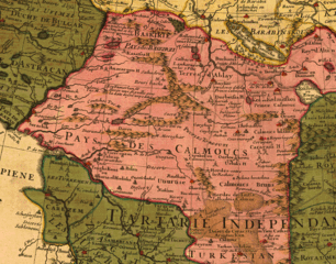
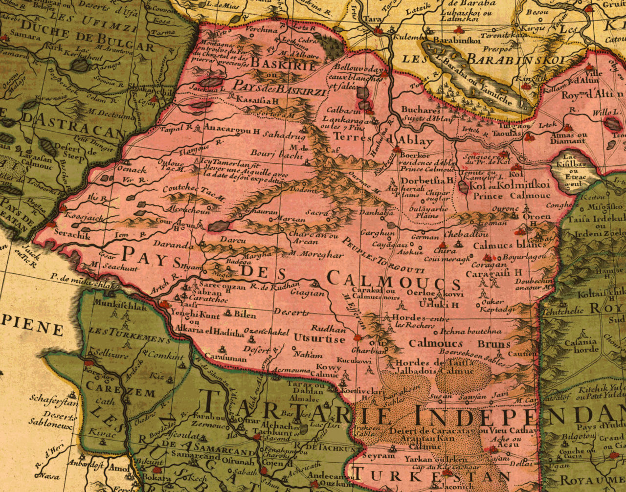
File:Pays des calmoucs.gif

Size of this preview: 763 × 600 pixels. Other resolutions: 306 × 240 pixels | 611 × 480 pixels | 977 × 768 pixels | 1,280 × 1,006 pixels | 2,560 × 2,012 pixels | 2,606 × 2,048 pixels.
Original file (2,606 × 2,048 pixels, file size: 1.96 MB, MIME type: image/gif)
| This is a file from the Wikimedia Commons. Information from its description page there is shown below. Commons is a freely licensed media file repository. You can help. |
Summary
| Description | Map fragment. The map itself is from Map Collection of the Library of Congress. | ||
| Date | |||
| Source |
|
||
| Author | L'Isle, Guillaume de, 1675-1726. | ||
| Permission (Reusing this file) |
No Copyright imposed on this map image because this map was published in 1706. |

Licensing
|
This is a faithful photographic reproduction of a two-dimensional, public domain work of art. The work of art itself is in the public domain for the following reason:
The official position taken by the Wikimedia Foundation is that "faithful reproductions of two-dimensional public domain works of art are public domain".
This photographic reproduction is therefore also considered to be in the public domain in the United States. In other jurisdictions, re-use of this content may be restricted; see Reuse of PD-Art photographs for details. | ||||
File history
Click on a date/time to view the file as it appeared at that time.
| Date/Time | Thumbnail | Dimensions | User | Comment | |
|---|---|---|---|---|---|
| current | 13:28, 7 April 2011 | | 2,606 × 2,048 (1.96 MB) | Lumu | full resolution |
| 03:59, 8 April 2006 |  | 640 × 480 (307 KB) | Calmouk | Map fragment. The map itself is from Map Collection of the Library of Congress. URL : http://memory.loc.gov/cgi-bin/query/S?ammem/gmd:@field(SUBJ+@od1(Russia--Siberia+)) No Copyright imposed on this map image because this map was published in 1706. Addi |
File usage
The following pages on the English Wikipedia use this file (pages on other projects are not listed):
Global file usage
The following other wikis use this file:
- Usage on arz.wikipedia.org
- Usage on azb.wikipedia.org
- Usage on ca.wikipedia.org
- Usage on cs.wikipedia.org
- Usage on de.wikipedia.org
- Usage on fr.wikipedia.org
- Usage on ky.wikipedia.org
- Usage on mn.wikipedia.org
- Usage on pt.wikipedia.org
- Usage on ru.wikipedia.org
- Usage on sr.wikipedia.org
- Usage on uk.wikipedia.org
- Usage on uz.wikipedia.org