
File:Parthasarathy Temple, Parthivapuram. Kanyakumari, Tamil Nadu - 5.jpg
Original file (3,910 × 2,932 pixels, file size: 3.97 MB, MIME type: image/jpeg)
| This is a file from the Wikimedia Commons. Information from its description page there is shown below. Commons is a freely licensed media file repository. You can help. |
Summary
| Description |
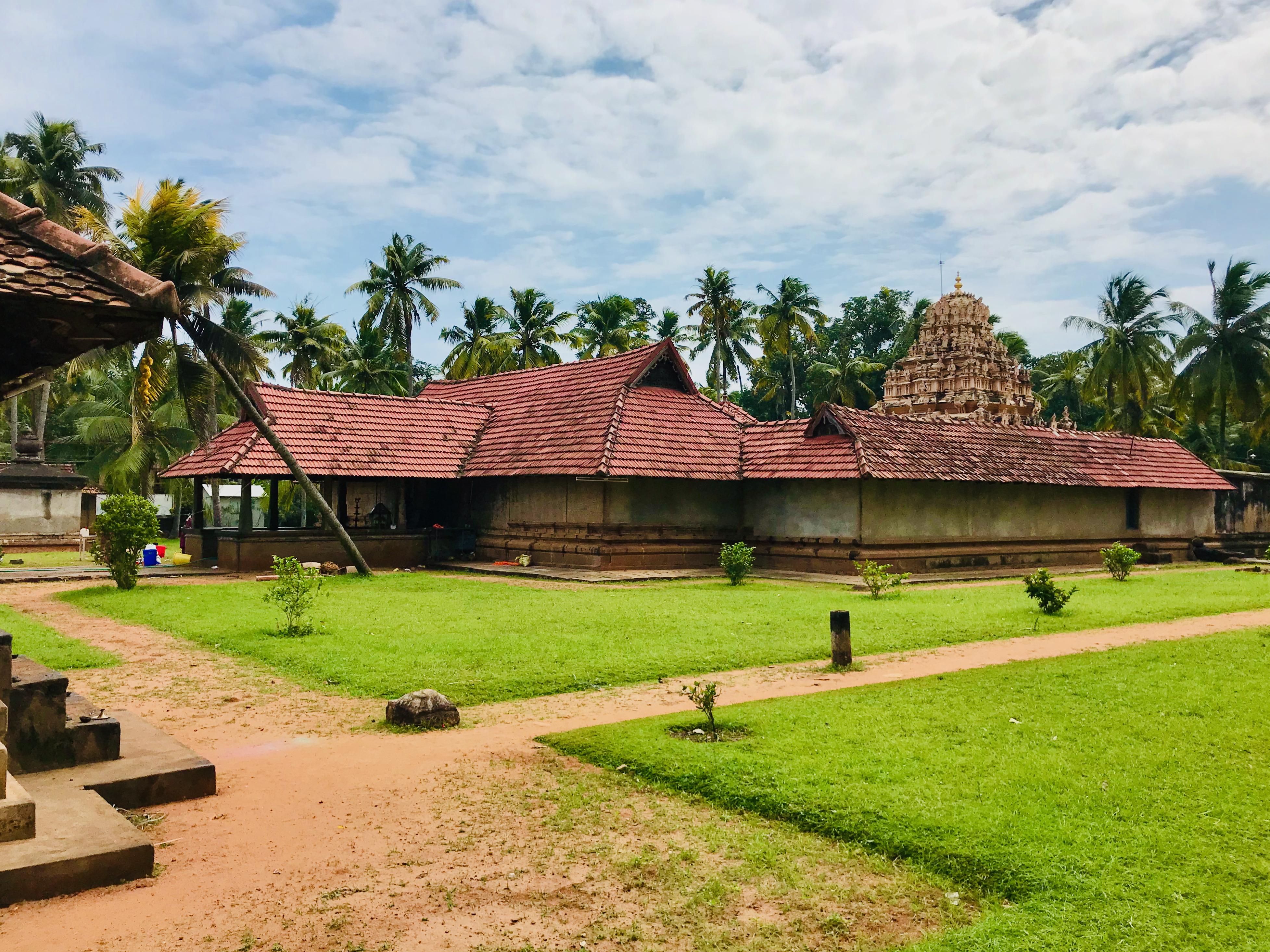
English: The 9th-century Parthasarathi temple was built by the Ay king Karunandadakkan. Now part of Tamil Nadu Kanyakumari District, the temple has Travancore and Kerala heritage. Dedicated to Vishnu, the temple illustrates the tritala sandhara vimana, one of numerous 1st millennium models for Hindu temple architecture.
On the vimana are reliefs, symbolic iconography and sculptures of Hindu gods and goddesses from the Vaishnava, Shaiva and Shakti traditions of Hinduism. Brahma, Vishnu and Shiva are the most prominent sculptures gracing the sanctum vimana. The temple is spread over about 2.5 acres and is built on a square plan from adhisthana to sikhara. The Adishtana is built from granite with mouldings. Inscriptions in Tamil language, Vattezhuthu script, are engraved on the north ledge of the outer base of the entrance. The pranala of the temple is a fluted shaft with curved lotusbud with a lion mouth (Simha Mukha). A seated bhutagana is below the pranala. The temple is unusual in that it faces west. It consists of standard Hindu shrine structures otherwise, such as a sanctum (garbhagriha), circumambulation path (pradakshina-patha) and a main mandapa (Mukha mandapa). It has several smaller shrines, likely added during the Chola period. In front is a namaskara mandapa and garuda with granite base and pyramidical roof. Above it is a classical sandhara vimana.
|
||
| Date | |||
| Source | Own work | ||
| Author | Ms Sarah Welch |
| Camera location | | View this and other nearby images on: OpenStreetMap |
|---|
Licensing
| This file is made available under the Creative Commons CC0 1.0 Universal Public Domain Dedication. | |
| The person who associated a work with this deed has dedicated the work to the public domain by waiving all of their rights to the work worldwide under copyright law, including all related and neighboring rights, to the extent allowed by law. You can copy, modify, distribute and perform the work, even for commercial purposes, all without asking permission.
|
File history
Click on a date/time to view the file as it appeared at that time.
| Date/Time | Thumbnail | Dimensions | User | Comment | |
|---|---|---|---|---|---|
| current | 04:24, 6 February 2021 | | 3,910 × 2,932 (3.97 MB) | Ms Sarah Welch | Uploaded own work with UploadWizard |
File usage
Global file usage
The following other wikis use this file:
- Usage on ne.wikipedia.org
- Usage on www.wikidata.org