
File:Panama location map.svg

Size of this PNG preview of this SVG file: 800 × 403 pixels. Other resolutions: 320 × 161 pixels | 640 × 323 pixels | 1,024 × 516 pixels | 1,280 × 645 pixels | 2,560 × 1,290 pixels | 1,246 × 628 pixels.
Original file (SVG file, nominally 1,246 × 628 pixels, file size: 327 KB)
| This is a file from the Wikimedia Commons. Information from its description page there is shown below. Commons is a freely licensed media file repository. You can help. |
Summary
| Description |
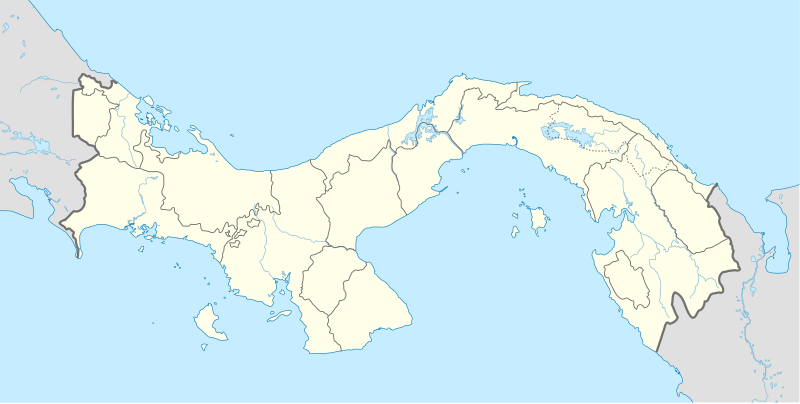
English: Location map of Panama
Equirectangular projection. Geographic limits of the map:
Deutsch: Positionskarte von Panama
Quadratische Plattkarte. Geographische Begrenzung der Karte:
|
| Date | |
| Source | Own work |
| Author | Alexrk |
| Other versions |
|


|
This map has been made or improved in the German Kartenwerkstatt (Map Lab). You can propose maps to improve as well.
|
Licensing
I, the copyright holder of this work, hereby publish it under the following licenses:

|
Permission is granted to copy, distribute and/or modify this document under the terms of the GNU Free Documentation License, Version 1.2 or any later version published by the Free Software Foundation; with no Invariant Sections, no Front-Cover Texts, and no Back-Cover Texts. A copy of the license is included in the section entitled GNU Free Documentation License. |
This file is licensed under the Creative Commons Attribution-Share Alike 3.0 Unported license.
- You are free:
- to share – to copy, distribute and transmit the work
- to remix – to adapt the work
- Under the following conditions:
- attribution – You must give appropriate credit, provide a link to the license, and indicate if changes were made. You may do so in any reasonable manner, but not in any way that suggests the licensor endorses you or your use.
- share alike – If you remix, transform, or build upon the material, you must distribute your contributions under the same or compatible license as the original.
You may select the license of your choice.
File history
Click on a date/time to view the file as it appeared at that time.
| Date/Time | Thumbnail | Dimensions | User | Comment | |
|---|---|---|---|---|---|
| current | 16:43, 28 December 2020 | | 1,246 × 628 (327 KB) | Milenioscuro | new comarca: Naso Tjerdi (created December 4, 2020) + improvements in limits of some provinces |
| 17:55, 1 January 2014 |  | 1,246 × 628 (296 KB) | NordNordWest | + Panama Oeste | |
| 16:24, 22 July 2009 |  | 1,246 × 628 (530 KB) | Alexrk2 | Admingrenzen verbessert | |
| 14:18, 19 July 2009 |  | 1,246 × 628 (528 KB) | Alexrk2 | Admingrenzen korrigiert, +Flüsse | |
| 17:27, 31 May 2009 |  | 1,246 × 628 (347 KB) | Alexrk | Update Admin-Grenzen | |
| 17:03, 31 May 2009 |  | 1,246 × 628 (331 KB) | Alexrk | + Panamakanal | |
| 16:42, 31 May 2009 |  | 1,246 × 628 (330 KB) | Alexrk | Farben korr | |
| 15:54, 31 May 2009 |  | 1,246 × 628 (331 KB) | Alexrk | {{Information |Description={{en|1=Location map of Panama Equirectangular projection. Geographic limits of the map: * N: 10.28° N * S: 6.79° N * W: 83.56° W * O: 76.64° W}} {{de|1=Positionskarte von Panama Quadratische Pla |
File usage
More than 100 pages use this file. The following list shows the first 100 pages that use this file only. A full list is available.
- 2003 UNCAF Nations Cup
- Achutupo
- Agua Buena
- Aguadulce, Coclé
- Ailigandí
- Alanje
- Albrook "Marcos A. Gelabert" International Airport
- Albrook Air Force Station
- Alcalde Díaz
- Almirante, Bocas del Toro
- Alto de la Estancia
- Alto del Espino
- Ancón, Panama
- Antón
- Arraiján
- Aserrío de Gariché
- Atalaya, Veraguas
- Balboa, Panama
- Barú District, Chiriquí
- Berbá
- Bisira
- Blockade of Porto Bello
- Boca de Parita
- Bocas Town, Bocas del Toro
- Bocas del Toro "Isla Colón" International Airport
- Bocas del Toro Province
- Boquete, Chiriquí
- Burica
- Bágala
- Caimitillo
- Calobre
- Calzada Larga
- Capellanía
- Capetí
- Capira
- Cartí Sugtupu
- Cativá
- Cañazas
- Celmira
- Cermeño
- Cerro Cama
- Cerro Punta, Chiriquí
- Chagres and Fort San Lorenzo
- Chame, Panama
- Changuinola
- Chepo, Panamá Province
- Chigoré
- Chiguirí Arriba
- Chilibre
- Chimán
- Chiriquí Grande
- Chitré
- Churuquita Chiquita
- Churuquita Grande
- Coetupo
- Coloncito, Panama
- Colón, Panama
- Contadora Island
- Cristóbal, Colón
- David, Chiriquí
- Divalá
- El Caño
- El Copé
- El Cortezo, Coclé
- El Cristo, Coclé
- El Espavé
- El Espino de Santa Rosa
- El Giral
- El Real de Santa María
- El Roble, Coclé
- El Silencio, Panama
- El Uvito
- El Valle de la Unión
- Enrique Malek International Airport
- Francis Hosier
- Gaigirgordub, Guna Yala
- Isla Grande
- La Chorrera, Panama
- La Ermita
- La Palma, Darién
- Las Tablas, Los Santos
- Liga Panameña de Fútbol
- Los Pozos, Herrera
- Natá, Coclé
- Nombre de Dios, Colón
- Nuevo Chagres
- Operation Acid Gambit
- Pedasí District
- Penonomé, Coclé
- Portobelo, Colón
- Ruben Cantu Airport
- San Miguelito District
- Santa Fe, Veraguas
- Santiago de Veraguas
- Soná, Panama
- Soná District
- Taboga, Panama
- Taboga Island
- Taborcillo
- Tocumen International Airport
View more links to this file.
Global file usage
The following other wikis use this file:
- Usage on af.wikipedia.org
- Usage on als.wikipedia.org
- Usage on an.wikipedia.org
- Usage on ar.wikipedia.org
- Usage on arz.wikipedia.org
- Usage on ast.wikipedia.org
- Ponte de les Amériques
- Canal de Panamá
- Ciudá de Panamá
- Módulu:Mapa de llocalización/datos/Panamá
- Módulu:Mapa de llocalización/datos/Panamá/usu
- Aeropuertu Internacional Enrique Malek
- Aeropuertu Internacional de Tocumen
- Puertu de Balboa
- Terminal Internacional de Manzanillo
- Terminal Internacional de PSA Panamá
- Usage on az.wikipedia.org
- Usage on ba.wikipedia.org
- Usage on be-tarask.wikipedia.org
- Usage on be.wikipedia.org
- Usage on bg.wikipedia.org
- Usage on bn.wikipedia.org
- Usage on bs.wikipedia.org
- Usage on ca.wikipedia.org
View more global usage of this file.