
File:Pan estate - 485371 - cropped.jpg
No higher resolution available.
Pan_estate_-_485371_-_cropped.jpg (422 × 303 pixels, file size: 32 KB, MIME type: image/jpeg)
| This is a file from the Wikimedia Commons. Information from its description page there is shown below. Commons is a freely licensed media file repository. You can help. |
| Description |
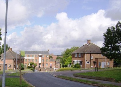
English: Pan estate, near to Newport, Isle of Wight, Great Britain.
The main road through the estate suburb of Newport called Pan. |
| Date | |
| Source |
This file was derived from: Pan estate - geograph.org.uk - 485371.jpg |
| Author | see below |
| Other versions |
 |
| Attribution (required by the license) | Graham Horn / Pan estate / |
| Camera location | | View this and other nearby images on: OpenStreetMap |
|---|
_heading:270.00&language=en)
| Object location | | View this and other nearby images on: OpenStreetMap |
|---|
_heading:270.00&language=en)
Licensing
This file is licensed under the Creative Commons Attribution-Share Alike 2.0 Generic license.
Attribution: Graham Horn
- You are free:
- to share – to copy, distribute and transmit the work
- to remix – to adapt the work
- Under the following conditions:
- attribution – You must give appropriate credit, provide a link to the license, and indicate if changes were made. You may do so in any reasonable manner, but not in any way that suggests the licensor endorses you or your use.
- share alike – If you remix, transform, or build upon the material, you must distribute your contributions under the same or compatible license as the original.

|
This file was moved to Wikimedia Commons from en.wikipedia using a bot script. All source information is still present. It requires review. Additionally, there may be errors in any or all of the information fields; information on this file should not be considered reliable and the file should not be used until it has been reviewed and any needed corrections have been made. Once the review has been completed, this template should be removed. For details about this file, see below. Check now! |
Original upload log
The original description page was here. All following user names refer to en.wikipedia.
- 2007-10-03 19:17 Bashereyre 422×303× (32957 bytes) Photo taken by Graham Horn on 17th June 2007 for "Photograph every grid square" and released via Creative Commons on 4th July that year.
File history
Click on a date/time to view the file as it appeared at that time.
| Date/Time | Thumbnail | Dimensions | User | Comment | |
|---|---|---|---|---|---|
| current | 02:44, 18 April 2010 | | 422 × 303 (32 KB) | File Upload Bot (Magnus Manske) | {{BotMoveToCommons|en.wikipedia|year={{subst:CURRENTYEAR}}|month={{subst:CURRENTMONTHNAME}}|day={{subst:CURRENTDAY}}}} {{Information |Description={{en|Photo taken by Graham Horn on 17th June 2007 for "Photograph every grid square" and released via Creati |
File usage
The following pages on the English Wikipedia use this file (pages on other projects are not listed):
Global file usage
The following other wikis use this file:
- Usage on www.wikidata.org