
File:Pac-12 Conference states.svg

Size of this PNG preview of this SVG file: 800 × 507 pixels. Other resolutions: 320 × 203 pixels | 640 × 405 pixels | 1,024 × 648 pixels | 1,280 × 811 pixels | 2,560 × 1,621 pixels | 927 × 587 pixels.
Original file (SVG file, nominally 927 × 587 pixels, file size: 67 KB)
| This is a file from the Wikimedia Commons. Information from its description page there is shown below. Commons is a freely licensed media file repository. You can help. |
Template:Pac-12 Conference Map.svg
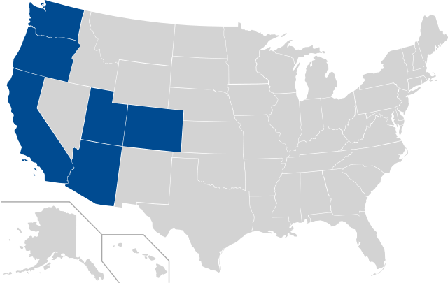
| Description | This is a vectorized map of states with en:Pac-10 schools (and expansion schools); |
| Date | (UTC) |
| Source | Derived fromPac_10_USA_states.svg; map of states with en:Pac-10 schools |
| Author | derivative work: Pac_10_USA_states.svg |
| This is a retouched picture, which means that it has been digitally altered from its original version. Modifications: Added CO and UT. The original can be viewed here: Pac 10 USA states.svg:
|
I, the copyright holder of this work, hereby publish it under the following license:
| I, the copyright holder of this work, release this work into the public domain. This applies worldwide. In some countries this may not be legally possible; if so: I grant anyone the right to use this work for any purpose, without any conditions, unless such conditions are required by law. |
Original upload log
This image is a derivative work of the following images:
- File:Pac_10_USA_states.svg licensed with PD-self
- 2007-11-22T21:28:52Z Mcmillin24 1051x725 (123824 Bytes) {{Information |Description=This is a vectorized version of [[:en::Image:Pac_10_USA_states.png]] |Source=Derived from [[:en::Image:BlankMap-USA-states.PNG]]; map of states with [[:en:Pac-10]] schools (and their division); |Dat
Uploaded with derivativeFX
File history
Click on a date/time to view the file as it appeared at that time.
| Date/Time | Thumbnail | Dimensions | User | Comment | |
|---|---|---|---|---|---|
| current | 00:05, 6 June 2016 | | 927 × 587 (67 KB) | Corkythehornetfan | fixed right side |
| 01:26, 15 February 2016 |  | 959 × 593 (81 KB) | Corkythehornetfan | remove some unneeded coding // Editing SVG source code using User:Rillke/SVGedit.js; upload handled by User:Rillke/MwJSBot.js | |
| 22:53, 13 February 2016 |  | 959 × 593 (81 KB) | Corkythehornetfan | updated map to transparent/colors // Editing SVG source code using User:Rillke/SVGedit.js; upload handled by User:Rillke/MwJSBot.js | |
| 07:54, 1 July 2011 |  | 841 × 580 (66 KB) | CASportsFan | Colorado and Utah are now full members. | |
| 04:37, 17 June 2010 |  | 841 × 580 (66 KB) | Bradwilkins | {{Information |Description=This is a vectorized map of states with en:Pac-10 schools (and expansion schools); |Source=Derived fromFile:Pac_10_USA_states.svg; map of states with en:Pac-10 schools |Date=2010-06-17 04:28 (UTC) |Author=[[User:Bradwilkin |
File usage
The following pages on the English Wikipedia use this file (pages on other projects are not listed):
Global file usage
The following other wikis use this file:
- Usage on de.wikipedia.org
- Usage on es.wikipedia.org
- Usage on fa.wikipedia.org
- Usage on fr.wikipedia.org
- Usage on it.wikipedia.org
- Usage on ja.wikipedia.org
- Usage on pl.wikipedia.org
- Usage on pt.wikipedia.org
- Usage on ru.wikipedia.org
- Usage on sv.wikipedia.org
- Usage on zh.wikipedia.org