
File:PA 84 quad in Piatt.jpg
No higher resolution available.
PA_84_quad_in_Piatt.jpg (715 × 509 pixels, file size: 116 KB, MIME type: image/jpeg)
| This is a file from the Wikimedia Commons. Information from its description page there is shown below. Commons is a freely licensed media file repository. You can help. |
Summary
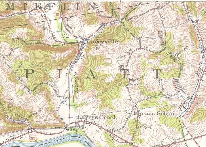
| Description | A United States Geological Survey Topographic Quadrangle marking the southernmost stretch of Pennsylvania Route 84 (now Pennsylvania Route 287) from Larrysville to Larrys Creek in 1953. |
| Date | |
| Source | Williamsport NW quadrangle |
| Author | United States Geological Survey |
Licensing
This image is in the public domain in the United States because it only contains materials that originally came from the United States Geological Survey, an agency of the United States Department of the Interior. For more information, see the official USGS copyright policy.
|
File history
Click on a date/time to view the file as it appeared at that time.
| Date/Time | Thumbnail | Dimensions | User | Comment | |
|---|---|---|---|---|---|
| current | 12:43, 22 July 2009 | | 715 × 509 (116 KB) | Mitchazenia | {{Information |Description=A United States Geological Survey Topographic Quadrangle marking the southernmost stretch of Pennsylvania Route 84 (now Pennsylvania Route 287) from Larrysville to Larrys Creek in 1953. |Source=[http://historical.mytopo.com/getI |
File usage
The following pages on the English Wikipedia use this file (pages on other projects are not listed):
Global file usage
The following other wikis use this file:
- Usage on lv.wikipedia.org