
File:Outline Map of Novgorod Oblast.svg

Size of this PNG preview of this SVG file: 512 × 403 pixels. Other resolutions: 305 × 240 pixels | 610 × 480 pixels | 976 × 768 pixels | 1,280 × 1,008 pixels | 2,560 × 2,015 pixels.
Original file (SVG file, nominally 512 × 403 pixels, file size: 308 KB)
| This is a file from the Wikimedia Commons. Information from its description page there is shown below. Commons is a freely licensed media file repository. You can help. |
Summary
| Description |
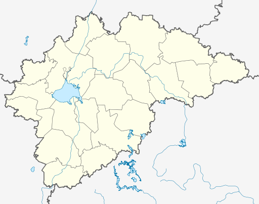
Русский: Позиционная карта Новгородской области
|top = 59.6 |bottom = 56.7 |left = 29.5 |right = 36.5 |
| Date | |
| Source |
Own work This W3C-unspecified vector image was created with Inkscape . |
| Author | Виктор В |
| Other versions |
Derivative works of this file: Numbered Map of Novgorod Oblast.png [] |


Licensing
This file is licensed under the Creative Commons Attribution-Share Alike 2.0 Generic license.
- You are free:
- to share – to copy, distribute and transmit the work
- to remix – to adapt the work
- Under the following conditions:
- attribution – You must give appropriate credit, provide a link to the license, and indicate if changes were made. You may do so in any reasonable manner, but not in any way that suggests the licensor endorses you or your use.
- share alike – If you remix, transform, or build upon the material, you must distribute your contributions under the same or compatible license as the original.
File history
Click on a date/time to view the file as it appeared at that time.
| Date/Time | Thumbnail | Dimensions | User | Comment | |
|---|---|---|---|---|---|
| current | 06:35, 5 September 2010 | | 512 × 403 (308 KB) | Виктор В | == {{int:filedesc}} == {{Information |Description={{ru|1=Позиционная карта Новгородской области *Проекция — равноугольная. *Стандартная параллель — 58°12′00″с.ш. *Па� |
File usage
The following pages on the English Wikipedia use this file (pages on other projects are not listed):
- 2014 Winter Olympics torch relay
- Abramkovo
- Abrosovo, Novgorod Oblast
- Batetsky (rural locality)
- Bolshaya Vishera
- Borovichi
- Chudovo, Chudovsky District, Novgorod Oblast
- Demyansk
- Dolgiye Borody (rural locality)
- Grigorovo, Novgorod Oblast
- Kholm, Kholmsky District, Novgorod Oblast
- Khvoynaya, Khvoyninsky District, Novgorod Oblast
- Krechevitsy Airport
- Kresttsy, Krestetsky District, Novgorod Oblast
- Kulotino, Novgorod Oblast
- Lyubytino
- Malaya Vishera
- Maryovo
- Moshenskoye, Novgorod Oblast
- Nebolchi
- Northwestern Federal District
- Novgorod Airport
- Okulovka (town), Novgorod Oblast
- Pankovka
- Parfino
- Pestovo, Pestovsky District, Novgorod Oblast
- Poddorye
- Proletariy
- Shimsk
- Soltsy
- Soltsy-2 (air base)
- Staraya Russa
- Uglovka, Novgorod Oblast
- Valday, Novgorod Oblast
- Veliky Novgorod
- Volot, Volot Settlement, Volotovsky District, Novgorod Oblast
- Yazhelbitsy
- Module:Location map/data/Russia Novgorod Oblast
- Module:Location map/data/Russia Novgorod Oblast/doc
Global file usage
The following other wikis use this file:
- Usage on af.wikipedia.org
- Usage on ar.wikipedia.org
- Usage on azb.wikipedia.org
- Usage on be.wikipedia.org
- Usage on bg.wikipedia.org
- Usage on ceb.wikipedia.org
- Usage on ce.wikipedia.org
- Сийлахь-йоккха Новгород
- Бельково (Мошенскан кӀошт)
- Кеп:Меттиган карта Росси Новгородан область
- Антипово (Батецкан кӀошт)
- Батецки
- Батецко
- Бахарино
- Бели (Батецкан кӀошт)
- Йоккха Удри
- Большой Селищи
- Йоккха Ясковици
- Йоккха Войново
- Большой Волок
- Большой Латовец
- Большой Теребец
- Бор (Мойкан йуьртан меттиг)
- Бор (Передольскан йуьртан меттиг)
- Борки (Батецкан кӀошт)
- Борок (Батецкан кӀошт)
- Брод (Батецкан кӀошт)
- Будыни
- Велегощи
- Велеши
- Витци
- Вольни Горка
- Вольни Загорье
- Вольни Кусони
View more global usage of this file.