
File:One of the paths traversing Lower Wood Nature Reserve - geograph.org.uk - 1614916.jpg
No higher resolution available.
One_of_the_paths_traversing_Lower_Wood_Nature_Reserve_-_geograph.org.uk_-_1614916.jpg (640 × 536 pixels, file size: 227 KB, MIME type: image/jpeg)
| This is a file from the Wikimedia Commons. Information from its description page there is shown below. Commons is a freely licensed media file repository. You can help. |
Summary
| Description |
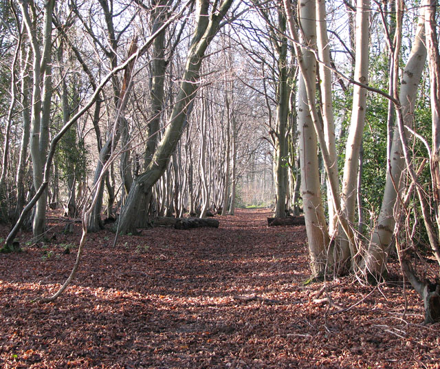
English: One of the paths traversing Lower Wood Nature Reserve. Lower Wood has existed since the end of the last ice age. It is recorded in the Domesday book and has supplied the local population with timber for hundreds of years up until the 1970s. A legacy of the wood's working past are the many coppiced trees > 1614914 - 1614970 dating from the times when ash poles were supplied to a brush-making factory in nearby Wymondham. The woodland is also one of the best places in Norfolk to see hornbeam trees (Carpinus betulus) > 1614949. The sycamores that grow here are in the process of being removed - they are not native to the UK and threaten plant growth on the woodland floor. The 37 hectares of ancient coppice and woodland > 1614907 are now a nature reserve and SSSI, managed by the Norfolk Wildlife Trust and traversed by a number of tracks and paths. |
| Date | |
| Source | From geograph.org.uk |
| Author | Evelyn Simak |
| Attribution (required by the license) | Evelyn Simak / One of the paths traversing Lower Wood Nature Reserve / |
| Camera location | | View this and other nearby images on: OpenStreetMap |
|---|
_heading:270.00&language=en)
| Object location | | View this and other nearby images on: OpenStreetMap |
|---|
_heading:270.00&language=en)
Licensing

|
This image was taken from the Geograph project collection. See this photograph's page on the Geograph website for the photographer's contact details. The copyright on this image is owned by Evelyn Simak and is licensed for reuse under the Creative Commons Attribution-ShareAlike 2.0 license.
|
This file is licensed under the Creative Commons Attribution-Share Alike 2.0 Generic license.
Attribution: Evelyn Simak
- You are free:
- to share – to copy, distribute and transmit the work
- to remix – to adapt the work
- Under the following conditions:
- attribution – You must give appropriate credit, provide a link to the license, and indicate if changes were made. You may do so in any reasonable manner, but not in any way that suggests the licensor endorses you or your use.
- share alike – If you remix, transform, or build upon the material, you must distribute your contributions under the same or compatible license as the original.
File history
Click on a date/time to view the file as it appeared at that time.
| Date/Time | Thumbnail | Dimensions | User | Comment | |
|---|---|---|---|---|---|
| current | 10:23, 4 March 2011 | | 640 × 536 (227 KB) | GeographBot | == {{int:filedesc}} == {{Information |description={{en|1=One of the paths traversing Lower Wood Nature Reserve Lower Wood has existed since the end of the last ice age. It is recorded in the Domesday book and has supplied the local population with timber |
File usage
The following pages on the English Wikipedia use this file (pages on other projects are not listed):