
File:Old Street Roundabout - geograph.org.uk - 1758354.jpg
Size of this preview: 800 × 600 pixels. Other resolutions: 320 × 240 pixels | 640 × 480 pixels | 1,024 × 768 pixels | 1,280 × 960 pixels.
Original file (1,280 × 960 pixels, file size: 167 KB, MIME type: image/jpeg)
| This is a file from the Wikimedia Commons. Information from its description page there is shown below. Commons is a freely licensed media file repository. You can help. |
Summary
| Description |
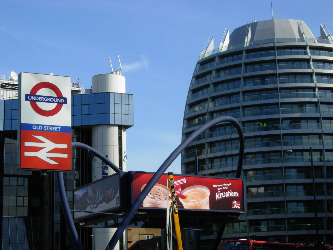
English: Old Street Roundabout This location, where Old Street crosses City Road, is a 'development hotspot' on the northern fringe of the City. In this view the modernistic Inmarsat Building and one of the egg-shaped Bezier Development blocks can be seen. In the centre of the roundabout the double arch structure that supports advertising hoardings was designed by Hanscomb Davies and erected in 1993. Old Street station is served by the Northern Line and by National Rail services to and from Moorgate. |
| Date | |
| Source | From geograph.org.uk |
| Author | Stephen McKay |
| Attribution (required by the license) | Stephen McKay / Old Street Roundabout / |
| Camera location | | View this and other nearby images on: OpenStreetMap |
|---|
_heading:112.00&language=en)
| Object location | | View this and other nearby images on: OpenStreetMap |
|---|
_heading:112.00&language=en)
Licensing

|
This image was taken from the Geograph project collection. See this photograph's page on the Geograph website for the photographer's contact details. The copyright on this image is owned by Stephen McKay and is licensed for reuse under the Creative Commons Attribution-ShareAlike 2.0 license.
|
This file is licensed under the Creative Commons Attribution-Share Alike 2.0 Generic license.
Attribution: Stephen McKay
- You are free:
- to share – to copy, distribute and transmit the work
- to remix – to adapt the work
- Under the following conditions:
- attribution – You must give appropriate credit, provide a link to the license, and indicate if changes were made. You may do so in any reasonable manner, but not in any way that suggests the licensor endorses you or your use.
- share alike – If you remix, transform, or build upon the material, you must distribute your contributions under the same or compatible license as the original.
File history
Click on a date/time to view the file as it appeared at that time.
| Date/Time | Thumbnail | Dimensions | User | Comment | |
|---|---|---|---|---|---|
| current | 23:47, 5 March 2011 | | 1,280 × 960 (167 KB) | GeographBot | == {{int:filedesc}} == {{Information |description={{en|1=Old Street Roundabout This location, where Old Street crosses City Road, is a 'development hotspot' on the northern fringe of the City. In this view the modernistic Inmarsat Building and one of the |
File usage
No pages on the English Wikipedia use this file (pages on other projects are not listed).
Global file usage
The following other wikis use this file:
- Usage on ur.wikipedia.org