
File:OSPAR Commission area map.svg

Size of this PNG preview of this SVG file: 555 × 600 pixels. Other resolutions: 222 × 240 pixels | 444 × 480 pixels | 710 × 768 pixels | 947 × 1,024 pixels | 1,894 × 2,048 pixels | 740 × 800 pixels.
Original file (SVG file, nominally 740 × 800 pixels, file size: 202 KB)
| This is a file from the Wikimedia Commons. Information from its description page there is shown below. Commons is a freely licensed media file repository. You can help. |
Summary
| Description |
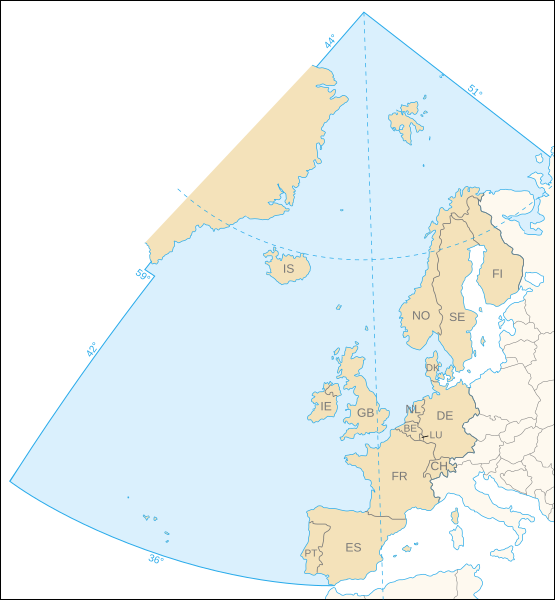
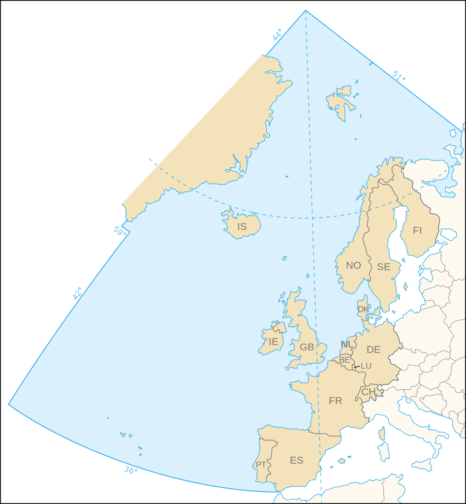
English: Map of the marine area and the 15 contracting parties of the OSPAR Commission for the protection of the marine environment of the North-East Atlantic.
Français : Carte de la zone maritime et des 15 pays signataires de la Commission OSPAR pour la protection du milieu marin de l'Atlantique du nord-est. |
||
| Date | |||
| Source | Own work, based upon the map (corrected following the article 1 of the 1992 OSPAR Convention) available on the OSPAR Commission's site | ||
| Author | Eric Gaba (Sting - fr:Sting) | ||
| Permission (Reusing this file) |
|
Licensing
I, the copyright holder of this work, hereby publish it under the following license:
This file is licensed under the Creative Commons Attribution-Share Alike 2.5 Generic license.
- You are free:
- to share – to copy, distribute and transmit the work
- to remix – to adapt the work
- Under the following conditions:
- attribution – You must give appropriate credit, provide a link to the license, and indicate if changes were made. You may do so in any reasonable manner, but not in any way that suggests the licensor endorses you or your use.
- share alike – If you remix, transform, or build upon the material, you must distribute your contributions under the same or compatible license as the original.
File history
Click on a date/time to view the file as it appeared at that time.
| Date/Time | Thumbnail | Dimensions | User | Comment | |
|---|---|---|---|---|---|
| current | 21:44, 9 November 2006 | | 740 × 800 (202 KB) | Sting | White background |
| 21:31, 9 November 2006 |  | 740 × 800 (202 KB) | Sting | {{Information| |Description=Map of the marine area and the 15 contracting parties of the OSPAR Commission for the protection of the marine environment of the North-East Atlantic |Source=Own work, based upon [http://www.ospar.org/eng/html/welcome.html the |
File usage
The following pages on the English Wikipedia use this file (pages on other projects are not listed):
Global file usage
The following other wikis use this file:
- Usage on ast.wikipedia.org
- Usage on ca.wikipedia.org
- Usage on cs.wikipedia.org
- Usage on da.wikipedia.org
- Usage on de.wikipedia.org
- Usage on de.wiktionary.org
- Usage on es.wikipedia.org
- Usage on fr.wikipedia.org
- Usage on gl.wikipedia.org
- Usage on nl.wikipedia.org
- Usage on no.wikipedia.org
- Usage on pt.wikipedia.org
- Usage on sk.wikipedia.org
- Usage on sv.wikipedia.org