
File:Nome Beach map.PNG
No higher resolution available.
Nome_Beach_map.PNG (703 × 576 pixels, file size: 183 KB, MIME type: image/png)
| This is a file from the Wikimedia Commons. Information from its description page there is shown below. Commons is a freely licensed media file repository. You can help. |
Summary
| Description |
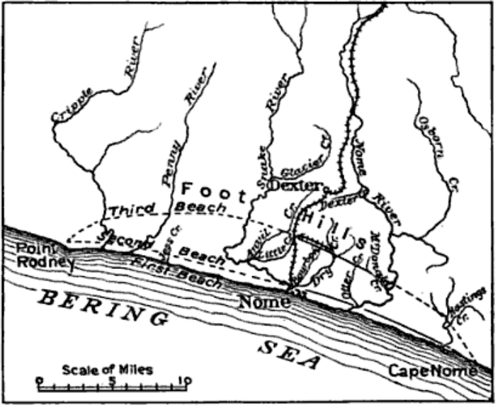
English: Sketch map of Nome, Alaska region showing the first, second and third beach lines, also creeks and railroad |
| Date | |
| Source | Through the Yukon and Alaska, Mining and Scientific Press p343 [1] |
| Author | Thomas Arthur Rickard, |
Licensing
This media file is in the public domain in the United States. This applies to U.S. works where the copyright has expired, often because its first publication occurred prior to January 1, 1929, and if not then due to lack of notice or renewal. See this page for further explanation.
|
 | |
 |
This image might not be in the public domain outside of the United States; this especially applies in the countries and areas that do not apply the rule of the shorter term for US works, such as Canada, Mainland China (not Hong Kong or Macao), Germany, Mexico, and Switzerland. The creator and year of publication are essential information and must be provided. See Wikipedia:Public domain and Wikipedia:Copyrights for more details.
|
File history
Click on a date/time to view the file as it appeared at that time.
| Date/Time | Thumbnail | Dimensions | User | Comment | |
|---|---|---|---|---|---|
| current | 15:53, 6 December 2009 | | 703 × 576 (183 KB) | Dankarl | {{Information |Description={{en|1=Sketch map of Nome, Alaska region showing the first, second and third beach lines, also creeks and railroad}} |Source=Through the Yukon and Alaska, Mining and Scientific Press p343 [http://books.google.com/books?id=lPIMA |
File usage
The following pages on the English Wikipedia use this file (pages on other projects are not listed):