
File:Nigeria 1960-1963.png
Size of this preview: 676 × 600 pixels. Other resolutions: 271 × 240 pixels | 541 × 480 pixels | 866 × 768 pixels | 1,154 × 1,024 pixels | 1,869 × 1,658 pixels.
Original file (1,869 × 1,658 pixels, file size: 90 KB, MIME type: image/png)
| This is a file from the Wikimedia Commons. Information from its description page there is shown below. Commons is a freely licensed media file repository. You can help. |

|
This historical map image could be re-created using vector graphics as an SVG file. This has several advantages; see Commons:Media for cleanup for more information. If an SVG form of this image is available, please upload it and afterwards replace this template with
{{vector version available|new image name}}.
It is recommended to name the SVG file “Nigeria 1960-1963.svg”—then the template Vector version available (or Vva) does not need the new image name parameter. |
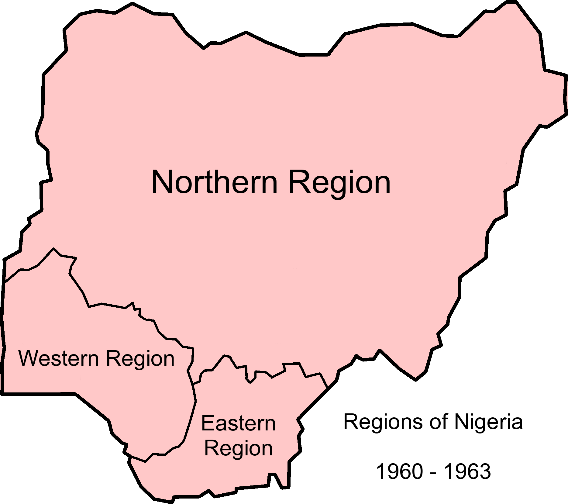
| Description | Map of Nigerian regions, 1960-1963. Info from http://www.statoids.com/ung.html, http://www.zum.de/whkmla/region/westafrica/nigeriaind.html and http://hdl.loc.gov/loc.gmd/g8840.ct003019 |
| Date | (UTC) |
| Source | |
| Author |
|
This file is licensed under the Creative Commons Attribution-Share Alike 3.0 Unported license.
- You are free:
- to share – to copy, distribute and transmit the work
- to remix – to adapt the work
- Under the following conditions:
- attribution – You must give appropriate credit, provide a link to the license, and indicate if changes were made. You may do so in any reasonable manner, but not in any way that suggests the licensor endorses you or your use.
- share alike – If you remix, transform, or build upon the material, you must distribute your contributions under the same or compatible license as the original.
Original upload log
This image is a derivative work of the following images:
- File:Nigeria_1963-1967.png licensed with Cc-by-sa-3.0-migrated, GFDL
- 2010-12-09T12:52:32Z StalwartUK 1869x1658 (103207 Bytes) {{Information |Description=Map of Nigerian regions, 1963-1967. Info from http://www.statoids.com/ung.html, http://www.zum.de/whkmla/region/westafrica/nigeriaind.html and http://hdl.loc.gov/loc.gmd/g8840.ct003019 |Source=*[[:F
- File:Nigeria_states-1967-1976.png licensed with Cc-by-sa-3.0-migrated, GFDL
- 2010-04-21T21:32:04Z Bejnar 1869x1658 (140363 Bytes) {{Information |Description=Map of Nigerian states, 1967 - 1976, from data from United States Geological Survey, Africa Data Dissemination Service. |Source=*[[:File:Nigeria_states-1976-1987.png|]] |Date=2010-04-21 21:30 (UTC)
Uploaded with derivativeFX
File history
Click on a date/time to view the file as it appeared at that time.
| Date/Time | Thumbnail | Dimensions | User | Comment | |
|---|---|---|---|---|---|
| current | 12:57, 9 December 2010 | | 1,869 × 1,658 (90 KB) | StalwartUK | {{Information |Description=Map of Nigerian regions, 1960-1963. Info from http://www.statoids.com/ung.html, http://www.zum.de/whkmla/region/westafrica/nigeriaind.html and http://hdl.loc.gov/loc.gmd/g8840.ct003019 |Source=*File:Nigeria_1963-1967.png * |
File usage
The following pages on the English Wikipedia use this file (pages on other projects are not listed):
Global file usage
The following other wikis use this file:
- Usage on bn.wikipedia.org
- Usage on ca.wikipedia.org
- Usage on de.wikipedia.org
- Usage on eo.wikipedia.org
- Usage on es.wikipedia.org
- Usage on et.wikipedia.org
- Usage on ha.wikipedia.org
- Usage on hy.wikipedia.org
- Usage on incubator.wikimedia.org
- Usage on ja.wikipedia.org
- Usage on vi.wikipedia.org
- Usage on zh.wikipedia.org