
File:Ngari map.svg

Size of this PNG preview of this SVG file: 800 × 557 pixels. Other resolutions: 320 × 223 pixels | 640 × 446 pixels | 1,024 × 713 pixels | 1,280 × 892 pixels | 2,560 × 1,784 pixels | 1,520 × 1,059 pixels.
Original file (SVG file, nominally 1,520 × 1,059 pixels, file size: 189 KB)
| This is a file from the Wikimedia Commons. Information from its description page there is shown below. Commons is a freely licensed media file repository. You can help. |
Summary
| Description |
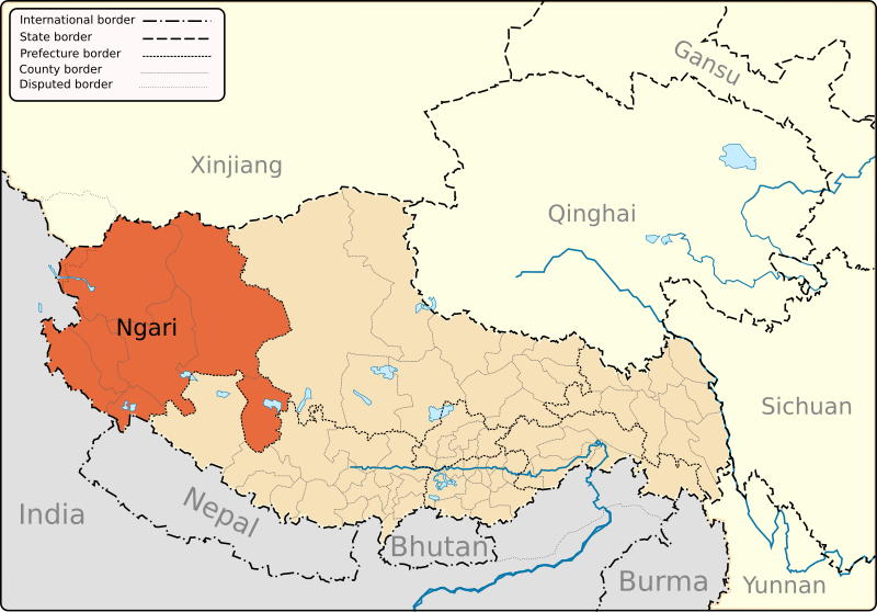
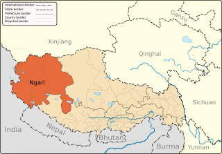
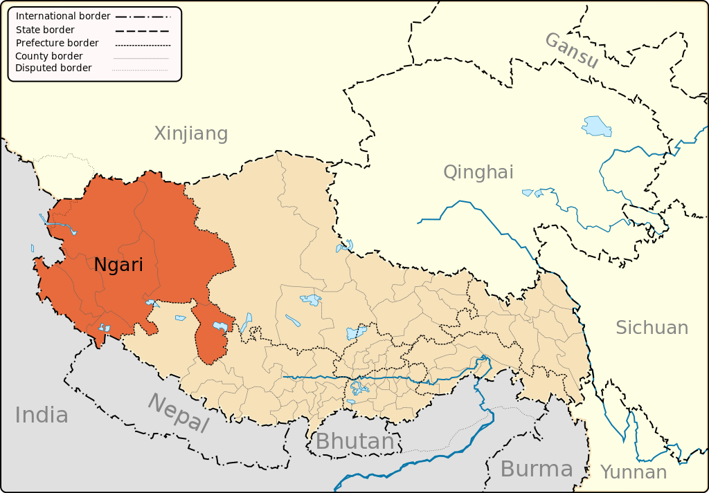
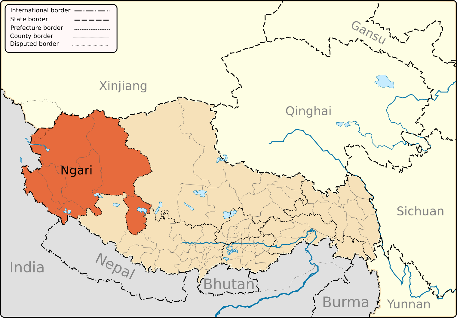
English: A map of the administrative boundaries of The Tibet Autonomous Region with Ngari (aka Ali) Prefecture highlighted. |
| Date | |
| Source | Own work |
| Author | Keithonearth |
| Other versions |
|
| SVG development |


Licensing
I, the copyright holder of this work, hereby publish it under the following licenses:
This file is licensed under the Creative Commons Attribution-Share Alike 3.0 Unported license.
- You are free:
- to share – to copy, distribute and transmit the work
- to remix – to adapt the work
- Under the following conditions:
- attribution – You must give appropriate credit, provide a link to the license, and indicate if changes were made. You may do so in any reasonable manner, but not in any way that suggests the licensor endorses you or your use.
- share alike – If you remix, transform, or build upon the material, you must distribute your contributions under the same or compatible license as the original.

|
Permission is granted to copy, distribute and/or modify this document under the terms of the GNU Free Documentation License, Version 1.2 or any later version published by the Free Software Foundation; with no Invariant Sections, no Front-Cover Texts, and no Back-Cover Texts. A copy of the license is included in the section entitled GNU Free Documentation License. |
You may select the license of your choice.
File history
Click on a date/time to view the file as it appeared at that time.
| Date/Time | Thumbnail | Dimensions | User | Comment | |
|---|---|---|---|---|---|
| current | 20:14, 12 March 2013 | | 1,520 × 1,059 (189 KB) | Keithonearth | fixing Ngari/Shigatse prefecture boundary as pointed out by user:Fhah4 [http://en.wikipedia.org/w/index.php?title=Wikipedia:Graphics_Lab/Map_workshop&diff=541288793&oldid=541266575 here] |
| 05:04, 31 December 2008 |  | 1,520 × 1,059 (212 KB) | Keithonearth | Changing colour scheme to make more sense, progression from non-highlighted to most highlighted. Category:Tibet | |
| 02:17, 30 December 2008 |  | 1,520 × 1,059 (212 KB) | Keithonearth | {{Information |Description={{en|1=A map of the administrative boundaries of The Tibetan Autonomous Region with Nari (aka Ali) Prefecture highlighted.}} |Source=Own work by uploader |Author=Keithonearth |Date=2008-12-29 |Permission= | |
File usage
The following pages on the English Wikipedia use this file (pages on other projects are not listed):
- Bangda Lake
- Chepzi
- Coqên County
- Coqên Town
- Dawa Lake
- Demchok, Ngari Prefecture
- Gar County
- Gertse County
- Guozha Lake
- Gê'gyai County
- Jaggang
- Longmu Lake
- Lumajangdong Co
- Minsar
- Ngari Gunsa Airport
- Ngari Prefecture
- Orba Co
- Purang County
- Purang Town
- Risum Township
- Rutog County
- Rutog Town
- Shiquanhe
- Tegla Kar
- Tholing
- Tholing Monastery
- Tong Tso
- Tsaparang
- Tsosib Sumkyil Township
- Zanda County
- Zhari Namco
- Zoco, Tibet
- Wikipedia:Graphics Lab/Map workshop/Archive/Mar 2013
- Template:Ngari Prefecture
Global file usage
The following other wikis use this file:
- Usage on bn.wikipedia.org
- Usage on bo.wikipedia.org
- Usage on cdo.wikipedia.org
- Usage on da.wikipedia.org
- Usage on es.wikipedia.org
- Usage on eu.wikipedia.org
- Usage on fa.wikipedia.org
- Usage on fi.wikipedia.org
- Usage on fr.wikipedia.org
- Usage on hi.wikipedia.org
- Usage on it.wikipedia.org
- Usage on it.wikivoyage.org
- Usage on pnb.wikipedia.org
- Usage on pt.wikipedia.org
- Usage on ru.wikipedia.org
- Usage on sv.wikipedia.org
- Usage on th.wikipedia.org
- Usage on tr.wikipedia.org
- Usage on uk.wikipedia.org
- Usage on ur.wikipedia.org
- Usage on vi.wikipedia.org
- Usage on www.wikidata.org
- Usage on zh-min-nan.wikipedia.org