
File:Nexco Systems Map.svg

Size of this PNG preview of this SVG file: 663 × 600 pixels. Other resolutions: 265 × 240 pixels | 531 × 480 pixels | 849 × 768 pixels | 1,132 × 1,024 pixels | 2,264 × 2,048 pixels | 735 × 665 pixels.
Original file (SVG file, nominally 735 × 665 pixels, file size: 103 KB)
| This is a file from the Wikimedia Commons. Information from its description page there is shown below. Commons is a freely licensed media file repository. You can help. |
Summary
| Description |
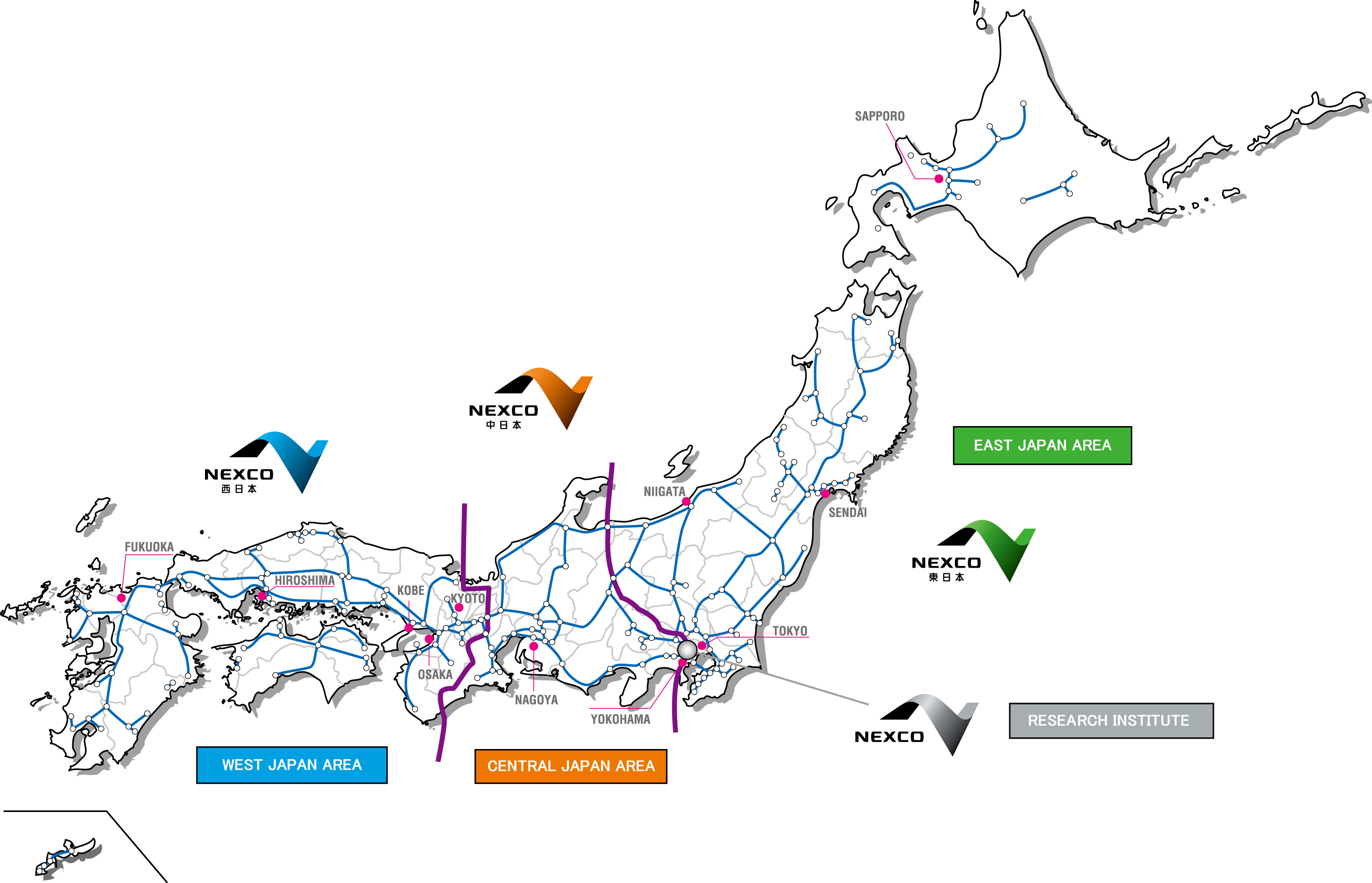
English: Map of the operational territories of the three major expressway companies in Japan, Nexco West, Nexco Central and Nexco East The black lines are prefecture boundaries. |
| Date | |
| Source |
Nexco Research Institute Map of company territories (Archived) This vector image includes elements that have been taken or adapted from this file: This vector image includes elements that have been taken or adapted from this file: This vector image includes elements that have been taken or adapted from this file: This vector image includes elements that have been taken or adapted from this file: |
| Author | The Navigators |
| Other versions | Japan Highway Area.JPG - JPEG version. |
Licensing
| I, the copyright holder of this work, release this work into the public domain. This applies worldwide. In some countries this may not be legally possible; if so: I grant anyone the right to use this work for any purpose, without any conditions, unless such conditions are required by law. |

|
This work includes material that may be protected as a trademark in some jurisdictions. If you want to use it, you have to ensure that you have the legal right to do so and that you do not infringe any trademark rights. See our general disclaimer. This tag does not indicate the copyright status of the attached work. A normal copyright tag is still required. See Commons:Licensing. |
File history
Click on a date/time to view the file as it appeared at that time.
| Date/Time | Thumbnail | Dimensions | User | Comment | |
|---|---|---|---|---|---|
| current | 00:13, 11 March 2019 | | 735 × 665 (103 KB) | The Navigators | {{Information |description= {{en|1=Map of the operational territories of the three major expressway companies in Japan, Nexco West, Nexco Central and Nexco East The black lines are prefecture boundaries.}} |date= 10 March 2019 |source= Nexco Research Institute [http://www.ri-nexco.co.jp/Portals/0/images/contents/English/co_prjapan.jpg Map of company terr... |
File usage
The following pages on the English Wikipedia use this file (pages on other projects are not listed):
Global file usage
The following other wikis use this file:
- Usage on fr.wikipedia.org
- Usage on ja.wikipedia.org
- Usage on nl.wikipedia.org
- Usage on www.wikidata.org
- Usage on zh.wikipedia.org