
File:Netherlands, Winschoten, map, around 1865-1870.jpg

Original file (1,396 × 1,200 pixels, file size: 648 KB, MIME type: image/jpeg)
| This is a file from the Wikimedia Commons. Information from its description page there is shown below. Commons is a freely licensed media file repository. You can help. |
Summary
| Description |
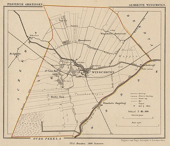
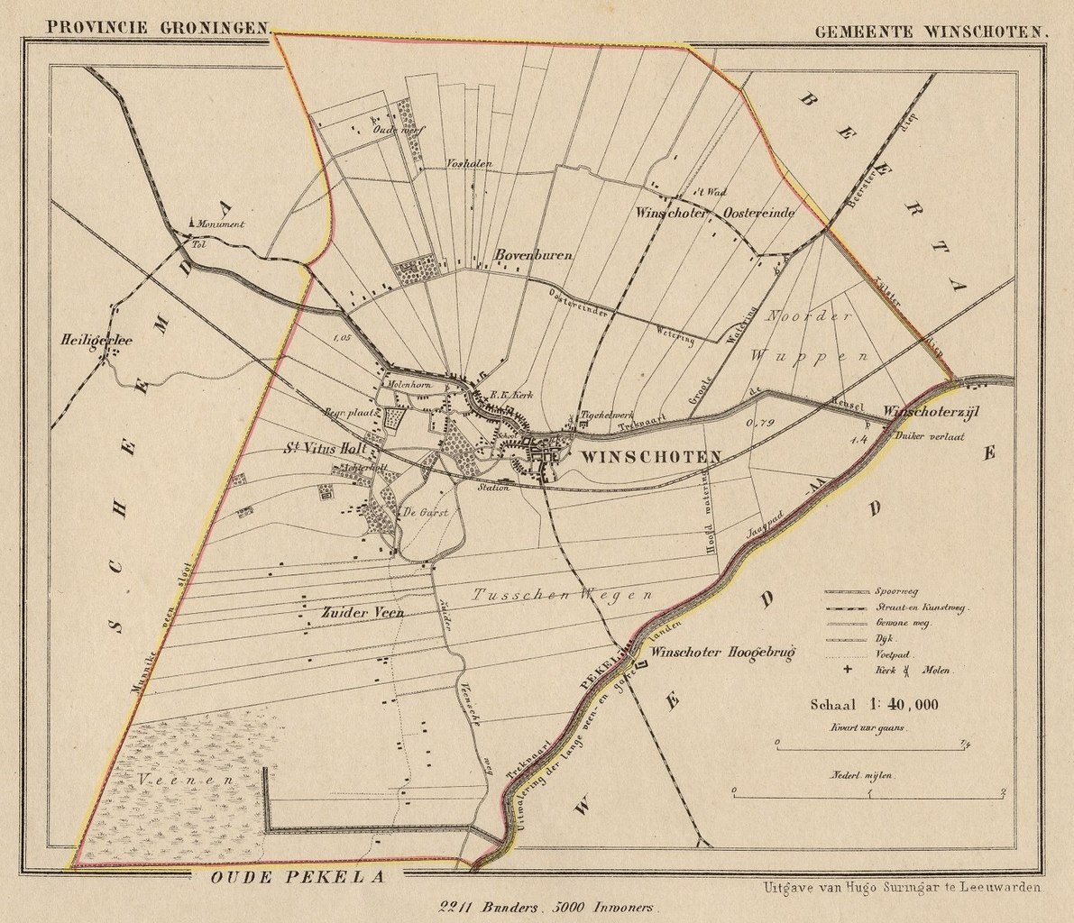
Nederlands: Kaart uit de periode 1865-1870 van de gemeente Winschoten (Prov. Groningen).
English: Map from around 1865-1870 of the municipality of Winschoten (Province of Groningen, Netherlands). |
| Date | Published around 1870 as part of a series of provincial atlases of the Netherlands. |
| Source | Gemeente-atlas van Nederland naar officieele bronnen bewerkt. |
| Author | J. Kuyper |
| Permission (Reusing this file) |
This image is in the public domain. The author J. Kuyper died in 1908. [In the Netherlands copyright expires 70 years after the death of the author or 70 years after first publication in the case of anonymous or pseudonymous works or works published by a legal entity]. [Het auteursrecht in Nederland vervalt 70 jaar na de dood van de auteur of 70 jaar na de eerste openbaarmaking van het werk, indien het gaat om een anoniem of om een onder pseudoniem verschenen werk of werk van een rechtspersoon]. |
Licensing
|
This work is in the public domain in its country of origin and other countries and areas where the copyright term is the author's life plus 70 years or fewer.
| |
| This file has been identified as being free of known restrictions under copyright law, including all related and neighboring rights. | |
The old town hall of Winschoten is at:
| Camera location | | View this and other nearby images on: OpenStreetMap |
|---|
File history
Click on a date/time to view the file as it appeared at that time.
| Date/Time | Thumbnail | Dimensions | User | Comment | |
|---|---|---|---|---|---|
| current | 10:02, 25 November 2011 | | 1,396 × 1,200 (648 KB) | Loranchet | {{Information |Description ={{nl|1=Kaart uit de periode 1865-1870 van de gemeente Winschoten (Prov. Groningen).}} {{en|1=Map from around 1865-1870 of the municipality of Winschoten (Province of Groningen, Netherlands).}} |Source =Gemeente-atlas |
File usage
Global file usage
The following other wikis use this file:
- Usage on fy.wikipedia.org
- Usage on nl.wikipedia.org
- Usage on www.wikidata.org
- Usage on zh.wikipedia.org