
File:Neerpelt Limburg Belgium Map.png
No higher resolution available.
Neerpelt_Limburg_Belgium_Map.png (270 × 203 pixels, file size: 5 KB, MIME type: image/png)
| This is a file from the Wikimedia Commons. Information from its description page there is shown below. Commons is a freely licensed media file repository. You can help. |

|
File:Neerpelt Limburg Belgium Map.svg is a vector version of this file. It should be used in place of this PNG file when not inferior.
File:Neerpelt Limburg Belgium Map.png → File:Neerpelt Limburg Belgium Map.svg
For more information, see Help:SVG. |
 |
Summary
| Description |
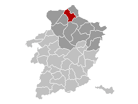
Brezhoneg: Lec'hiañ Neerpelt, Belgia.
English: Map, municipality belgium Neerpelt.
Français : Carte indiquant la localisation de la commune de Neerpelt dans la Province de Limbourg. |
| Source | Own work, originally from w:nl:Gebruiker:LennartBolks/kaartenhoekje. |
| Author | LennartBolks |
Licensing
| This work has been released into the public domain by its author, LennartBolks. This applies worldwide. In some countries this may not be legally possible; if so: |
File history
Click on a date/time to view the file as it appeared at that time.
| Date/Time | Thumbnail | Dimensions | User | Comment | |
|---|---|---|---|---|---|
| current | 00:49, 12 April 2006 | | 270 × 203 (5 KB) | Profoss | |
| 10:44, 9 April 2005 |  | 270 × 203 (4 KB) | Nicnac25~commonswiki | Map, municipality belgium Neerpelt {{PD}} FR; Carte indiquant la localisation de la commune de Neerpelt dans la Province de Limbourg. EN; Map from w:nl:Gebruiker:LennartBolks/kaartenhoekje in Public Domain by the Author choice. [[Category:Maps of pro |
File usage
No pages on the English Wikipedia use this file (pages on other projects are not listed).
Global file usage
The following other wikis use this file:
- Usage on af.wikipedia.org
- Usage on ar.wikipedia.org
- Usage on ca.wikipedia.org
- Usage on el.wikipedia.org
- Usage on eo.wikipedia.org
- Usage on es.wikipedia.org
- Usage on eu.wikipedia.org
- Usage on it.wikipedia.org
- Usage on li.wikipedia.org
- Usage on nl.wikipedia.org
- Usage on pt.wikipedia.org
- Usage on ro.wikipedia.org
- Usage on th.wikipedia.org
- Usage on vi.wikipedia.org
- Usage on www.wikidata.org