
File:NYCS map 3.svg

Size of this PNG preview of this SVG file: 490 × 599 pixels. Other resolutions: 196 × 240 pixels | 393 × 480 pixels | 628 × 768 pixels | 838 × 1,024 pixels | 1,676 × 2,048 pixels | 648 × 792 pixels.
Original file (SVG file, nominally 648 × 792 pixels, file size: 417 KB)
| This is a file from the Wikimedia Commons. Information from its description page there is shown below. Commons is a freely licensed media file repository. You can help. |
Summary
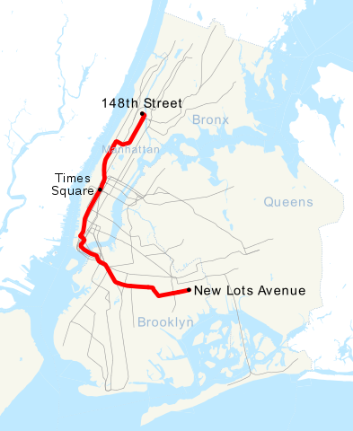
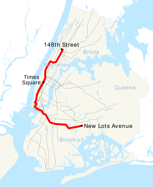
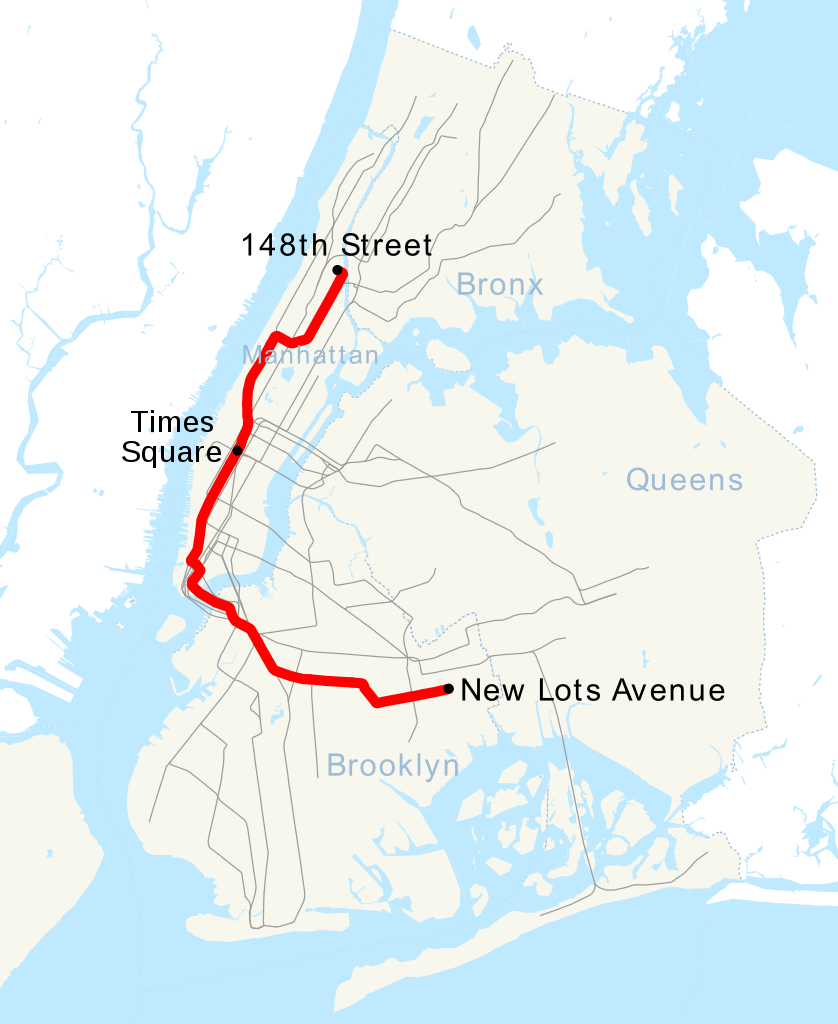
| Description | This is a map showing the New York City Subway's 3 service. It was created with TIGER/Line GIS data (water and boundaries) and my own data (subway lines and stations, traced on TIGER/Line road data). If you would like a copy of the subway data, email me. |
| Date | 30 April 2007 (original upload date) |
| Source | No machine-readable source provided. Own work assumed (based on copyright claims). |
| Author | No machine-readable author provided. NE2 assumed (based on copyright claims). |
Licensing
| I, the copyright holder of this work, release this work into the public domain. This applies worldwide. In some countries this may not be legally possible; if so: I grant anyone the right to use this work for any purpose, without any conditions, unless such conditions are required by law. |
File history
Click on a date/time to view the file as it appeared at that time.
| Date/Time | Thumbnail | Dimensions | User | Comment | |
|---|---|---|---|---|---|
| current | 16:28, 23 June 2018 | | 648 × 792 (417 KB) | LRG5784 | Reverted to version as of 22:44, 20 March 2016 (UTC) End of weekend changes |
| 19:03, 26 June 2017 |  | 648 × 792 (442 KB) | PrecipiceofDuck | Updated with Hurricane Sandy Fix&Fortify Clark St Tunnel repair work | |
| 22:44, 20 March 2016 |  | 648 × 792 (417 KB) | PrecipiceofDuck | Map updated to show Times Square as late night terminal. | |
| 21:50, 18 March 2016 |  | 648 × 792 (415 KB) | PrecipiceofDuck | Map updated to include 7 line extension. | |
| 21:50, 4 November 2011 |  | 648 × 792 (343 KB) | Train2104 | Text to path | |
| 23:54, 30 April 2007 |  | 648 × 792 (391 KB) | NE2 | == Summary == This is a map showing the New York City Subway's 3 service. It was created with TIGER/Line GIS data (water and boundaries) and my own data (subway lines and stations, traced on TIGER/Line road data). If you would like a copy of the subway da |
File usage
The following pages on the English Wikipedia use this file (pages on other projects are not listed):
Global file usage
The following other wikis use this file:
- Usage on ca.wikipedia.org
- Usage on de.wikipedia.org
- Usage on es.wikipedia.org
- Usage on fi.wikipedia.org
- Usage on fr.wikipedia.org
- Usage on he.wikipedia.org
- Usage on ja.wikipedia.org
- Usage on ko.wikipedia.org
- Usage on lmo.wikipedia.org
- Usage on nl.wikipedia.org
- Usage on no.wikipedia.org
- Usage on pl.wikipedia.org
- Usage on pt.wikipedia.org
- Usage on ru.wikipedia.org
- Usage on www.wikidata.org
- Usage on zh.wikipedia.org