
File:NJ-NY lights comparison.png
Size of this preview: 800 × 450 pixels. Other resolutions: 320 × 180 pixels | 640 × 360 pixels | 1,024 × 576 pixels | 1,280 × 720 pixels | 1,920 × 1,080 pixels.
Original file (1,920 × 1,080 pixels, file size: 506 KB, MIME type: image/png)
| This is a file from the Wikimedia Commons. Information from its description page there is shown below. Commons is a freely licensed media file repository. You can help. |
Summary
| Description |
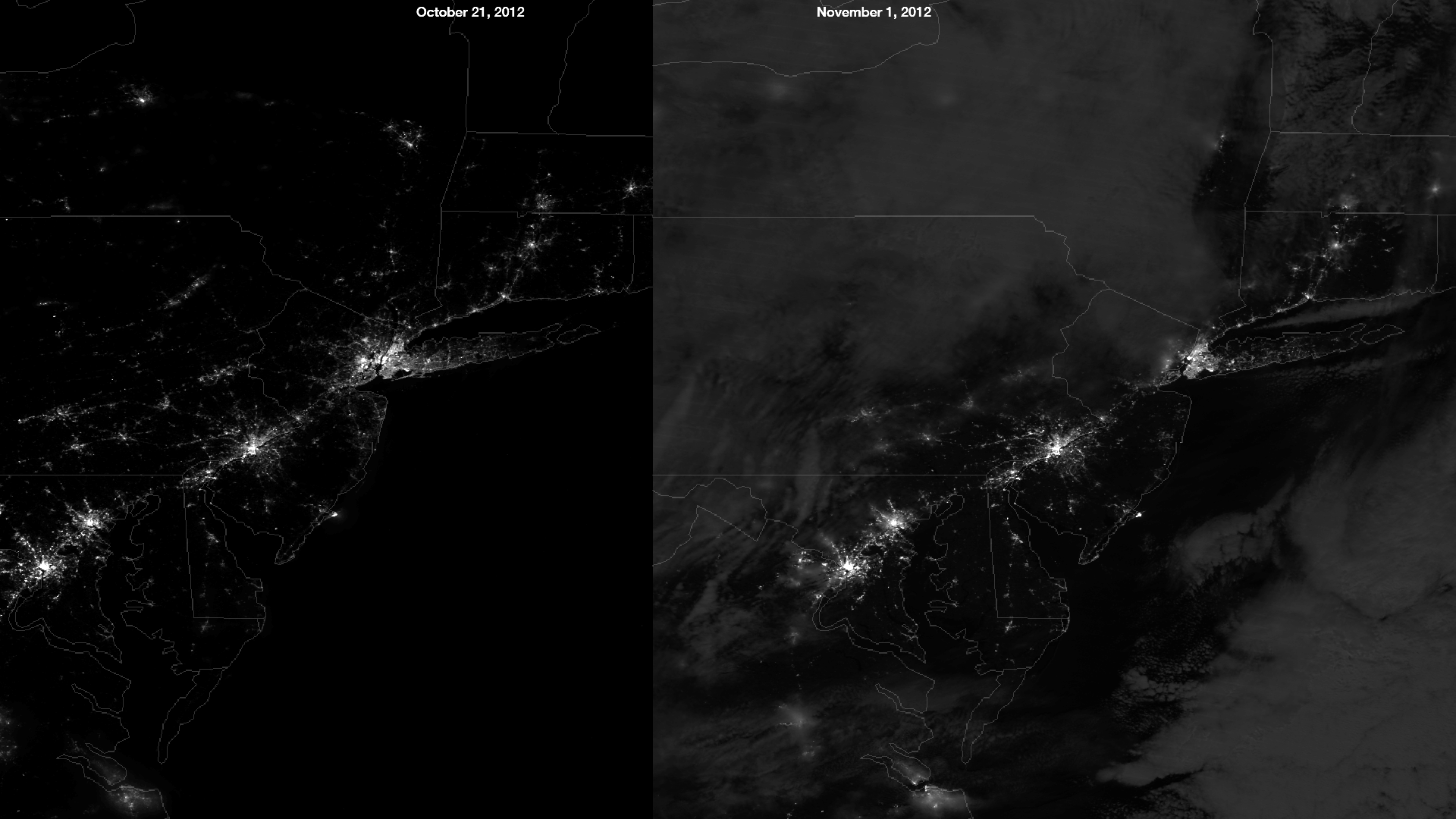
English: The NASA/NOAA Suomi NPP satellite's day/night band measures light emanating from the ground showing human settlements and industrial activity, and also moonlight reflected off of clouds. The image on the left was taken on October 21, 2012, an evening of a waxing crescent moon with little cloud cover over the northeastern US. The image on the right was taken in the early morning of November 1, 2012, two days after a full moon. Hurricane Sandy's impact on the region can be seen clearly by comparing these two images. |
| Date | |
| Source | https://www.nnvl.noaa.gov/MediaDetail2.php?MediaID=1231&MediaTypeID=1 |
| Author | NASA |
Licensing
| This file is in the public domain in the United States because it was solely created by NASA. NASA copyright policy states that "NASA material is not protected by copyright unless noted". (See Template:PD-USGov, NASA copyright policy page or JPL Image Use Policy.) | ||
 |
Warnings:
|
File history
Click on a date/time to view the file as it appeared at that time.
| Date/Time | Thumbnail | Dimensions | User | Comment | |
|---|---|---|---|---|---|
| current | 08:07, 9 April 2018 | | 1,920 × 1,080 (506 KB) | A1Cafel | User created page with UploadWizard |
File usage
The following pages on the English Wikipedia use this file (pages on other projects are not listed):