
File:Monklands Villa Maria Montreal 2012-09-19-b.jpg
Original file (4,424 × 2,944 pixels, file size: 9.5 MB, MIME type: image/jpeg)
| This is a file from the Wikimedia Commons. Information from its description page there is shown below. Commons is a freely licensed media file repository. You can help. |
Summary
| Description |
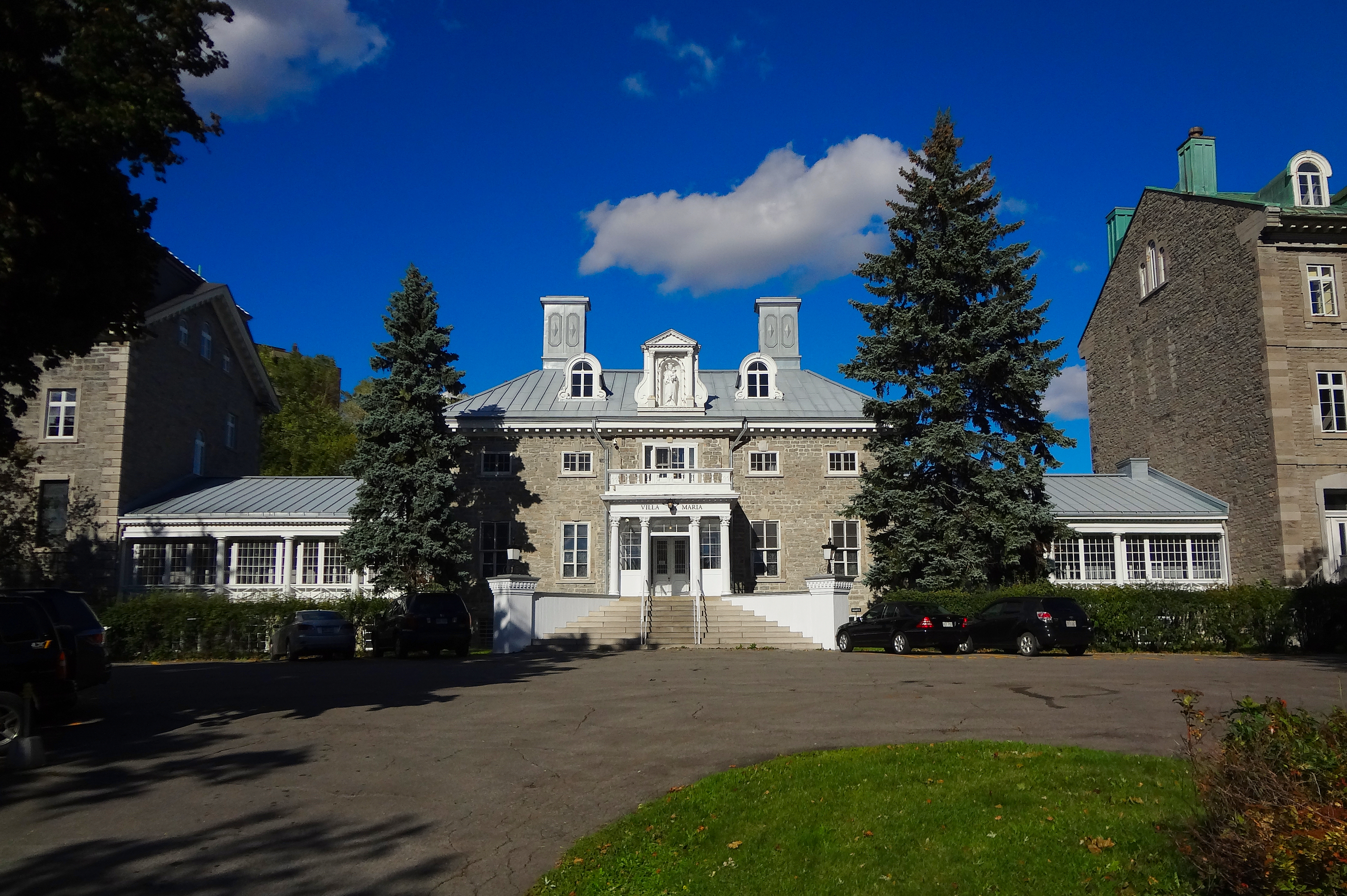
English: Monklands / Villa Maria Convent - National Historic Site of Canada
In 1795, James Monk, Chief Justice of Lower Canada, purchased an estate in Montreal that had previously belonged to the Décarie family. The first Monk residence, built in 1803, was the central section of the present-day Villa Maria. Sir James Monk willed the property known as ‘Monklands’ to his niece, Elizabeth Ann Monk. In 1844, the family leased Monklands to the Crown as a residence for the Governors General of Canada. Modifications were made to create a more imposing residence. Three Governors General, Sir Charles Metcalfe, Lord Cathcart and Lord Elgin, resided at Monklands.Français : C'est en 1803 que fut construit le pavillon Monklands. Son propriétaire se nommait James Monk et était juge en chef de la cour du Banc du Roi. La rue faisant face à l'école fut nommée Monkland par la suite.
De 1844 à 1849, Monklands fut la résidence de trois Gouverneurs généraux du Canada: Lord Metcalfe, Lord Cathcart et Lord Elgin. En 1854, la Congrégation Notre-Dame acheta Monklands pour en faire un pensionnat pour jeunes filles. |
This photo is of a cultural heritage site in Canada, number 13012
|
|
| Date | |
| Source | Own work |
| Author | Tanneryvillage |
| Camera location | | View this and other nearby images on: OpenStreetMap |
|---|
Licensing
- You are free:
- to share – to copy, distribute and transmit the work
- to remix – to adapt the work
- Under the following conditions:
- attribution – You must give appropriate credit, provide a link to the license, and indicate if changes were made. You may do so in any reasonable manner, but not in any way that suggests the licensor endorses you or your use.
- share alike – If you remix, transform, or build upon the material, you must distribute your contributions under the same or compatible license as the original.

|
This image was uploaded as part of Wiki Loves Monuments 2012.
|
File history
Click on a date/time to view the file as it appeared at that time.
| Date/Time | Thumbnail | Dimensions | User | Comment | |
|---|---|---|---|---|---|
| current | 00:03, 20 September 2012 | | 4,424 × 2,944 (9.5 MB) | Tanneryvillage | User created page with UploadWizard |
File usage
Global file usage
The following other wikis use this file:
- Usage on es.wikipedia.org
- Usage on www.wikidata.org