
File:MoabHoodoo.JPG
Size of this preview: 800 × 600 pixels. Other resolutions: 320 × 240 pixels | 640 × 480 pixels | 1,024 × 768 pixels | 1,280 × 960 pixels | 2,560 × 1,920 pixels | 3,648 × 2,736 pixels.
Original file (3,648 × 2,736 pixels, file size: 3.2 MB, MIME type: image/jpeg)
| This is a file from the Wikimedia Commons. Information from its description page there is shown below. Commons is a freely licensed media file repository. You can help. |
| Description |
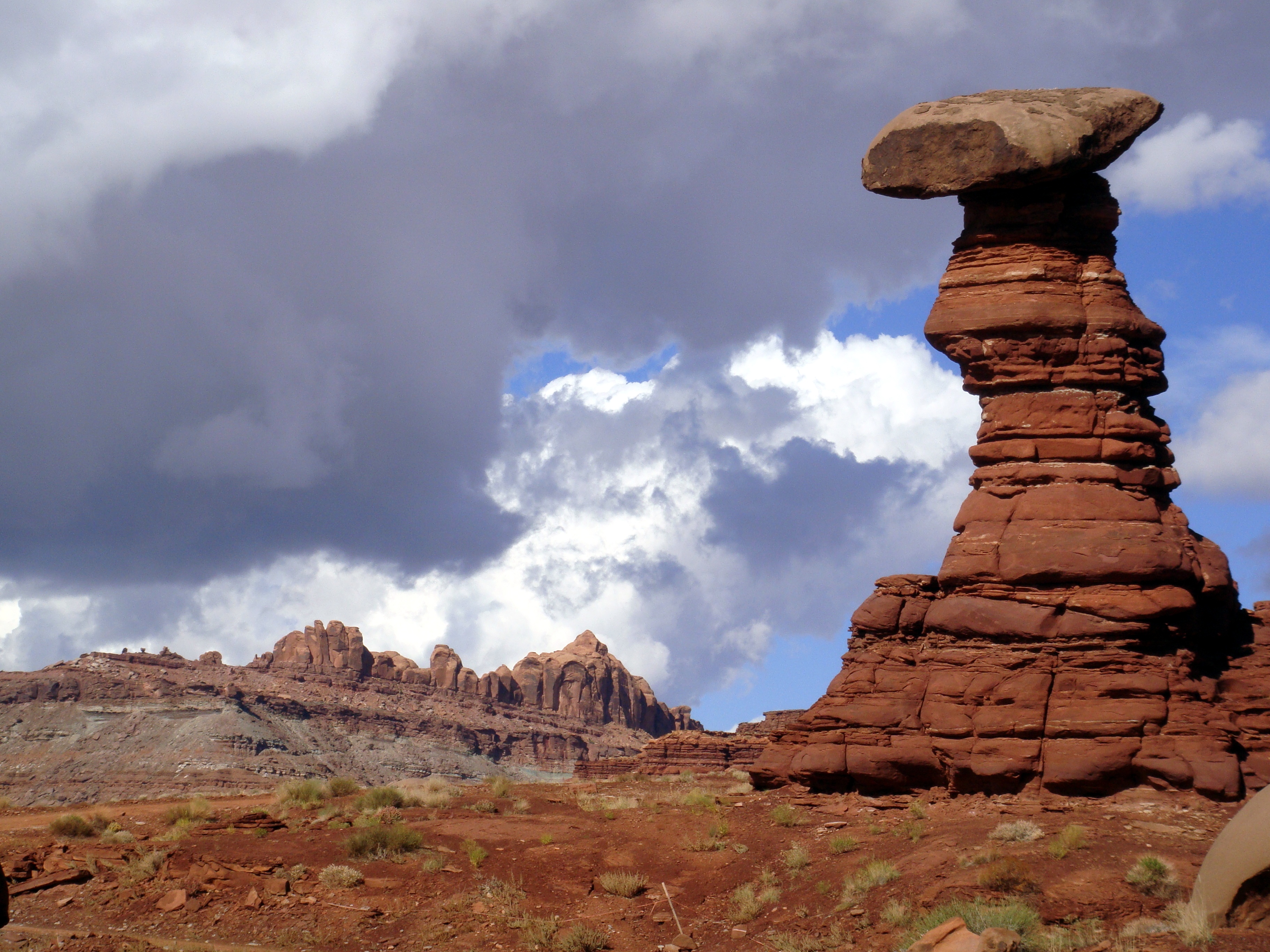
English: Hoodoo within the Chinle Formation, west of Moab, Utah, along the Chicken Corners off-road trail. Ridge in background is the Wingate Sandstone. |
||
| Date | Taken on 23 October 2010 | ||
| Source | Own work | ||
| Author | Qfl247 | ||
| Permission (Reusing this file) |
|

File history
Click on a date/time to view the file as it appeared at that time.
| Date/Time | Thumbnail | Dimensions | User | Comment | |
|---|---|---|---|---|---|
| current | 11:39, 25 March 2011 | | 3,648 × 2,736 (3.2 MB) | Citypeek | automatic white balance |
| 04:31, 14 January 2011 |  | 3,648 × 2,736 (3.41 MB) | Qfl247 | {{Information |Description={{en|1=Hoodoo within the Chinle Formation, west of Moab, Utah, along the Chicken Corners off-road trail. Ridge in background is the Wingate Formation.}} |Source={{own}} |Author=[[User:Qfl247|Qfl |
File usage
The following pages on the English Wikipedia use this file (pages on other projects are not listed):
Global file usage
The following other wikis use this file:
- Usage on ar.wikipedia.org
- Usage on az.wikipedia.org
- Usage on bg.wikipedia.org
- Usage on fa.wikipedia.org
- Usage on hu.wikipedia.org
- Usage on ru.wikipedia.org
- Usage on uk.wikipedia.org