
File:Mississippi River levee map.gif
Size of this preview: 326 × 600 pixels. Other resolutions: 130 × 240 pixels | 261 × 480 pixels | 417 × 768 pixels | 1,117 × 2,055 pixels.
Original file (1,117 × 2,055 pixels, file size: 200 KB, MIME type: image/gif)
| This is a file from the Wikimedia Commons. Information from its description page there is shown below. Commons is a freely licensed media file repository. You can help. |
Summary
| Description |
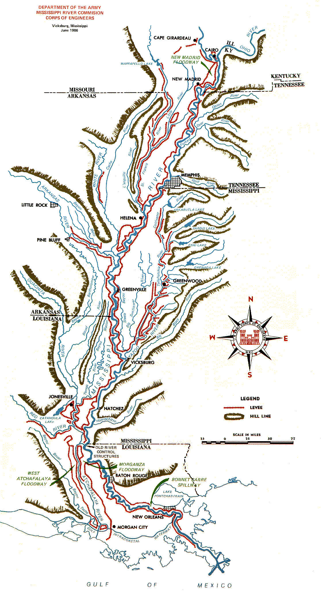
English: MIssissippi River levee map from Cairo to New Orleans (http://www.mvn.usace.army.mil/bcarre/missproj.asp). |
| Date | |
| Source | http://www.mvn.usace.army.mil/pao/bro/mrc_map.gif |
| Author | United States Army Corps of Engineers |
Licensing
This file is a work of a U.S. Army soldier or employee, taken or made as part of that person's official duties. As a work of the U.S. federal government, it is in the public domain in the United States.
|
 |
File history
Click on a date/time to view the file as it appeared at that time.
| Date/Time | Thumbnail | Dimensions | User | Comment | |
|---|---|---|---|---|---|
| current | 02:44, 19 May 2011 | | 1,117 × 2,055 (200 KB) | Kkmurray | {{Information |Description ={{en|1=MIssissippi River levee map from Cairo to New Orleans (http://www.mvn.usace.army.mil/bcarre/missproj.asp).}} |Source =http://www.mvn.usace.army.mil/pao/bro/mrc_map.gif |Author =United States Army Corps |
File usage
The following pages on the English Wikipedia use this file (pages on other projects are not listed):