
File:Minnesota Lakes and Rivers.jpg
Original file (1,808 × 2,000 pixels, file size: 376 KB, MIME type: image/jpeg)
| This is a file from the Wikimedia Commons. Information from its description page there is shown below. Commons is a freely licensed media file repository. You can help. |
Summary
| Description |
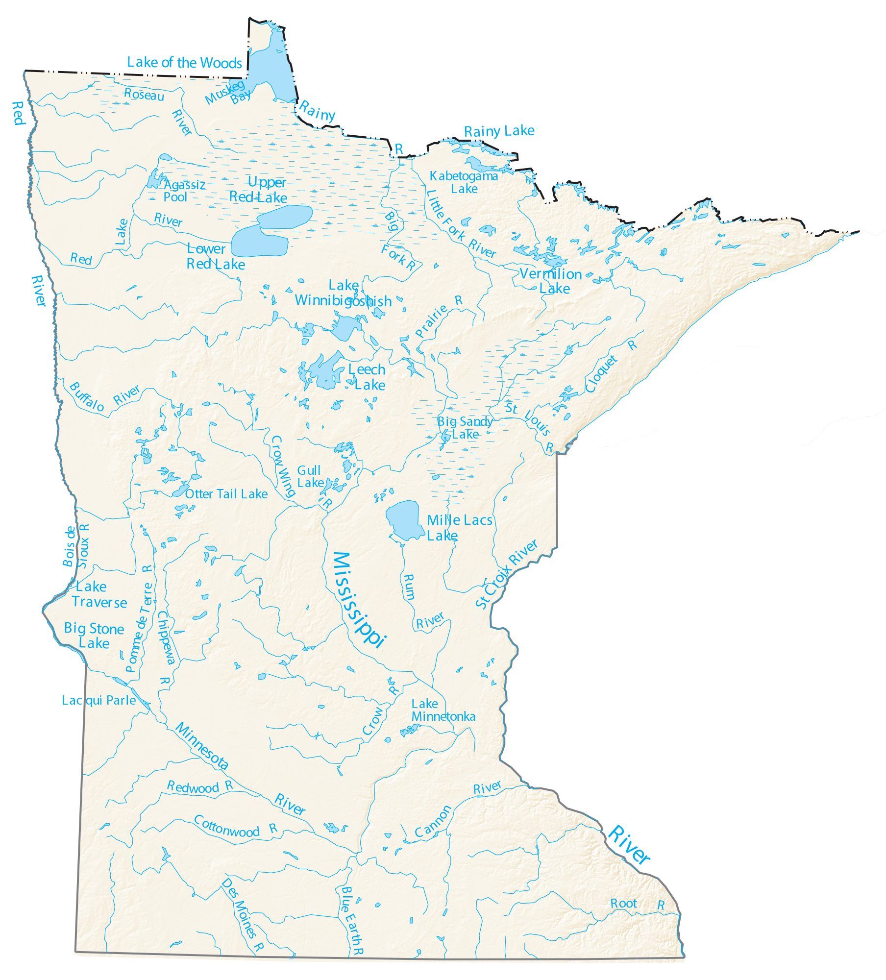
English: This map includes major rivers and lakes of the U.S. state of Minnesota, including the following:.
Lakes and reservoirs Lake Superior Lake of the Woods Red Lake Rainy Lake Upper Red Lake Lower Red Lake Leech Lake Mille Lacs Lake Lake Traverse Big Stone Lake Lake Winnibigoshish Vermilion Lake Lake Minnetonka Kabetogama Lake Big Sandy Lake Otter Tail Lake Gull Lake Muskeg Bay Agassiz Pool Lac qui Parle Rivers and streams Mississippi River Minnesota River St Croix River Rainy River Des Moines River Blue Earth River Root River Rum River St Louis River Crow Wing River Little Fork River Big Fork River Cloquet River Cannon River Crow River Cottonwood River Redwood River Pomme de Terre River Chippewa River Bois de Sioux River Buffalo River Roseau River Prairie River |
| Date | |
| Source |
U.S. Department of Interior, U.S. Geological Survey https://gisgeography.com/wp-content/uploads/2013/02/Minnesota-Map-Rivers-Lakes.pdf https://gisgeography.com/minnesota-lakes-rivers-map/ |
| Author | Attributed to the U.S. Government Department of Interior and U.S. Geological Survey |
Licensing
This work is in the public domain in the United States because it is a work prepared by an officer or employee of the United States Government as part of that person’s official duties under the terms of Title 17, Chapter 1, Section 105 of the US Code.
Note: This only applies to original works of the Federal Government and not to the work of any individual U.S. state, territory, commonwealth, county, municipality, or any other subdivision. This template also does not apply to postage stamp designs published by the United States Postal Service since 1978. (See § 313.6(C)(1) of Compendium of U.S. Copyright Office Practices). It also does not apply to certain US coins; see The US Mint Terms of Use.
|
 | |
| This file has been identified as being free of known restrictions under copyright law, including all related and neighboring rights. | ||
File history
Click on a date/time to view the file as it appeared at that time.
| Date/Time | Thumbnail | Dimensions | User | Comment | |
|---|---|---|---|---|---|
| current | 22:24, 28 April 2021 | | 1,808 × 2,000 (376 KB) | G. Moore | Uploaded a work by Attributed to the U.S. Government Department of Interior and U.S. Geological Survey from U.S. Department of Interior, U.S. Geological Survey https://gisgeography.com/wp-content/uploads/2013/02/Minnesota-Map-Rivers-Lakes.pdf https://gisgeography.com/minnesota-lakes-rivers-map/ with UploadWizard |