
File:May-2014 Mae Lao-earthquake Shakemap.jpg

Size of this preview: 512 × 600 pixels. Other resolutions: 205 × 240 pixels | 612 × 717 pixels.
Original file (612 × 717 pixels, file size: 141 KB, MIME type: image/jpeg)
| This is a file from the Wikimedia Commons. Information from its description page there is shown below. Commons is a freely licensed media file repository. You can help. |
| Description |
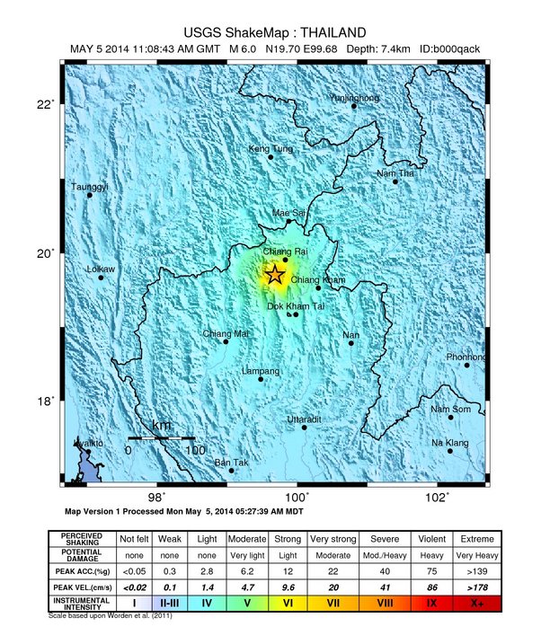
English: English: USGS ShakeMap of 2014 Mae Lao earthquake |
|||
| Date | ||||
| Source | https://earthquake.usgs.gov/product/shakemap/usb000qack/us/1399289290694/download/intensity.jpg | |||
| Author | United States Geological Survey | |||
| Permission (Reusing this file) |
|
File history
Click on a date/time to view the file as it appeared at that time.
| Date/Time | Thumbnail | Dimensions | User | Comment | |
|---|---|---|---|---|---|
| current | 09:56, 7 May 2014 | | 612 × 717 (141 KB) | Dfddtdt | {{subst:Upload marker added by en.wp UW}} {{Information |Description = {{en|English: USGS ShakeMap of 2014 Mae Lao earthquake}} |Source = http://earthquake.usgs.gov/product/shakemap/usb000qack/us/1399289290694/download/intensity.jpg |Date = 5 May 2014... |
File usage
The following pages on the English Wikipedia use this file (pages on other projects are not listed):
Global file usage
The following other wikis use this file:
- Usage on th.wikipedia.org
- Usage on zh.wikipedia.org