
File:Matureivavao Map.jpg

Size of this preview: 800 × 582 pixels. Other resolutions: 320 × 233 pixels | 640 × 466 pixels | 1,024 × 745 pixels | 1,240 × 902 pixels.
Original file (1,240 × 902 pixels, file size: 228 KB, MIME type: image/jpeg)
| This is a file from the Wikimedia Commons. Information from its description page there is shown below. Commons is a freely licensed media file repository. You can help. |

|
This map image could be re-created using vector graphics as an SVG file. This has several advantages; see Commons:Media for cleanup for more information. If an SVG form of this image is available, please upload it and afterwards replace this template with
{{vector version available|new image name}}.
It is recommended to name the SVG file “Matureivavao Map.svg”—then the template Vector version available (or Vva) does not need the new image name parameter. |


Summary
| Description |
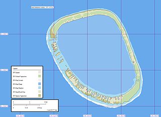
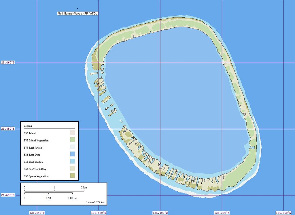
Deutsch: Karte des Matureivavao-Atolls, Tuamotu-Archipel, Französisch-Polynesien
English: Map of Matureivavao Atoll, Tuamotu Archipelago, French Polynesia |
| Date | not specified |
| Source | own work using Landsat S-08-20_2000, Global Mapper and Marplot |
| Author | Peter Minton (User Pjminton) |
Licensing
| This work has been released into the public domain by its author, Peter Minton. This applies worldwide. In some countries this may not be legally possible; if so: Peter Minton grants anyone the right to use this work for any purpose, without any conditions, unless such conditions are required by law.
|
Original upload log
| date/time | username | dimension | file size | edit summary |
|---|---|---|---|---|
| 04:38, 24 January 2006 | Pjminton | 1240×902 | 228 KB | Created by Peter Minton (evsrequest@gmail.com) using Landsat S-08-20_2000, Global Mapper and Marplot.) |
File history
Click on a date/time to view the file as it appeared at that time.
| Date/Time | Thumbnail | Dimensions | User | Comment | |
|---|---|---|---|---|---|
| current | 11:58, 10 July 2008 | | 1,240 × 902 (228 KB) | Telim tor | == Summary == {{Information |Description = {{de|Karte des Matureivavao-Atolls, Tuamotu-Archipel, Französisch-Polynesien}} {{en|Map of Matureivavao Atoll, Tuamotu Archipelago, French Polynesia}} |Source = own work using Landsat S-08-20_2000, Global Mappe |
File usage
The following pages on the English Wikipedia use this file (pages on other projects are not listed):
Global file usage
The following other wikis use this file:
- Usage on de.wikipedia.org
- Usage on es.wikipedia.org
- Usage on fi.wikipedia.org
- Usage on fr.wikipedia.org
- Usage on he.wikipedia.org
- Usage on nl.wikipedia.org
- Usage on pl.wikipedia.org
- Usage on zh.wikipedia.org