
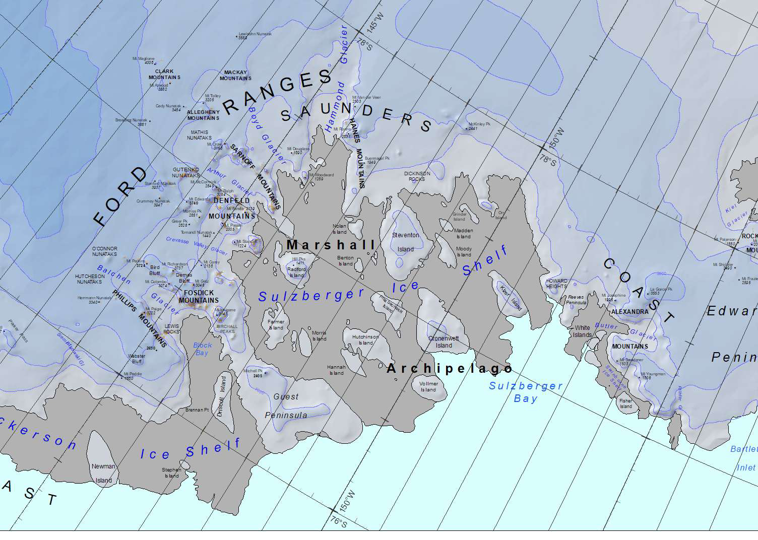
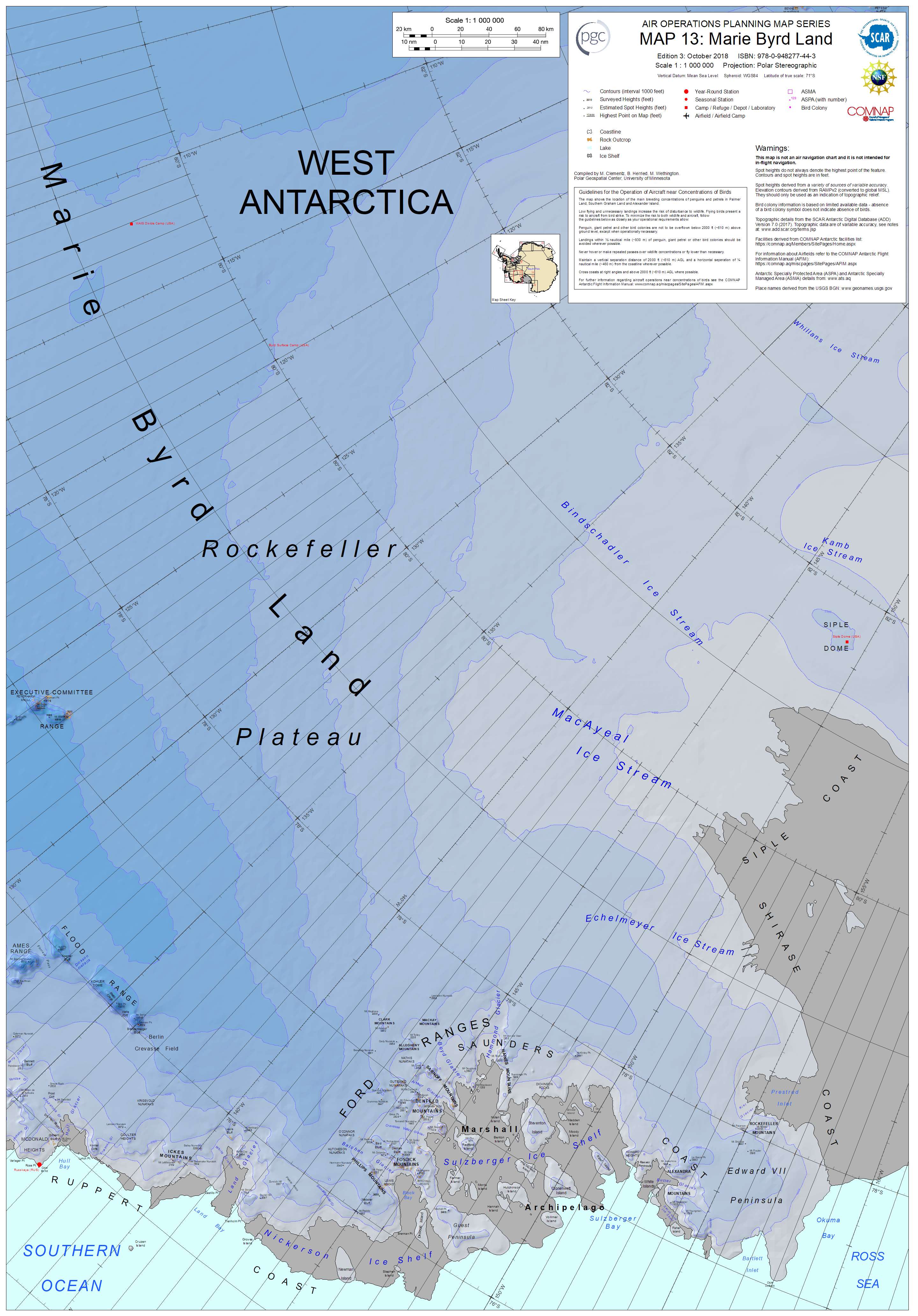
File:Marshall archipelago.jpg
Size of this preview: 800 × 570 pixels. Other resolutions: 320 × 228 pixels | 640 × 456 pixels | 1,024 × 730 pixels | 1,280 × 912 pixels | 1,504 × 1,072 pixels.
Original file (1,504 × 1,072 pixels, file size: 596 KB, MIME type: image/jpeg)
| This is a file from the Wikimedia Commons. Information from its description page there is shown below. Commons is a freely licensed media file repository. You can help. |
Summary
| Description |
English: Map of the Marshall Archipelago |
| Date | |
| Source | http://data.pgc.umn.edu/maps/antarctica/pgc/17/preview/Map%2013%20Marie%20Byrd%20Land%20Ed%203.jpg |
| Author | M. Clementz, B. Herried, and M. Wethington as a work-for-hire of the Polar Geospacial Center, University of Michigan |
Licensing

|
The copyright holder of this file, the Polar Geospatial Center, allows anyone to use it for any purpose, provided that the copyright holder is properly attributed. Redistribution, derivative work, commercial use, and all other use is permitted. |
Attribution:
Polar Geospatial Center, 2018, PGC Map Catalog, https://doi.org/10.7910/DVN/6R8F7U, Harvard Dataverse, V1, Map 13, 29 July 2019]
|
File history
Click on a date/time to view the file as it appeared at that time.
| Date/Time | Thumbnail | Dimensions | User | Comment | |
|---|---|---|---|---|---|
| current | 04:29, 25 September 2019 | | 1,504 × 1,072 (596 KB) | A loose necktie | User created page with UploadWizard |
File usage
The following pages on the English Wikipedia use this file (pages on other projects are not listed):
Global file usage
The following other wikis use this file:
- Usage on he.wikipedia.org
- Usage on it.wikipedia.org