
File:Maricopa County Incorporated and Planning areas Sun City highlighted.svg

Size of this PNG preview of this SVG file: 694 × 599 pixels. Other resolutions: 278 × 240 pixels | 556 × 480 pixels | 889 × 768 pixels | 1,185 × 1,024 pixels | 2,371 × 2,048 pixels | 940 × 812 pixels.
Original file (SVG file, nominally 940 × 812 pixels, file size: 1.05 MB)
| This is a file from the Wikimedia Commons. Information from its description page there is shown below. Commons is a freely licensed media file repository. You can help. |
Summary
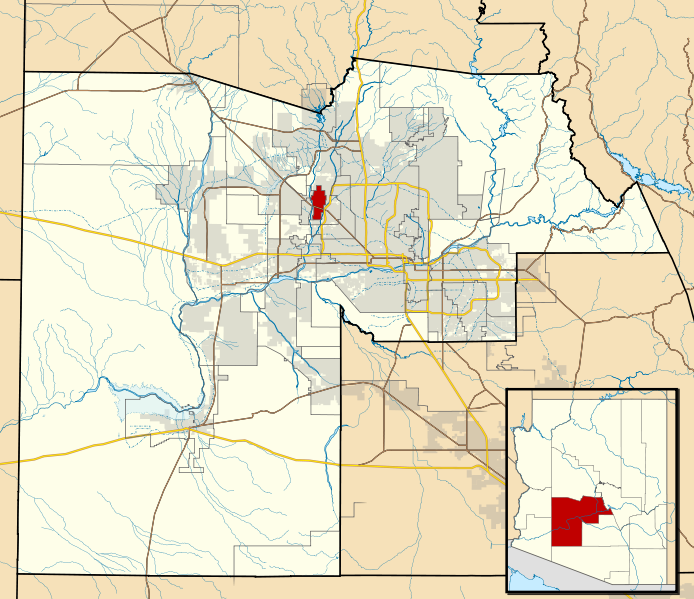
| Description | This map shows the incorporated areas and Indian reservation boundaries in Maricopa County, Arizona, along with water bodies and major highways and roads. Sun City is highlighted in red. Other incorporated cities are shown in gray, planning area borders for these cities and Indian reservation borders are shown as solid black lines. Changes from Previous Version: Updated the maps to include water bodies and to make "less boring" than the plain black/white/gray maps. Format was updated to match standards laid out by WikiProject Maps/Conventions. Map data is based on data from the following Webpage: Maricopa County Interactive GIS Map. I created this map in Inkscape. |
| Date | |
| Source | My own work, based on government information |
| Author | Ixnayonthetimmay |
| Permission (Reusing this file) |
Public Domain |
| Other versions | See Category:Maps of Maricopa County for other versions of this image. |
Licensing
| I, the copyright holder of this work, release this work into the public domain. This applies worldwide. In some countries this may not be legally possible; if so: I grant anyone the right to use this work for any purpose, without any conditions, unless such conditions are required by law. |
File history
Click on a date/time to view the file as it appeared at that time.
| Date/Time | Thumbnail | Dimensions | User | Comment | |
|---|---|---|---|---|---|
| current | 06:44, 20 May 2011 | | 940 × 812 (1.05 MB) | Ixnayonthetimmay | Uploading new version |
| 04:43, 30 August 2008 |  | 900 × 800 (413 KB) | Ixnayonthetimmay | == Summary == {{Information |Description=This map shows the incorporated areas and unincorporated areas in Maricopa County, Arizona. [[:en:Sentinel, Arizona| | |
| 23:43, 15 September 2007 |  | 900 × 800 (385 KB) | Ixnayonthetimmay | {{Information |Description= |Source= |Date= |Author= |Permission= |other_versions= }} | |
| 10:14, 28 May 2007 |  | 900 × 780 (330 KB) | Ixnayonthetimmay | ||
| 01:20, 22 May 2007 |  | 900 × 780 (322 KB) | Ixnayonthetimmay | ||
| 05:26, 30 January 2007 |  | 904 × 758 (178 KB) | Ixnayonthetimmay | {{Information |Description=This map shows the incorporated areas in Maricopa County, Arizona, highlighting Sun City in red. It also shows the boundaries for the |
File usage
No pages on the English Wikipedia use this file (pages on other projects are not listed).
Global file usage
The following other wikis use this file:
- Usage on ar.wikipedia.org
- Usage on arz.wikipedia.org
- Usage on azb.wikipedia.org
- Usage on ca.wikipedia.org
- Usage on ceb.wikipedia.org
- Usage on de.wikipedia.org
- Usage on eu.wikipedia.org
- Usage on fa.wikipedia.org
- Usage on fr.wikipedia.org
- Usage on ht.wikipedia.org
- Usage on it.wikipedia.org
- Usage on simple.wikipedia.org
- Usage on sr.wikipedia.org
- Usage on tt.wikipedia.org
- Usage on vo.wikipedia.org
- Usage on www.wikidata.org
- Usage on zh-min-nan.wikipedia.org
- Usage on zh.wikipedia.org