
File:Map of the grassland ecoregions of the United States.jpg
Size of this preview: 800 × 498 pixels. Other resolutions: 320 × 199 pixels | 640 × 398 pixels | 1,024 × 637 pixels | 1,280 × 797 pixels | 2,826 × 1,759 pixels.
Original file (2,826 × 1,759 pixels, file size: 1.97 MB, MIME type: image/jpeg)
| This is a file from the Wikimedia Commons. Information from its description page there is shown below. Commons is a freely licensed media file repository. You can help. |
Summary
| Description |
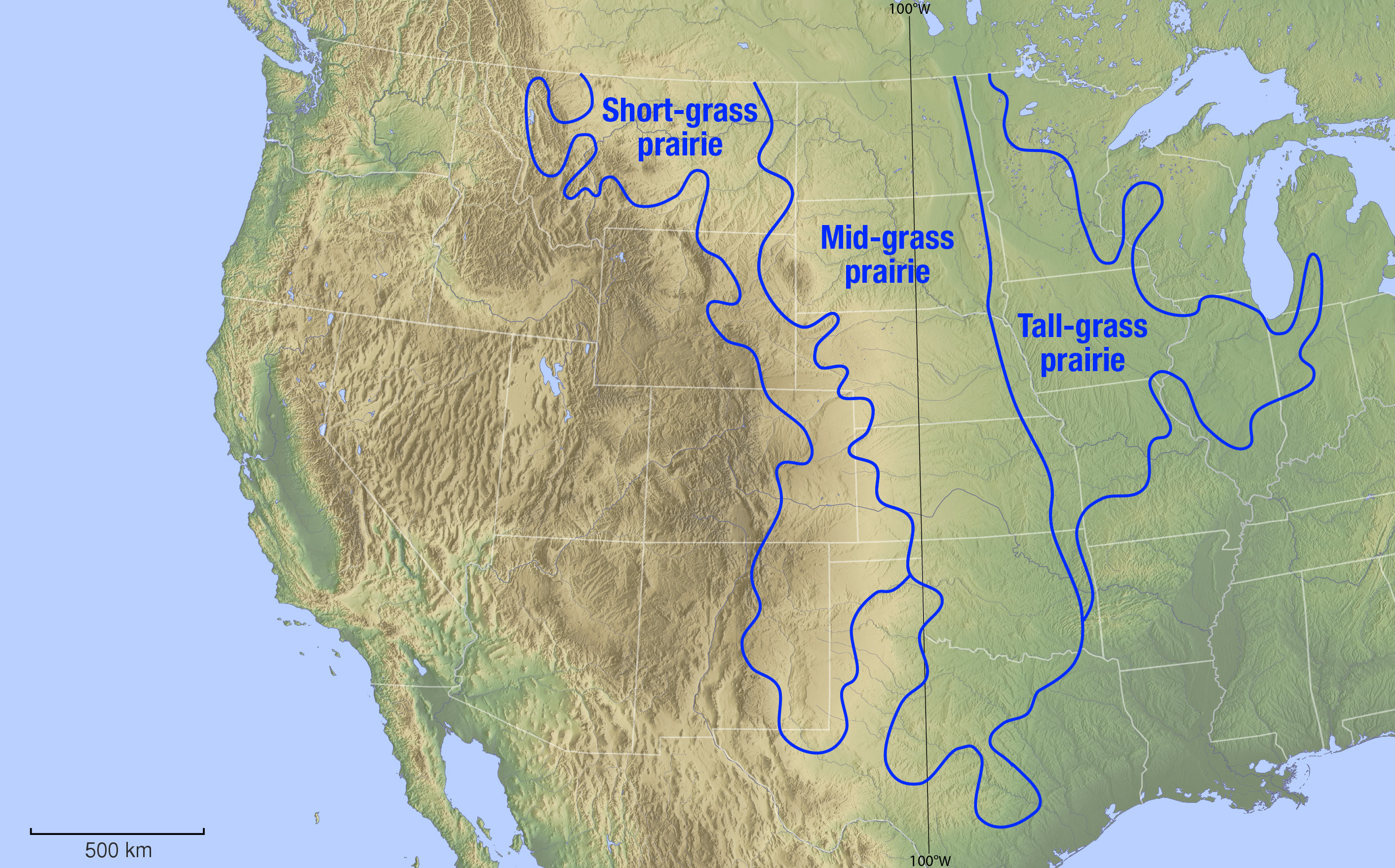
English: Biogeographical map showing the different temperate grassland ecoregions of the Great Plains and Tallgrass prairies regions of the United States. Data from a display at Brigham Young University's Bean museum. |
| Date | see file history |
| Source |
Own work, using |
| Author | Maximilian Dörrbecker (Chumwa) |
| Permission (Reusing this file) |
I, the copyright holder of this work, hereby publish it under the following license: This file is licensed under the Creative Commons Attribution-Share Alike 2.5 Generic license.
Sie dürfen das Bild zu den folgenden Bedingungen nutzen:
|
File history
Click on a date/time to view the file as it appeared at that time.
| Date/Time | Thumbnail | Dimensions | User | Comment | |
|---|---|---|---|---|---|
| current | 18:43, 25 November 2013 | | 2,826 × 1,759 (1.97 MB) | Chumwa | |
| 18:17, 22 November 2013 |  | 2,826 × 1,761 (2.12 MB) | Chumwa | == {{int:filedesc}} == {{Information | Description = {{en|1=Biogeographical map showing the different temperate grassland ecoregions of the Great Plains and Tallgrass prairies regions of the United States. Data from a display at Brigham Young Universi... |
File usage
No pages on the English Wikipedia use this file (pages on other projects are not listed).
Global file usage
The following other wikis use this file:
- Usage on de.wikipedia.org
- Usage on la.wikipedia.org