
File:Map of the Dutch Cape Colony in 1795.jpg
Size of this preview: 800 × 475 pixels. Other resolutions: 320 × 190 pixels | 640 × 380 pixels | 1,024 × 608 pixels | 1,280 × 761 pixels | 2,560 × 1,521 pixels | 3,546 × 2,107 pixels.
Original file (3,546 × 2,107 pixels, file size: 763 KB, MIME type: image/jpeg)
| This is a file from the Wikimedia Commons. Information from its description page there is shown below. Commons is a freely licensed media file repository. You can help. |
Summary
| Description |
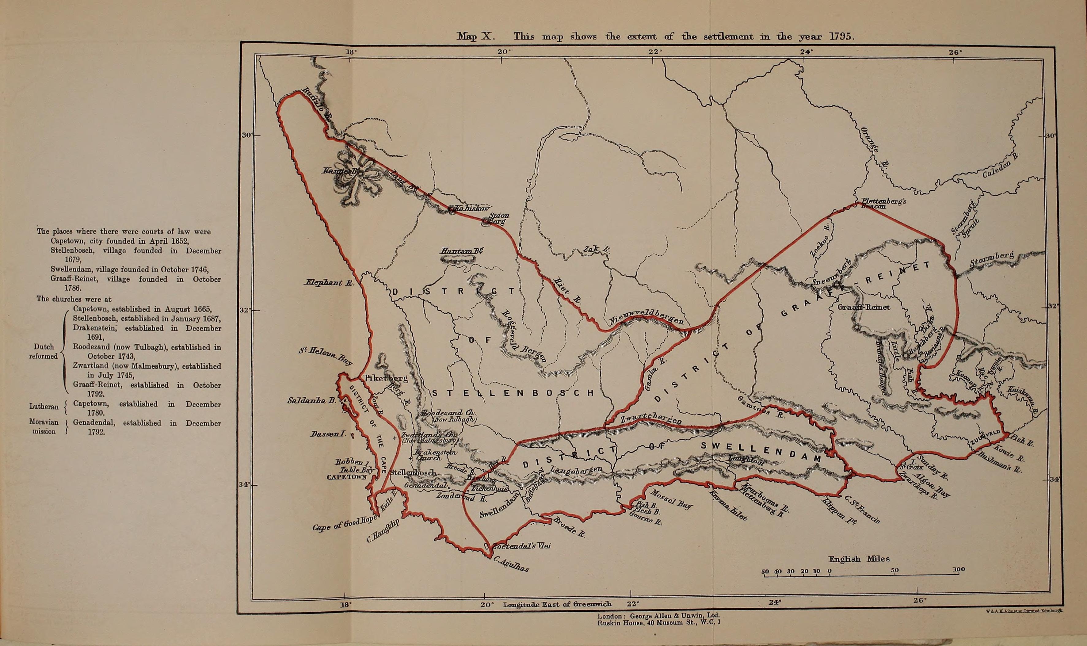
English: Map of the Dutch Cape Colony in 1795, from page 374 of "History of Africa south of the Zambesi - from the settlement of the Portuguese at Sofala in September 1505 to the conquest of the Cape Colony by the British in September 1795" (1916) |
|||||||||||||||||
| Date | ||||||||||||||||||
| Source | https://archive.org/stream/historyofafricas03thea/historyofafricas03thea#page/n374/mode/1up | |||||||||||||||||
| Author |
|
|||||||||||||||||

Licensing
|
This work is in the public domain in its country of origin and other countries and areas where the copyright term is the author's life plus 70 years or fewer. This work is in the public domain in the United States because it was published (or registered with the U.S. Copyright Office) before January 1, 1929. | |
| This file has been identified as being free of known restrictions under copyright law, including all related and neighboring rights. | |
File history
Click on a date/time to view the file as it appeared at that time.
| Date/Time | Thumbnail | Dimensions | User | Comment | |
|---|---|---|---|---|---|
| current | 21:21, 28 August 2014 | | 3,546 × 2,107 (763 KB) | Underlying lk | User created page with UploadWizard |
File usage
The following pages on the English Wikipedia use this file (pages on other projects are not listed):
Global file usage
The following other wikis use this file:
- Usage on es.wikipedia.org
- Usage on it.wikipedia.org
- Usage on ru.wikipedia.org
- Usage on simple.wikipedia.org
- Usage on uk.wikipedia.org
- Usage on zh.wikipedia.org