
File:Map of the Ancient Rome at Caesar time (with conquests)-fr.svg

Size of this PNG preview of this SVG file: 800 × 473 pixels. Other resolutions: 320 × 189 pixels | 640 × 379 pixels | 1,024 × 606 pixels | 1,280 × 757 pixels | 2,560 × 1,515 pixels | 2,050 × 1,213 pixels.
Original file (SVG file, nominally 2,050 × 1,213 pixels, file size: 1.26 MB)
| This is a file from the Wikimedia Commons. Information from its description page there is shown below. Commons is a freely licensed media file repository. You can help. |
| Description |
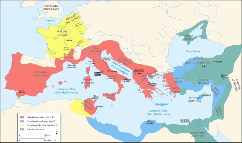
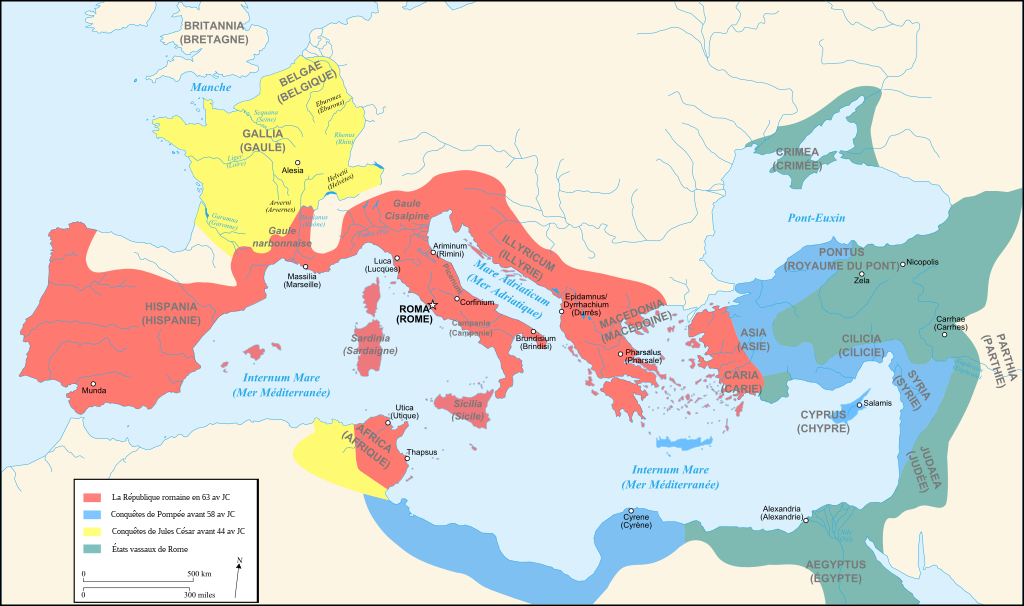
Français : Carte de l'Empire Romain au Ier siècle av JC English: Map of Roman Empire (1st century BC) . |
||||||||
| Date | |||||||||
| Source | Own work + Image:Blank map of South Europe and North Africa.svg by myself | ||||||||
| Author | User:Historicair um15:17, 13 August 2007 (UTC) | ||||||||
| Permission (Reusing this file) |
I, the copyright holder of this work, hereby publish it under the following licenses:
This file is licensed under the Creative Commons Attribution-Share Alike 2.5 Generic, 2.0 Generic and 1.0 Generic license.
You may select the license of your choice. |
||||||||
| Other versions |
[]
|

-en.svg)
-es.svg)
-fr.svg)
-zh.svg)
-fr.svg)
-fr.svg)
|
This SVG file contains embedded text that can be translated into your language, using any capable SVG editor, text editor or the SVG Translate tool. For more information see: About translating SVG files. |
-fr.svg)
[[Category:yo snot dog go in Apia house
]]
File history
Click on a date/time to view the file as it appeared at that time.
| Date/Time | Thumbnail | Dimensions | User | Comment | |
|---|---|---|---|---|---|
| current | 15:17, 13 August 2007 | | 2,050 × 1,213 (1.26 MB) | Historicair | {{Information |Description={{fr}}Carte de l'Empire Romain au Ier siècle av JC {{en}}Map of Roman Empire (1st century BC). |Source=Own work + Image:Blank map of South Europe and North Africa.svg by myself |Date=13/08/2007 |Author=~~~~ |Permission={{s |
File usage
The following pages on the English Wikipedia use this file (pages on other projects are not listed):
Global file usage
The following other wikis use this file:
- Usage on eu.wikipedia.org
- Usage on fa.wikipedia.org
- Usage on fr.wikipedia.org
- Usage on fur.wikipedia.org
- Usage on nl.wikipedia.org
- Usage on th.wikipedia.org
-fr.svg)