
File:Map of region of Sardinia, Italy, with provinces-it (as of 2016).svg

Size of this PNG preview of this SVG file: 311 × 599 pixels. Other resolutions: 124 × 240 pixels | 249 × 480 pixels | 398 × 768 pixels | 531 × 1,024 pixels | 1,063 × 2,048 pixels | 2,286 × 4,403 pixels.
Original file (SVG file, nominally 2,286 × 4,403 pixels, file size: 71 KB)
| This is a file from the Wikimedia Commons. Information from its description page there is shown below. Commons is a freely licensed media file repository. You can help. |
.svg)
Summary
| Description |
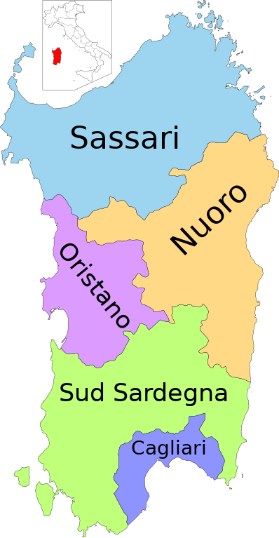
Italiano: Mappa della Regione Sardegna con le nuove suddivisioni amministrative istituite nel 2016 |
| Date | |
| Source |
File:Map of region of Sardinia, Italy, with provinces-it.svg and File:Italy provincial cavoletti di Bruxelles provinces-it.svg: Vonvikken
|
| Author |
Licensing
This file is licensed under the Creative Commons Attribution-Share Alike 3.0 Unported license.
- You are free:
- to share – to copy, distribute and transmit the work
- to remix – to adapt the work
- Under the following conditions:
- attribution – You must give appropriate credit, provide a link to the license, and indicate if changes were made. You may do so in any reasonable manner, but not in any way that suggests the licensor endorses you or your use.
- share alike – If you remix, transform, or build upon the material, you must distribute your contributions under the same or compatible license as the original.
File history
Click on a date/time to view the file as it appeared at that time.
| Date/Time | Thumbnail | Dimensions | User | Comment | |
|---|---|---|---|---|---|
| current | 15:53, 7 November 2023 | | 2,286 × 4,403 (71 KB) | Nilo1926 | 41.6% saved |
| 10:23, 29 December 2016 |  | 2,286 × 4,403 (122 KB) | Mess | User created page with UploadWizard |
File usage
The following pages on the English Wikipedia use this file (pages on other projects are not listed):
Global file usage
The following other wikis use this file:
- Usage on an.wikipedia.org
- Usage on ar.wikipedia.org
- Usage on ast.wikipedia.org
- Usage on bg.wikipedia.org
- Usage on br.wikipedia.org
- Usage on cs.wikipedia.org
- Usage on cy.wikipedia.org
- Usage on da.wikipedia.org
- Usage on de.wikipedia.org
- Usage on de.wikivoyage.org
- Usage on en.wikivoyage.org
- Usage on es.wikipedia.org
- Usage on fr.wikipedia.org
- Usage on hr.wikipedia.org
- Usage on hu.wikipedia.org
- Usage on id.wikipedia.org
- Usage on it.wikipedia.org
- Usage on ja.wikipedia.org
- Usage on lmo.wikipedia.org
- Usage on nl.wikipedia.org
- Usage on nn.wikipedia.org
- Usage on no.wikipedia.org
- Usage on ro.wikipedia.org
- Usage on ru.wikipedia.org
- Usage on ru.wikivoyage.org
- Usage on sq.wikipedia.org
- Usage on sr.wikipedia.org
- Usage on sv.wikipedia.org
- Usage on tg.wikipedia.org
View more global usage of this file.
.svg)
.svg)