
File:Map of Polish residents in former territory of Polish-Lithuanian Commonwealth, Orgelbrand 1912.jpg

Size of this preview: 673 × 599 pixels. Other resolutions: 270 × 240 pixels | 539 × 480 pixels | 863 × 768 pixels | 1,150 × 1,024 pixels | 2,180 × 1,941 pixels.
Original file (2,180 × 1,941 pixels, file size: 1.47 MB, MIME type: image/jpeg)
| This is a file from the Wikimedia Commons. Information from its description page there is shown below. Commons is a freely licensed media file repository. You can help. |
Summary
| Description |
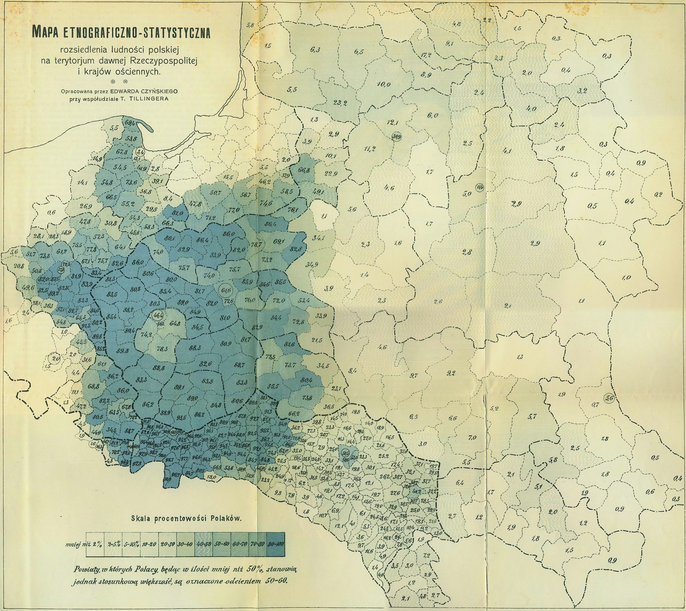
English: An etnographic/statistical map of the distribution of Polish population over the territory of the former Polish-Lithuanian Commonwealth and the neighbouring lands; drawn up by Tadeusz Czyński with collaboration of T. Tillinger; published in the Orgelbrand Encyclopaedia 1912. |
| Date | |
| Source | http://maps.mapywig.org/m/Polish_maps/various/Small_scale_maps/Mapa_etnogra-statyst_ludnosci_polskiej_Encykl_Orgelbranda_1912.jpg |
| Author | drawn up by Tadeusz Czyński with collaboration of T. Tillinger; published in the Orgelbrand Encyclopaedia 1912. |
Licensing
|
This work is in the public domain in its country of origin and other countries and areas where the copyright term is the author's life plus 70 years or fewer. This work is in the public domain in the United States because it was published (or registered with the U.S. Copyright Office) before January 1, 1929. | |
| This file has been identified as being free of known restrictions under copyright law, including all related and neighboring rights. | |
File history
Click on a date/time to view the file as it appeared at that time.
| Date/Time | Thumbnail | Dimensions | User | Comment | |
|---|---|---|---|---|---|
| current | 08:43, 13 April 2019 | | 2,180 × 1,941 (1.47 MB) | Ke an | User created page with UploadWizard |
File usage
No pages on the English Wikipedia use this file (pages on other projects are not listed).
Global file usage
The following other wikis use this file:
- Usage on fr.wikipedia.org
- Usage on it.wikipedia.org