
File:Map of New York State Railways Rochester Lines 1929.jpg
Original file (2,924 × 2,394 pixels, file size: 852 KB, MIME type: image/jpeg)
Summary[edit]
| Description |
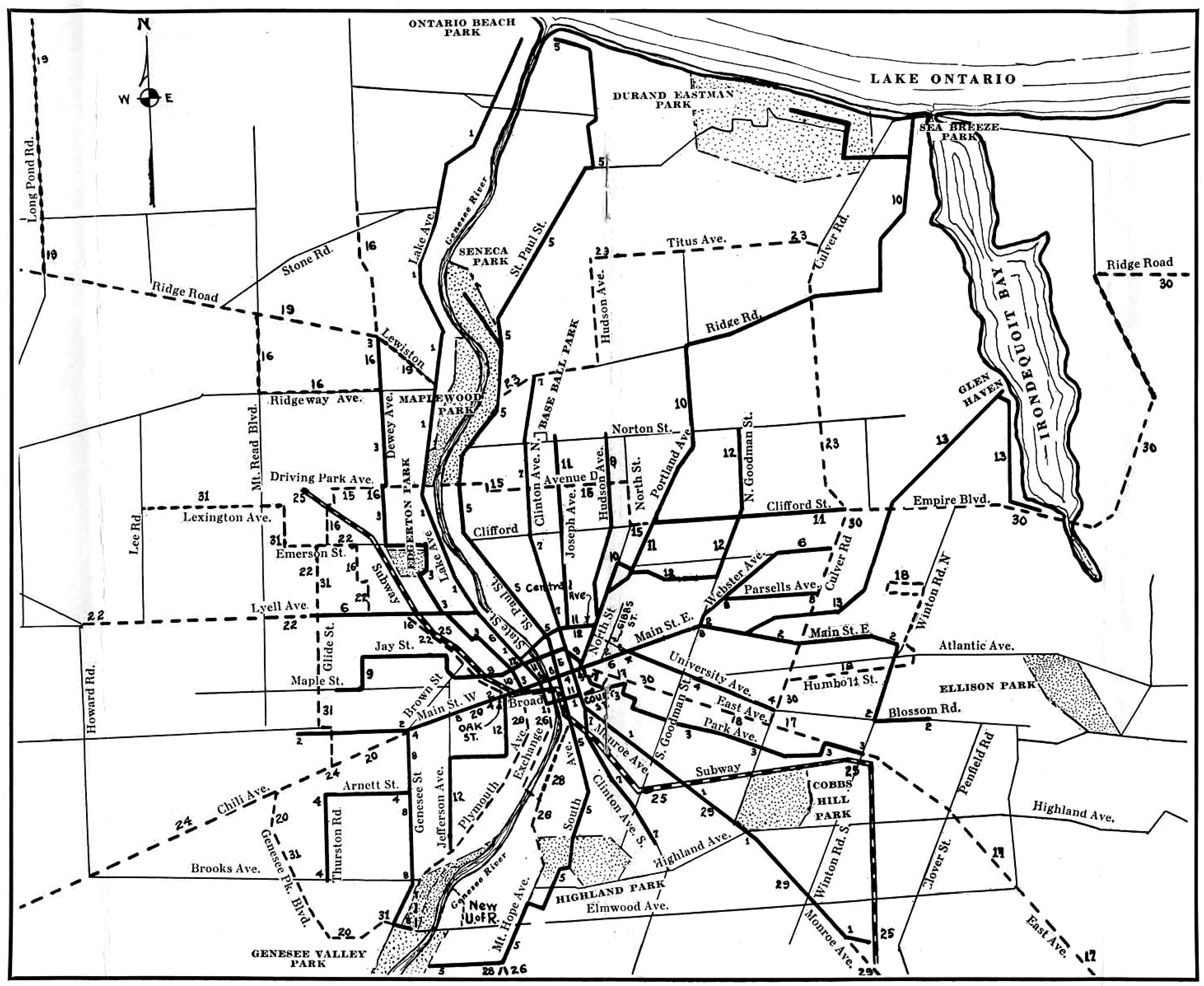
Map showing streetcar and bus routes in the city of Rochester, New York, USA, operated by New York State Railways Rochester Lines. |
|---|---|
| Source |
Original publication: 1929 |
| Date |
1929 |
| Author |
New York State Railways |
| Permission (Reusing this file) |
Copyright expired because the work was published without a copyright notice and/or without the necessary copyright registration. From a transit map published by the company 1929
|
- Other information
This transit map is now obsolete, no one holds copyright, the original company is defunct.
Licensing[edit]
| This image is in the public domain in the United States. In most cases, this means that it was first published prior to January 1, 1929 (see the template documentation for more cases). Other jurisdictions may have other rules, and this image might not be in the public domain outside the United States. See Wikipedia:Public domain and Wikipedia:Copyrights for more details. |
File history
Click on a date/time to view the file as it appeared at that time.
| Date/Time | Thumbnail | Dimensions | User | Comment | |
|---|---|---|---|---|---|
| current | 15:34, 9 September 2016 | | 2,924 × 2,394 (852 KB) | NightWriter77 (talk | contribs) | Uploading an old public-domain work using File Upload Wizard |
You cannot overwrite this file.