
File:Map of Evans Bay Patent Slip, Wellington, New Zealand.jpg
Original file (5,031 × 7,626 pixels, file size: 19.01 MB, MIME type: image/jpeg)
| This is a file from the Wikimedia Commons. Information from its description page there is shown below. Commons is a freely licensed media file repository. You can help. |
Summary
| Description |
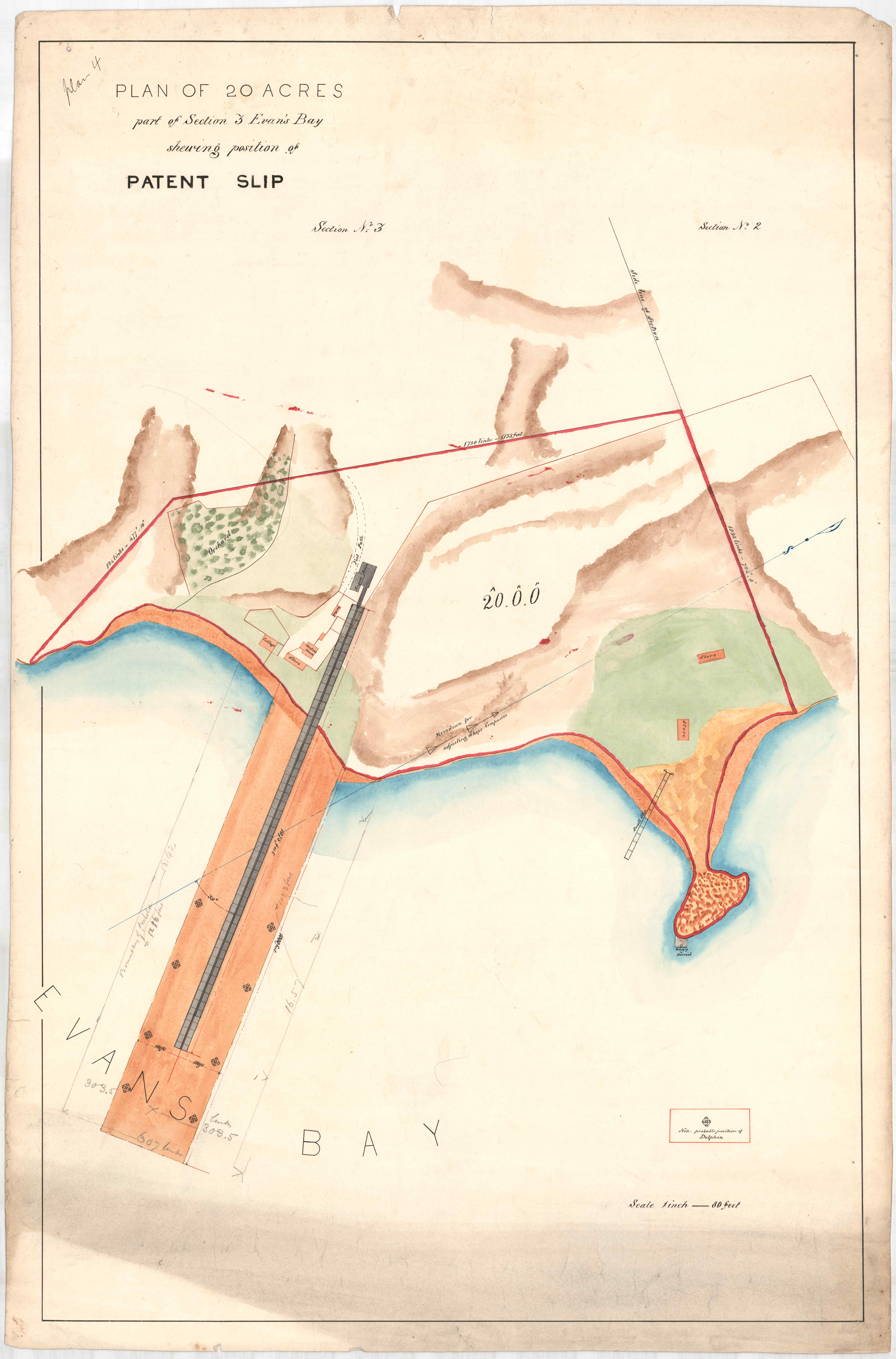
English: Coloured map showing coastline and location of patent slip. |
| Date | between 1868 and 1878 |
| Source | Wellington City Council Archives AF090-442: https://archivesonline.wcc.govt.nz/nodes/view/787690 |
| Author | unknown, Employee of Wellington Patent Slip Company |
"No Known Copyright To the best of Wellington City Archives knowledge, under New Zealand law: • there is no copyright or other intellectual property rights for this item in New Zealand; and • it may be copied and otherwise re-used in New Zealand without copyright or other intellectual property right related restriction."
Licensing
|
This work is in the public domain in its country of origin and other countries and areas where the copyright term is the author's life plus 70 years or fewer. This work is in the public domain in the United States because it was published (or registered with the U.S. Copyright Office) before January 1, 1929. | |
| This file has been identified as being free of known restrictions under copyright law, including all related and neighboring rights. | |
File history
Click on a date/time to view the file as it appeared at that time.
| Date/Time | Thumbnail | Dimensions | User | Comment | |
|---|---|---|---|---|---|
| current | 18:18, 3 November 2022 | | 5,031 × 7,626 (19.01 MB) | Wainuiomartian | Uploaded a work by unknown, Employee of Wellington Patent Slip Company from Wellington City Council Archives AF090-442: https://archivesonline.wcc.govt.nz/nodes/view/787690 with UploadWizard |