
File:Map of Corregidor 1941.jpg
Size of this preview: 800 × 481 pixels. Other resolutions: 320 × 192 pixels | 640 × 384 pixels | 1,024 × 615 pixels | 1,280 × 769 pixels | 2,066 × 1,241 pixels.
Original file (2,066 × 1,241 pixels, file size: 368 KB, MIME type: image/jpeg)
| This is a file from the Wikimedia Commons. Information from its description page there is shown below. Commons is a freely licensed media file repository. You can help. |


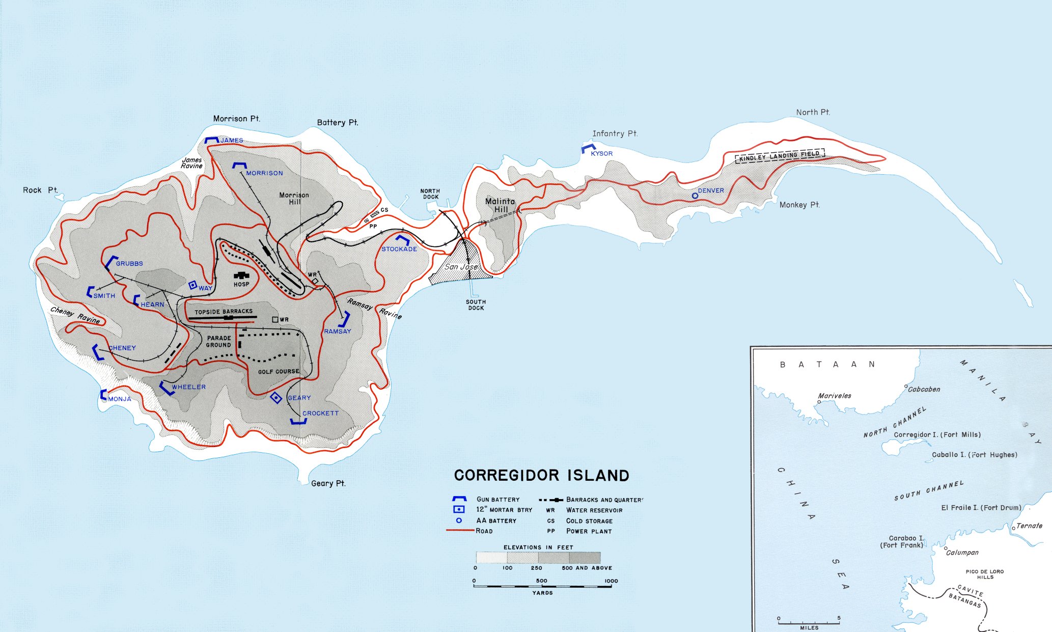
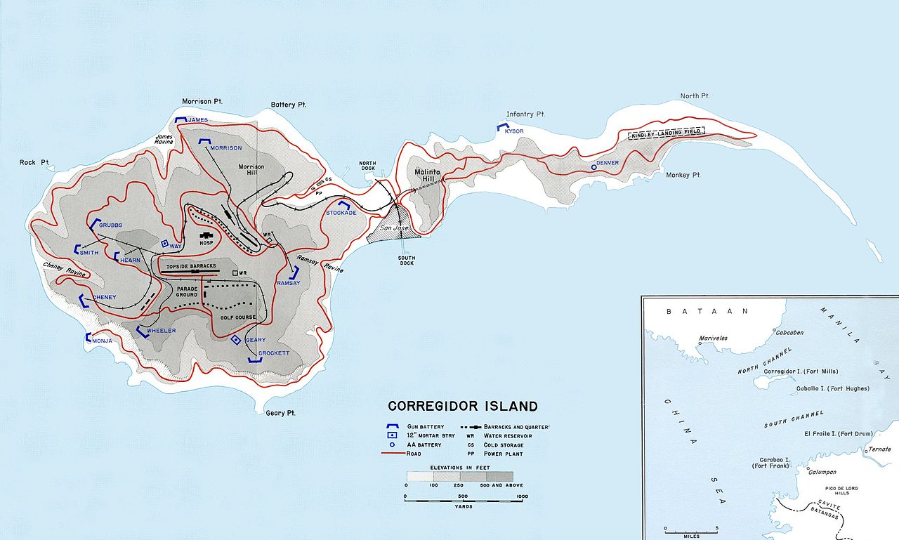
Map of Corregidor island in 1941.
![[1]](http://www.army.mil/cmh/books/wwii/5-2/Notes/Map23.jpg)
This file is a work of a U.S. Army soldier or employee, taken or made as part of that person's official duties. As a work of the U.S. federal government, it is in the public domain in the United States.
|
 |
File history
Click on a date/time to view the file as it appeared at that time.
| Date/Time | Thumbnail | Dimensions | User | Comment | |
|---|---|---|---|---|---|
| current | 03:03, 22 August 2006 | | 2,066 × 1,241 (368 KB) | Balcer~commonswiki | Map of Corregidor island in 1941. Source: [http://www.army.mil/cmh/books/wwii/5-2/Notes/Map23.jpg] [http://www.army.mil/cmh/books/wwii/5-2/5-2_Contents.htm] {{PD-USGov-Military-Army}} Category:Maps of World War II in the Pacific |
File usage
The following pages on the English Wikipedia use this file (pages on other projects are not listed):
- Battle of Corregidor
- Corregidor
- Fort Frank
- Fort Hughes
- Fort Mills
- Harbor Defenses of Manila and Subic Bays
- List of islands of the Philippines
- Naval Base Manila
- Philippines campaign (1941–1942)
- United States naval bases in the Philippines
- User:Longcake Higad/Trams in the Philippines
- Wikipedia:WikiProject Military history/News/August 2021/Op-ed
- Portal:Islands
Global file usage
The following other wikis use this file:
- Usage on azb.wikipedia.org
- Usage on bcl.wikipedia.org
- Usage on bjn.wikipedia.org
- Usage on ceb.wikipedia.org
- Usage on cs.wikipedia.org
- Usage on da.wikipedia.org
- Usage on de.wikipedia.org
- Usage on eo.wikipedia.org
- Usage on es.wikipedia.org
- Usage on fa.wikipedia.org
- Usage on fr.wikipedia.org
- Usage on id.wikipedia.org
- Usage on ilo.wikipedia.org
- Usage on io.wikipedia.org
- Usage on it.wikipedia.org
- Usage on ka.wikipedia.org
- Usage on ko.wikipedia.org
- Usage on ms.wikipedia.org
- Usage on nl.wikipedia.org
- Usage on no.wikipedia.org
- Usage on pag.wikipedia.org
- Usage on pl.wikipedia.org
- Usage on sr.wikipedia.org
- Usage on th.wikipedia.org
- Usage on tl.wikipedia.org
- Usage on uk.wikipedia.org
- Usage on www.wikidata.org