
File:Map of Avoca River.svg

Size of this PNG preview of this SVG file: 464 × 599 pixels. Other resolutions: 186 × 240 pixels | 372 × 480 pixels | 595 × 768 pixels | 793 × 1,024 pixels | 1,586 × 2,048 pixels | 804 × 1,038 pixels.
Original file (SVG file, nominally 804 × 1,038 pixels, file size: 3.5 MB)
| This is a file from the Wikimedia Commons. Information from its description page there is shown below. Commons is a freely licensed media file repository. You can help. |
| Description |
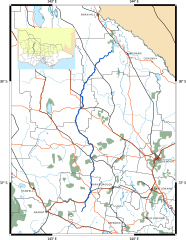
English: A map of the Avoca River in Victoria
Avoca River
Creeks and other rivers
Local government and state boundaries
Railways
Highways
Murray–Darling Basin (in inset)
Parks
Lakes and sea
Urban areas
|
||
| Date | |||
| Source | Own work | ||
| Author | Cassowary |

File history
Click on a date/time to view the file as it appeared at that time.
| Date/Time | Thumbnail | Dimensions | User | Comment | |
|---|---|---|---|---|---|
| current | 16:52, 12 February 2011 | | 804 × 1,038 (3.5 MB) | Cassowary | {{Information |Description ={{en|1=A map of the Avoca River in Victoria {{gfdl|migration=not-eligible}}}} |Source ={{own}} |Author =Cassowary |Date =2011-02-12 |Permission = |other_versions = }} |
File usage
The following pages on the English Wikipedia use this file (pages on other projects are not listed):
Global file usage
The following other wikis use this file:
- Usage on de.wikipedia.org
- Usage on fr.wikipedia.org
- Usage on www.wikidata.org