
File:Map of Alaska highlighting Kenai Peninsula Borough.svg

Size of this PNG preview of this SVG file: 800 × 423 pixels. Other resolutions: 320 × 169 pixels | 640 × 338 pixels | 1,024 × 541 pixels | 1,280 × 677 pixels | 2,560 × 1,353 pixels | 1,470 × 777 pixels.
Original file (SVG file, nominally 1,470 × 777 pixels, file size: 338 KB)
| This is a file from the Wikimedia Commons. Information from its description page there is shown below. Commons is a freely licensed media file repository. You can help. |
Summary
| Description |
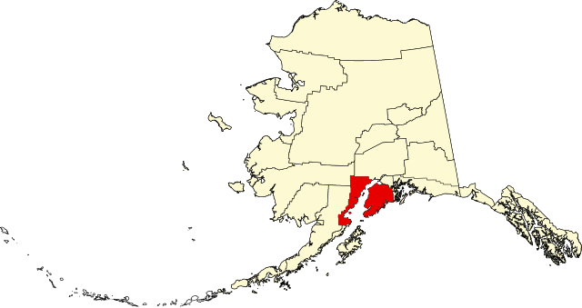
English: This is a locator map showing Kenai Peninsula Borough in Alaska |
| Date | |
| Source |
Own work: English: The maps use data from nationalatlas.gov, specifically countyp020.tar.gz on the Raw Data Download page. The maps also use state outline data from statesp020.tar.gz. The Florida maps use hydrogm020.tar.gz to display Lake Okeechobee. |
| Author | David Benbennick |
Licensing
| I, the copyright holder of this work, release this work into the public domain. This applies worldwide. In some countries this may not be legally possible; if so: I grant anyone the right to use this work for any purpose, without any conditions, unless such conditions are required by law. |
File history
Click on a date/time to view the file as it appeared at that time.
| Date/Time | Thumbnail | Dimensions | User | Comment | |
|---|---|---|---|---|---|
| current | 19:26, 5 March 2006 | | 1,470 × 777 (338 KB) | David Benbennick | {{subst:User:Dbenbenn/clm|county=Kenai Peninsula Borough|state=Alaska|type=borough and census area}} |
File usage
More than 100 pages use this file. The following list shows the first 100 pages that use this file only. A full list is available.
- Aialik Glacier
- Anchor Point, Alaska
- Anchor River
- Bear Creek, Alaska
- Bear Lake (Alaska)
- Beluga, Alaska
- Brown & Hawkins Store
- Chakachatna River
- Chigmit Mountains
- Chiswell Islands
- Clam Gulch, Alaska
- Cohoe, Alaska
- Cook Inlet Aquaculture Association
- Cooper Landing, Alaska
- Cooper Landing Post Office
- Coral Seymour Memorial Ballpark
- Crescent Lake (Alaska)
- Crown Point, Alaska
- Diamond Ridge, Alaska
- Fourpeaked Glacier
- Fox River, Alaska
- Fox River (Alaska)
- Fritz Creek, Alaska
- Funny River, Alaska
- Grewingk Glacier
- Halibut Cove, Alaska
- Happy Valley, Alaska
- Hoben Park
- Holy Transfiguration of Our Lord Chapel
- Homer, Alaska
- Homer Brewing Company
- Homer News
- Homer Tribune
- Hope, Alaska
- Johnson Pass
- Kachemak, Alaska
- Kachemak Bay National Estuarine Research Reserve
- Kachemak Bay State Park
- Kachemak Selo, Alaska
- Kalgin Island
- Kalifornsky, Alaska
- Kamishak Bay
- Kasilof, Alaska
- Kasilof River
- Kenai, Alaska
- Kenai Lake
- Kenai Mountains
- Kenai Peninsula
- Kenai Peninsula Borough, Alaska
- List of boroughs and census areas in Alaska
- Lowell Point, Alaska
- Martin River
- McCarty Glacier
- Moose Pass, Alaska
- Mount Iliamna
- Mount Marathon
- Mount Neacola
- Mount Torbert
- Nanwalek, Alaska
- Nanwalek Airport
- National Register of Historic Places listings in Kenai Peninsula Borough, Alaska
- Nikiski, Alaska
- Nikolaevsk, Alaska
- Ninilchik, Alaska
- Ninilchik River
- Nuka Island
- Peninsula Clarion
- Port Graham, Alaska
- Portage Glacier
- Primrose, Alaska
- Razdolna, Alaska
- Ridgeway, Alaska
- Rocky River (Alaska)
- Russian River (Alaska)
- Salamatof, Alaska
- Sargent Icefield
- Seldovia, Alaska
- Seldovia Airport
- Seldovia Village, Alaska
- Seward, Alaska
- Sixmile Creek (Alaska)
- Skilak Lake
- Snow River
- Soldotna, Alaska
- St. Nicholas Chapel (Seldovia, Alaska)
- St. Peter's Episcopal Church (Seward, Alaska)
- Sterling, Alaska
- Sts. Sergius and Herman of Valaam Church
- Sunrise, Alaska
- Tordrillo Mountains
- Trail Creek (Alaska)
- Trail Lakes
- Turnagain Pass
- Tustumena Glacier
- Tustumena Lake
- Tyonek, Alaska
- Voznesenka, Alaska
- User:Nyttend/County templates/AK
- Wikipedia:WikiProject Alaska
- Template:KenaiPeninsulaAK-geo-stub
View more links to this file.
Global file usage
The following other wikis use this file:
- Usage on ar.wikipedia.org
- Usage on bpy.wikipedia.org
- Usage on ca.wikipedia.org
- Kachemak
- Anchor Point (Alaska)
- Bear Creek (Alaska)
- Clam Gulch
- Cohoe
- Cooper Landing
- Crown Point (Alaska)
- Diamond Ridge
- Fox River
- Fritz Creek
- Funny River
- Halibut Cove
- Happy Valley (Alaska)
- Homer (Alaska)
- Hope (Alaska)
- Kalifornsky
- Kasilof
- Kenai (ciutat d'Alaska)
- Lowell Point
- Miller Landing
- Moose Pass
- Nanwalek
- Nikiski
- Nikolaevsk
- Ninilchik
- Port Graham
- Primrose (Alaska)
- Ridgeway (Alaska)
- Salamatof
- Seldovia
- Seldovia Village
- Seward (Alaska)
- Soldotna
- Sterling (Alaska)
- Sunrise (Alaska)
- Tyonek
- Plantilla:Borough de la Península de Kenai
- Llista de boroughs i àrees censals d'Alaska
- Usage on ceb.wikipedia.org
- Usage on ce.wikipedia.org
- Usage on cy.wikipedia.org
- Usage on da.wikipedia.org
- Usage on de.wikipedia.org
- Usage on es.wikipedia.org
- Usage on fi.wikipedia.org
View more global usage of this file.