
File:Manea Railway Station - geograph.org.uk - 1929644.jpg
Manea_Railway_Station_-_geograph.org.uk_-_1929644.jpg (800 × 531 pixels, file size: 147 KB, MIME type: image/jpeg)
| This is a file from the Wikimedia Commons. Information from its description page there is shown below. Commons is a freely licensed media file repository. You can help. |
Summary
| Description |
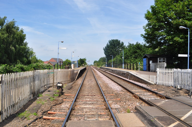
English: Manea Railway Station, near to Manea, Cambridgeshire, Great Britain.
Manea is 9� miles west of Ely and the only survivor of the four stations that once served fenland communities between Ely and March. Historically the main significance of the station was its agricultural traffic. |
| Date | |
| Source | From geograph.org.uk; transferred by User:Rubberstamp using geograph_org2commons. |
| Author | Ashley Dace |
| Permission (Reusing this file) |
Creative Commons Attribution Share-alike license 2.0 |
| Attribution (required by the license) | Ashley Dace / Manea Railway Station / |
| Camera location | | View this and other nearby images on: OpenStreetMap |
|---|
| Object location | | View this and other nearby images on: OpenStreetMap |
|---|
_region:GB-GBN_heading:315.00&language=en)
Licensing

|
This image was taken from the Geograph project collection. See this photograph's page on the Geograph website for the photographer's contact details. The copyright on this image is owned by Ashley Dace and is licensed for reuse under the Creative Commons Attribution-ShareAlike 2.0 license.
|
- You are free:
- to share – to copy, distribute and transmit the work
- to remix – to adapt the work
- Under the following conditions:
- attribution – You must give appropriate credit, provide a link to the license, and indicate if changes were made. You may do so in any reasonable manner, but not in any way that suggests the licensor endorses you or your use.
- share alike – If you remix, transform, or build upon the material, you must distribute your contributions under the same or compatible license as the original.
File history
Click on a date/time to view the file as it appeared at that time.
| Date/Time | Thumbnail | Dimensions | User | Comment | |
|---|---|---|---|---|---|
| current | 10:42, 29 July 2010 | | 800 × 531 (147 KB) | File Upload Bot (Magnus Manske) | == {{int:filedesc}} == {{Information |Description={{en|1=Manea Railway Station, near to Manea, Cambridgeshire, Great Britain. Manea is 9� miles west of Ely and the only survivor of the four stations that once served fenland communities between Ely and M |
File usage
Global file usage
The following other wikis use this file:
- Usage on arz.wikipedia.org
- Usage on nl.wikipedia.org
- Usage on www.wikidata.org