
File:M-29 in 1919.png
Size of this preview: 496 × 600 pixels. Other resolutions: 198 × 240 pixels | 583 × 705 pixels.
Original file (583 × 705 pixels, file size: 948 KB, MIME type: image/png)
| This is a file from the Wikimedia Commons. Information from its description page there is shown below. Commons is a freely licensed media file repository. You can help. |
Summary
| Description |
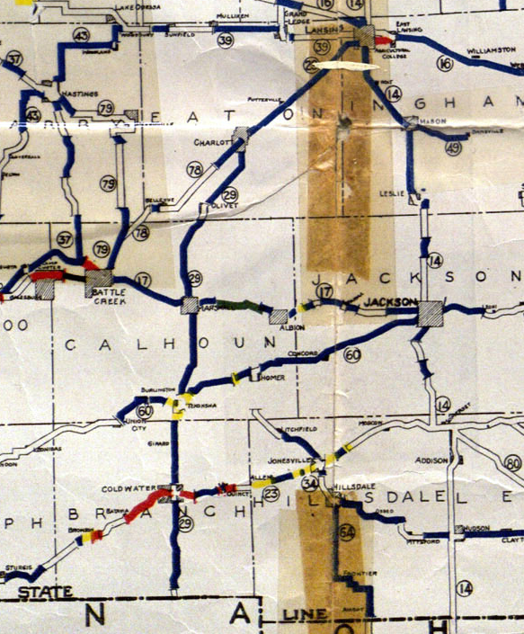
English: Map of the central southern area of the Lower Peninsula showing the route of M-29 in 1919 |
| Date | |
| Source | Michigan State Highway Department (July 1, 1919). State of Michigan: Lower Peninsula (Map). Cartography by MSHD. |
| Author | Michigan State Highway Department |
Licensing
This work is in the public domain in the United States because it was published (or registered with the U.S. Copyright Office) before January 1, 1929.
|
File history
Click on a date/time to view the file as it appeared at that time.
| Date/Time | Thumbnail | Dimensions | User | Comment | |
|---|---|---|---|---|---|
| current | 06:53, 12 October 2014 | | 583 × 705 (948 KB) | Imzadi1979 | User created page with UploadWizard |
File usage
The following pages on the English Wikipedia use this file (pages on other projects are not listed):