
File:Luxapalila Creek Columbus Mississippi.jpg
Size of this preview: 404 × 599 pixels. Other resolutions: 162 × 240 pixels | 323 × 480 pixels | 1,011 × 1,500 pixels.
Original file (1,011 × 1,500 pixels, file size: 1,017 KB, MIME type: image/jpeg)
| This is a file from the Wikimedia Commons. Information from its description page there is shown below. Commons is a freely licensed media file repository. You can help. |
| Description |
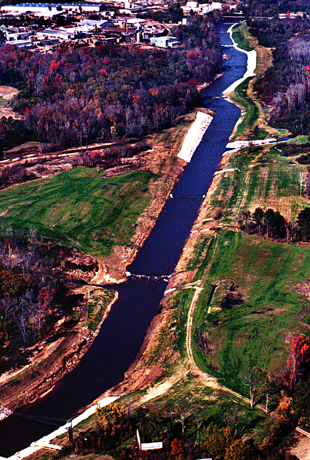
English: Aerial view of the Luxapalila Creek running through the center of Columbus, Mississippi, USA. Propst Park lies on the left side of the creek in this photograph. The Tuscaloosa Road bridge is visible at the top of the picture. The U.S. Army Corps of Engineers has constructed a flood-control project on the creek. View is upstream to the north. Note that the source photograph on the U.S. Army Corps of Engineers website has been erroneously placed in Milport, Alabama.
Coordinates: 33°30′6.57″N 88°23′32.45″W / 33.501825°N 88.3923472°W |
|||
| Location | Columbus, Mississippi, USA | |||
| Date | (Caveat: Dates provided by U.S. Army Corps of Engineers Digital Visual Library are not reliable and may be wrong.) | |||
| Source |
U.S. Army Corps of Engineers Digital Visual Library Image page Image description page Digital Visual Library home page |
|||
| Author | Adrien Lamarre, U.S. Army Corps of Engineers | |||
| Permission (Reusing this file) |
|
File history
Click on a date/time to view the file as it appeared at that time.
| Date/Time | Thumbnail | Dimensions | User | Comment | |
|---|---|---|---|---|---|
| current | 20:02, 29 April 2007 | | 1,011 × 1,500 (1,017 KB) | DanMS | {{Information | Description = {{en|Aerial view of the Luxapalila Creek running through the center of Columbus, Mississippi, USA. Propst Park lies on the left side of the creek in this photograph. The Tuscaloosa Road bridge is visible at the top of the |
File usage
The following pages on the English Wikipedia use this file (pages on other projects are not listed):
Global file usage
The following other wikis use this file:
- Usage on zh.wikipedia.org