
File:Longhoughton railway station (site), Northumberland (geograph 5912726).jpg
Size of this preview: 800 × 600 pixels. Other resolutions: 320 × 240 pixels | 640 × 480 pixels | 1,024 × 768 pixels | 1,280 × 960 pixels | 1,600 × 1,200 pixels.
Original file (1,600 × 1,200 pixels, file size: 617 KB, MIME type: image/jpeg)
| This is a file from the Wikimedia Commons. Information from its description page there is shown below. Commons is a freely licensed media file repository. You can help. |
,_Northumberland_(geograph_5912726).jpg)
Summary
| Description |
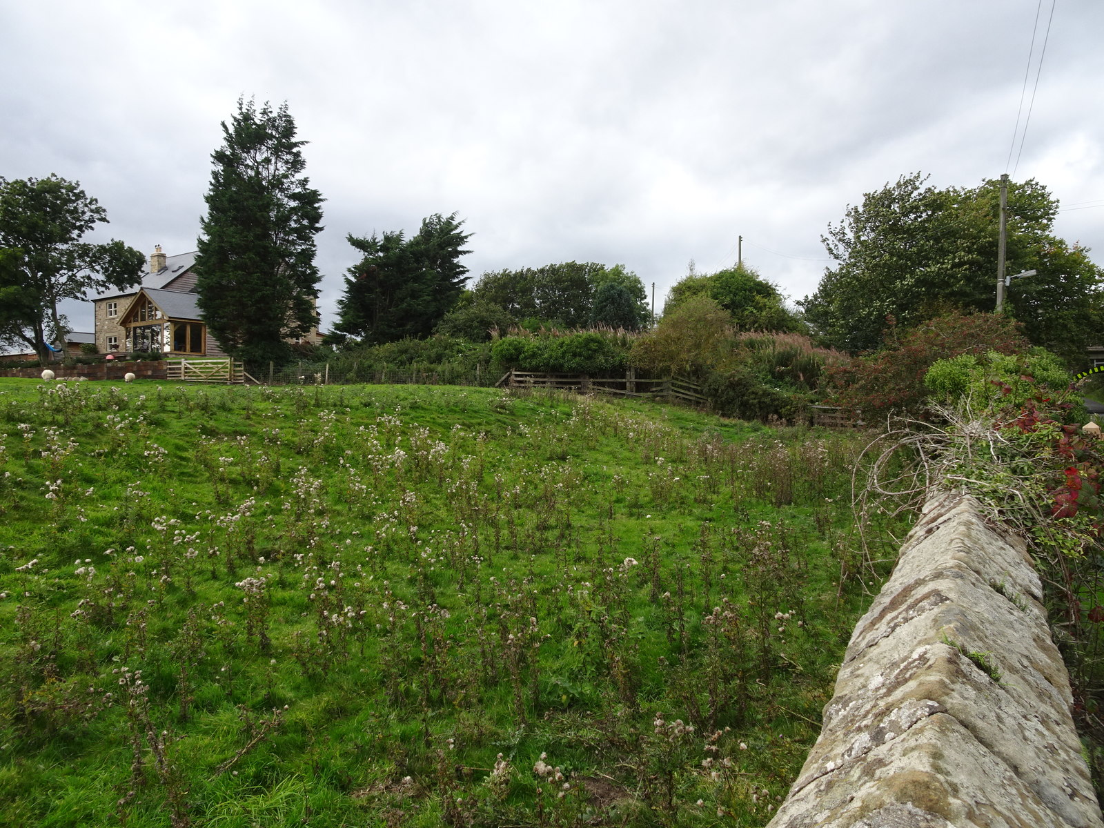
English: Longhoughton railway station (site), Northumberland Opened in 1847 by the Newcastle & Berwick Railway, later part of the North Eastern Railway, this station closed temporarily to passengers 1941-1946, and then permanently in 1962. View west from the road, with the station approach road running uphill behind the hedge. The station would have been just behind the more modern building on the site, no trace is believed to exist. A bridge carrying the railway over a road can be seen far right. |
| Date | |
| Source | From geograph.org.uk |
| Author | Nigel Thompson |
| Permission (Reusing this file) |
Creative Commons Attribution Share-alike license 2.0 |
| Attribution (required by the license) | Nigel Thompson / Longhoughton railway station (site), Northumberland / |
| Camera location | | View this and other nearby images on: OpenStreetMap |
|---|
,_Northumberland_(geograph_5912726).jpg¶ms=055.428041_N_-001.620592_E_globe:Earth_type:camera_source:geograph-osgb36(NU24111497)_heading:247.00&language=en)
| Object location | | View this and other nearby images on: OpenStreetMap |
|---|
,_Northumberland_(geograph_5912726).jpg¶ms=055.427600_N_-001.622180_E_globe:Earth_class:object_type:object_source:geograph-osgb36(NU24011492)_heading:247.00&language=en)
Licensing

|
This image was taken from the Geograph project collection. See this photograph's page on the Geograph website for the photographer's contact details. The copyright on this image is owned by Nigel Thompson and is licensed for reuse under the Creative Commons Attribution-ShareAlike 2.0 license.
|
This file is licensed under the Creative Commons Attribution-Share Alike 2.0 Generic license.
Attribution: Nigel Thompson
- You are free:
- to share – to copy, distribute and transmit the work
- to remix – to adapt the work
- Under the following conditions:
- attribution – You must give appropriate credit, provide a link to the license, and indicate if changes were made. You may do so in any reasonable manner, but not in any way that suggests the licensor endorses you or your use.
- share alike – If you remix, transform, or build upon the material, you must distribute your contributions under the same or compatible license as the original.
File history
Click on a date/time to view the file as it appeared at that time.
| Date/Time | Thumbnail | Dimensions | User | Comment | |
|---|---|---|---|---|---|
| current | 18:50, 31 December 2019 | | 1,600 × 1,200 (617 KB) | Lamberhurst | == {{int:filedesc}} == {{Information |Description={{en|1=Longhoughton railway station (site), Northumberland}} |Source=From [http://www.geograph.org.uk/photo/5912726 geograph.org.uk] |Date=2018-09-19 |Author=[http://www.geograph.org.uk/profile/84225 Nigel Thompson] |Permission=Creative Commons Attribution Share-alike license 2.0 |Other fields={{Credit line |Author=Nigel Thompson |License=[https://creativecommons.org/licenses/by-sa/2.0/ CC BY-SA 2.0] |Other=''Longhoughton railway station (s... |
File usage
The following pages on the English Wikipedia use this file (pages on other projects are not listed):
,_Northumberland_(geograph_5912726).jpg)