
File:Lone Jack Battlefield Missouri.jpg
Size of this preview: 777 × 600 pixels. Other resolutions: 311 × 240 pixels | 622 × 480 pixels | 995 × 768 pixels | 1,280 × 988 pixels | 1,840 × 1,420 pixels.
Original file (1,840 × 1,420 pixels, file size: 1.17 MB, MIME type: image/jpeg)
| This is a file from the Wikimedia Commons. Information from its description page there is shown below. Commons is a freely licensed media file repository. You can help. |
Summary
| Description |
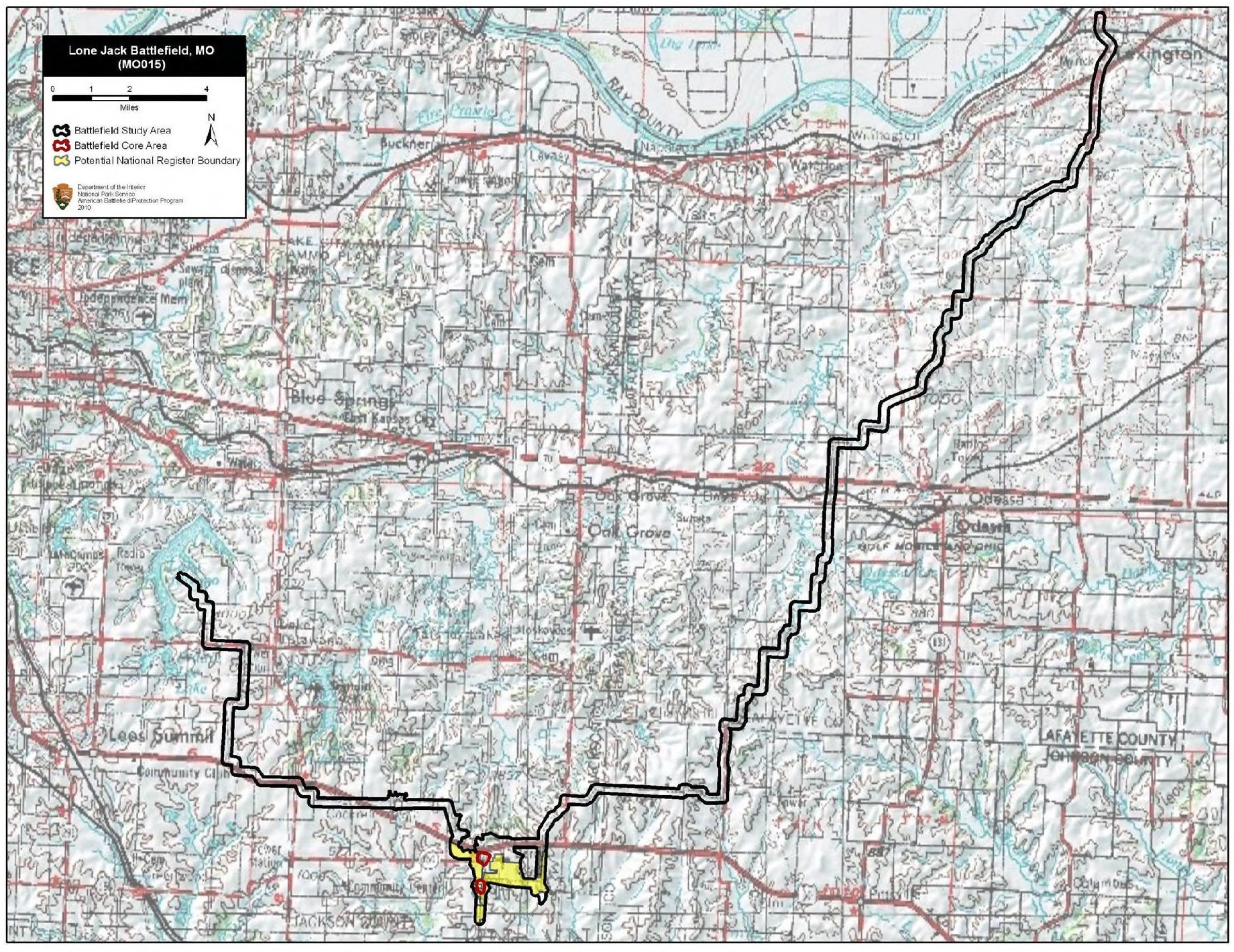
English: Map of battlefield core and study areas. The ABPP expanded the 1993 Study Area to include the Federal approach route (and later retreat route) from Lexington, and the Confederate camps, approach route, and retreat route associated with the action on the 16th. The Study Area was also adjusted to accommodate a new Core Area (see below). The 1993 Core Area was amended to reflect more accurately the size of the engagement south of Lone Jack and to include the location where Federal forces fought to break away from the battle on the east side of the battlefield. South of the original Core Area, the ABPP mapped a new Core Area to represent the area of the Federal attack on Colonel Coffee's camp on the 15th. |
| Date | |
| Source | National Park Service |
| Author | American Battlefield Protection Program |
Licensing
| This image or media file contains material based on a work of a National Park Service employee, created as part of that person's official duties. As a work of the U.S. federal government, such work is in the public domain in the United States. See the NPS website and NPS copyright policy for more information. |
File history
Click on a date/time to view the file as it appeared at that time.
| Date/Time | Thumbnail | Dimensions | User | Comment | |
|---|---|---|---|---|---|
| current | 21:59, 14 August 2017 | | 1,840 × 1,420 (1.17 MB) | SDriskell | User created page with UploadWizard |
File usage
The following pages on the English Wikipedia use this file (pages on other projects are not listed):
Global file usage
The following other wikis use this file:
- Usage on en.wikivoyage.org
- Usage on www.wikidata.org