
File:Lock keeper's tower at Gailey, Staffordshire - geograph.org.uk - 1577107.jpg
Size of this preview: 425 × 599 pixels. Other resolutions: 170 × 240 pixels | 454 × 640 pixels.
Original file (454 × 640 pixels, file size: 148 KB, MIME type: image/jpeg)
| This is a file from the Wikimedia Commons. Information from its description page there is shown below. Commons is a freely licensed media file repository. You can help. |
Summary
| Description |
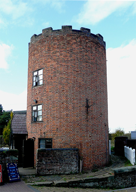
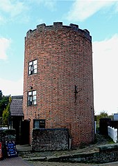
English: Lock keeper's tower at Gailey, Staffordshire On the Staffordshire and Worcestershire Canal this toll keeper's watch tower was necessary because the view northwards along the canal was obscured from the lock-side by Gailey Bridge (No 79) carrying Watling Street (now the A5). The lock here is at the northern end of the canal's summit pound (about ten miles to Compton Lock, Wolverhampton).
The building now houses a souvenir and ice-cream shop. |
| Date | |
| Source | From geograph.org.uk |
| Author | Roger Kidd |
| Attribution (required by the license) | Roger Kidd / Lock keeper's tower at Gailey, Staffordshire / |
| Camera location | | View this and other nearby images on: OpenStreetMap |
|---|
_heading:270.00&language=en)
| Object location | | View this and other nearby images on: OpenStreetMap |
|---|
_heading:270.00&language=en)
Licensing

|
This image was taken from the Geograph project collection. See this photograph's page on the Geograph website for the photographer's contact details. The copyright on this image is owned by Roger Kidd and is licensed for reuse under the Creative Commons Attribution-ShareAlike 2.0 license.
|
This file is licensed under the Creative Commons Attribution-Share Alike 2.0 Generic license.
Attribution: Roger Kidd
- You are free:
- to share – to copy, distribute and transmit the work
- to remix – to adapt the work
- Under the following conditions:
- attribution – You must give appropriate credit, provide a link to the license, and indicate if changes were made. You may do so in any reasonable manner, but not in any way that suggests the licensor endorses you or your use.
- share alike – If you remix, transform, or build upon the material, you must distribute your contributions under the same or compatible license as the original.
File history
Click on a date/time to view the file as it appeared at that time.
| Date/Time | Thumbnail | Dimensions | User | Comment | |
|---|---|---|---|---|---|
| current | 20:49, 3 March 2011 | | 454 × 640 (148 KB) | GeographBot | == {{int:filedesc}} == {{Information |description={{en|1=Lock keeper's tower at Gailey, Staffordshire On the Staffordshire and Worcestershire Canal this toll keeper's watch tower was necessary because the view northwards along the canal was obscured from |
File usage
The following pages on the English Wikipedia use this file (pages on other projects are not listed):
Global file usage
The following other wikis use this file: