
File:Locations of UMNH VP16420 & MSM P2117.png
Size of this preview: 563 × 599 pixels. Other resolutions: 225 × 240 pixels | 451 × 480 pixels | 722 × 768 pixels | 1,153 × 1,227 pixels.
Original file (1,153 × 1,227 pixels, file size: 265 KB, MIME type: image/png)
| This is a file from the Wikimedia Commons. Information from its description page there is shown below. Commons is a freely licensed media file repository. You can help. |
Summary
| Description |
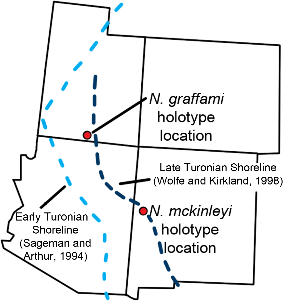
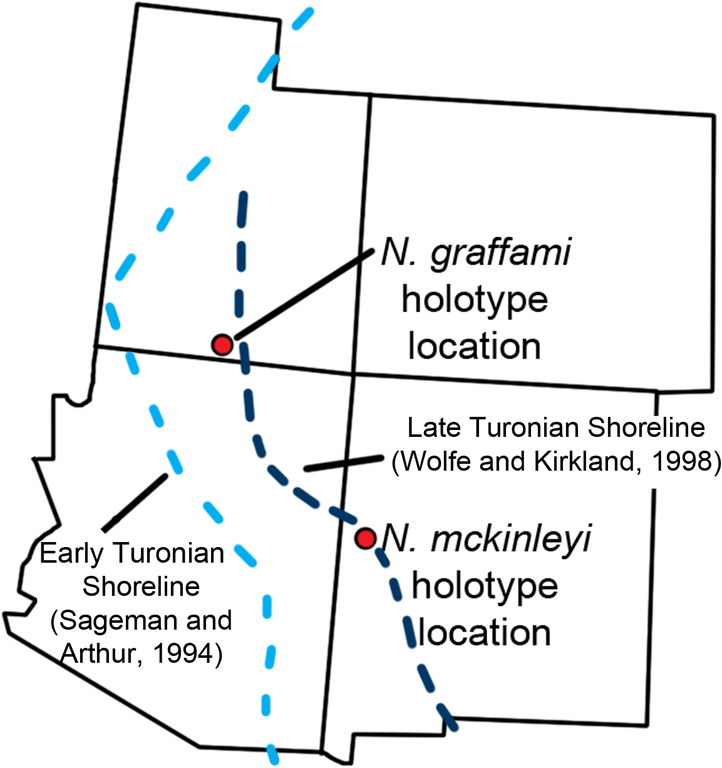
English: Location map. The locations of the quarries producing UMNH VP16420 and MSM P2117 with US states overlaid. This is in relation to the estimated Turonian shoreline (light blue shoreline based on Sageman and Arthur 1994; dark blue shoreline based on Wolfe and Kirkland 1998). The shoreline reconstructed by Sageman and Arthur 1994 is based on the early Turonian and that by Wolfe and Kirkland 1998 is for the late Turonian demonstrating a regression of the Western Interior Seaway during the Turonian. This shows that during the early Turonian UMNH VP16420 was offshore. |
||
| Date | |||
| Source | (2015). "The Slothful Claw: Osteology and Taphonomy of Nothronychus mckinleyi and N. graffami (Dinosauria: Theropoda) and Anatomical Considerations for Derived Therizinosaurids". PLOS ONE 10 (6): e0129449. DOI:10.1371/journal.pone.0129449. PMID 26061728. PMC: 4465624. | ||
| Author | Brandon P. Hedrick, Lindsay E. Zanno, Douglas G. Wolfe & Peter Dodson | ||
| Permission (Reusing this file) |
|
Licensing
This file is licensed under the Creative Commons Attribution 4.0 International license.
- You are free:
- to share – to copy, distribute and transmit the work
- to remix – to adapt the work
- Under the following conditions:
- attribution – You must give appropriate credit, provide a link to the license, and indicate if changes were made. You may do so in any reasonable manner, but not in any way that suggests the licensor endorses you or your use.
File history
Click on a date/time to view the file as it appeared at that time.
| Date/Time | Thumbnail | Dimensions | User | Comment | |
|---|---|---|---|---|---|
| current | 17:16, 16 August 2020 | | 1,153 × 1,227 (265 KB) | PaleoNeolitic | {{Information |description ={{en|1='''Location map.''' The locations of the quarries producing UMNH VP16420 and MSM P2117 with US states overlaid. This is in relation to the estimated Turonian shoreline (light blue shoreline based on Sageman and Arthur 1994; dark blue shoreline based on Wolfe and Kirkland 1998). The shoreline reconstructed by Sageman and Arthur 1994 is based on the early Turonian and that by Wolfe and Kirkland 1998 is for the late Turonian demonstrating a regression of the... |
File usage
The following pages on the English Wikipedia use this file (pages on other projects are not listed):
Global file usage
The following other wikis use this file:
- Usage on nl.wikipedia.org