
File:Location map Netherlands Greater Amsterdam.png

Size of this preview: 626 × 600 pixels. Other resolutions: 250 × 240 pixels | 501 × 480 pixels | 769 × 737 pixels.
Original file (769 × 737 pixels, file size: 667 KB, MIME type: image/png)
| This is a file from the Wikimedia Commons. Information from its description page there is shown below. Commons is a freely licensed media file repository. You can help. |
| Description |
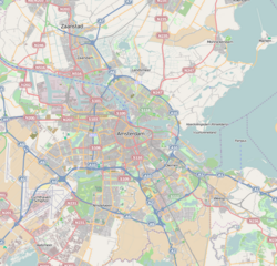
English: Map of Amsterdam
Geographic limits of the map:
This file is licensed under the Creative Commons Attribution-Share Alike 2.0 Generic license.
|
| Source | OpenStreetMap |
| Author | Dr. Blofeld |
File history
Click on a date/time to view the file as it appeared at that time.
| Date/Time | Thumbnail | Dimensions | User | Comment | |
|---|---|---|---|---|---|
| current | 11:39, 14 May 2010 | | 769 × 737 (667 KB) | Dr. Blofeld~commonswiki | {{Information |Description={{en|1=l}} |Source=l |Author=l |Date=l |Permission= |other_versions= }} |
File usage
The following pages on the English Wikipedia use this file (pages on other projects are not listed):
- 1928 Summer Olympics
- 2022–23 Vierde Divisie
- 2023–24 Vierde Divisie
- Amsterdam Airport Schiphol
- Amsterdam Zuid station
- Amsterdam derby
- Dijkgraafplein
- Football at the 1928 Summer Olympics
- Hilton Amsterdam
- IJ (Amsterdam)
- Ito-toren
- Museum Jan
- Museum tot zover
- Prinses Irenebuurt
- Rembrandtpark
- Tuindorp Oostzaan
- World of Ajax
- Zaans Museum
- Module:Location map/data/Netherlands Amsterdam Greater
- Module:Location map/data/Netherlands Amsterdam Greater/doc
Global file usage
The following other wikis use this file:
- Usage on ar.wikipedia.org
- Usage on bn.wikipedia.org
- Usage on ceb.wikipedia.org
- Usage on eu.wikipedia.org
- Usage on fa.wikipedia.org
- Usage on fr.wikipedia.org
- Musée d'Amsterdam
- Stadionplein
- Munttoren
- Palais royal d'Amsterdam
- Noorderkerk
- Oude Kerk d'Amsterdam
- Basilique Saint-Nicolas d'Amsterdam
- Leidseplein
- Place du Dam
- Museumplein
- Nieuwe Kerk d'Amsterdam
- Zuiderkerk (Amsterdam)
- Modèle:Géolocalisation/Amsterdam
- Spui (Amsterdam)
- Rembrandtplein
- Arbre d'Anne Frank
- Amsterdam-Centre
- Prinsengracht
- Église Moïse-et-Aaron
- Oudezijds Kolk
- RAI Amsterdam
- Consulat général de France à Amsterdam
- Amsterdam-Ouest
- Amsterdam-Est
- Amsterdam-Nord
- Amsterdam-Porte occidentale
- Singel (Amsterdam)
- Intronisation de Willem-Alexander
- Keizersgracht
- Herengracht
- Brouwersgracht
- Singelgracht
- Lijnbaansgracht
- Reguliersgracht
- Frederiksplein
- Waterlooplein
- Leidsegracht
- Plantage Muidergracht
- Muntplein (Amsterdam)
- Vijzelstraat
View more global usage of this file.