
File:Location map Kensington.png
Size of this preview: 549 × 599 pixels. Other resolutions: 220 × 240 pixels | 440 × 480 pixels | 829 × 905 pixels.
Original file (829 × 905 pixels, file size: 831 KB, MIME type: image/png)
| This is a file from the Wikimedia Commons. Information from its description page there is shown below. Commons is a freely licensed media file repository. You can help. |
| Description |
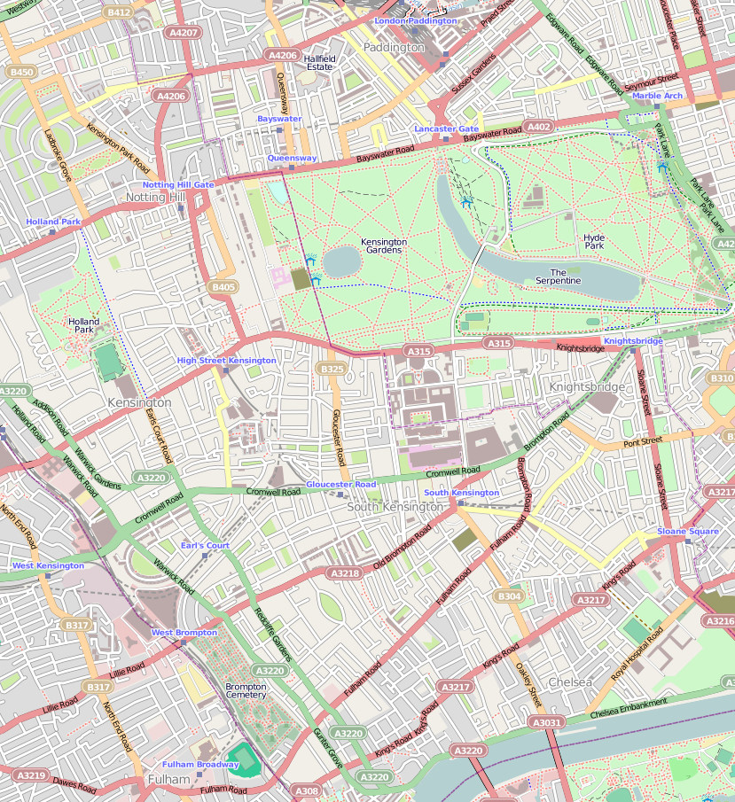
English: Map of Kensington, London
Geographic limits of the map:
|
| Date | |
| Source | OpenStreetMap |
| Author | OpenStreetMap, cropped by Dr. Blofeld |
| Permission (Reusing this file) |
This file is licensed under the Creative Commons Attribution-Share Alike 2.0 Generic license.
|
File history
Click on a date/time to view the file as it appeared at that time.
| Date/Time | Thumbnail | Dimensions | User | Comment | |
|---|---|---|---|---|---|
| current | 21:58, 7 October 2010 | | 829 × 905 (831 KB) | Blofeld Dr. | {{Information |Description={{en|1=f}} |Source=f |Author=f |Date=f |Permission= |other_versions= }} |
File usage
The following pages on the English Wikipedia use this file (pages on other projects are not listed):
- 13 Kensington Palace Gardens
- 27 Pembridge Gardens
- Abbey Court Hotel
- Baglioni Hotel
- Commonwealth Education Trust
- Earl's Court
- Kensington
- Kensington Gardens
- Kensington Palace
- Kensington Roof Gardens
- Radisson Blu Edwardian Vanderbilt Hotel
- San Lorenzo (restaurant)
- Spaghetti House siege
- Swan Inn
- The Bailey's Hotel
- The Bentley London
- The Carlton Tower Jumeirah
- User:Kcanz/sandbox
- Module:Location map/data/United Kingdom London Kensington
- Module:Location map/data/United Kingdom London Kensington/doc
Global file usage
The following other wikis use this file:
- Usage on ar.wikipedia.org
- Usage on azb.wikipedia.org
- Usage on be.wikipedia.org
- Usage on ceb.wikipedia.org
- Usage on es.wikipedia.org
- Usage on fa.wikipedia.org
- Usage on fr.wikipedia.org
- Usage on hy.wikipedia.org
- Usage on ja.wikipedia.org
- Usage on kn.wikipedia.org
- Usage on pl.wikipedia.org
- Usage on ro.wikipedia.org
- Usage on ru.wikipedia.org
- Usage on sco.wikipedia.org
- Usage on si.wikipedia.org
- Usage on tr.wikipedia.org
- Usage on ur.wikipedia.org
- Usage on vi.wikipedia.org
- Usage on war.wikipedia.org
- Usage on zh.wikipedia.org