
File:Location map Barcelona.png
Size of this preview: 689 × 600 pixels. Other resolutions: 276 × 240 pixels | 551 × 480 pixels | 919 × 800 pixels.
Original file (919 × 800 pixels, file size: 884 KB, MIME type: image/png)
| This is a file from the Wikimedia Commons. Information from its description page there is shown below. Commons is a freely licensed media file repository. You can help. |
Summary
| Description |
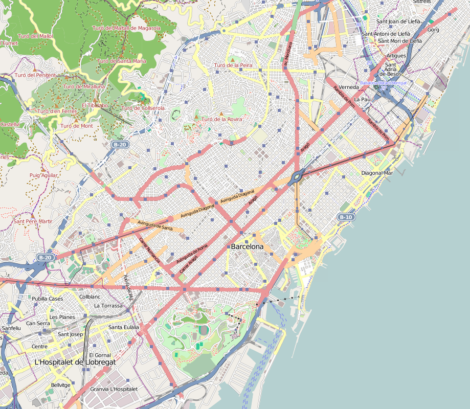
English: Map of Barcelona, Spain
Geographic limits of the map:
|
| Date | |
| Source | Maps for Free (OSM). |
| Author | Dr. Blofeld |
Licensing
This file is licensed under the Creative Commons Attribution-Share Alike 2.0 Generic license.
- You are free:
- to share – to copy, distribute and transmit the work
- to remix – to adapt the work
- Under the following conditions:
- attribution – You must give appropriate credit, provide a link to the license, and indicate if changes were made. You may do so in any reasonable manner, but not in any way that suggests the licensor endorses you or your use.
- share alike – If you remix, transform, or build upon the material, you must distribute your contributions under the same or compatible license as the original.
File history
Click on a date/time to view the file as it appeared at that time.
| Date/Time | Thumbnail | Dimensions | User | Comment | |
|---|---|---|---|---|---|
| current | 18:28, 30 May 2011 | | 919 × 800 (884 KB) | Blofeld Dr. | {{Information |Description ={{en|1=5}} |Source =5 |Author =5 |Date =5 |Permission = |other_versions = }} |
File usage
The following pages on the English Wikipedia use this file (pages on other projects are not listed):
- Arc de Triomf station
- Avinguda Carrilet station
- Barcelona Royal Shipyard
- Barcelona Sants railway station
- Basilica of Our Lady of Mercy
- Basilica of Saint Joseph Oriol
- Basilica of Saints Justus and Pastor
- Basilica of the Immaculate Conception (Barcelona)
- Bellvitge (Barcelona Metro)
- Bellvitge railway station
- Bordeta (Barcelona Metro)
- Can Serra station
- Can Tries – Gornal (Barcelona Metro)
- Canyelles station
- Casa Bonet (Barcelona)
- Casa Mulleras
- Correos (Barcelona Metro)
- Drassanes station
- Estació del Nord (Barcelona)
- FC Barcelona Museum
- Fernando (Barcelona Metro)
- Florida station (Barcelona)
- Foc (Barcelona Metro)
- Foneria (Barcelona Metro)
- Fontana metro station
- Glòries station
- Gorg station
- Hipercor bombing
- Hostafrancs station
- Hotel Arts
- Illa de la Discòrdia
- Institut Barcelona d'Estudis Internacionals
- Istituto Italiano Statale Comprensivo di Barcellona
- Jardí Botànic de Barcelona
- La Sagrera-Meridiana station
- Les Corts station
- Lesseps station
- Liceu station
- Madame Petit
- Maria Cristina station
- Marina station
- Mercat Nou station
- Montbau station
- Mossèn Costa i Llobera Gardens
- Mundet station
- Museu Frederic Marès
- Museu Geològic del Seminari de Barcelona
- Museu Nacional d'Art de Catalunya
- Museu Picasso
- Palau Nacional
- Palau Reial station
- Paral·lel station
- Parc de Montjuïc (Barcelona Metro)
- Passeig de Gràcia station
- Penitents station
- Plaça d'Espanya station
- Plaça de Catalunya station
- Plaça de Sants (Barcelona Metro)
- Plaça del Centre station
- Poble Sec station
- Provençana (Barcelona Metro)
- Provença–Diagonal station
- Rambla Just Oliveras station
- Rocafort station (Barcelona)
- Roquetes station
- Sagrada Família (Barcelona Metro)
- Sagrera railway station
- Santa Eulàlia station
- Santa Maria del Mar, Barcelona
- Sants Estació (Barcelona Metro)
- St George's Church, Barcelona
- Tarragona metro station
- Tibidabo
- Torrassa station
- Universitat (Barcelona Metro)
- Urgell station
- Urquinaona (Barcelona Metro)
- Vall d'Hebron station
- Vallcarca metro station
- Valldaura station
- Virreina Palace
- Zona Universitària station
- Module:Location map/data/Spain Barcelona
- Module:Location map/data/Spain Barcelona/doc
Global file usage
The following other wikis use this file:
- Usage on ar.wikipedia.org
- Usage on ast.wikipedia.org
- Usage on az.wikipedia.org
- Usage on ban.wikipedia.org
- Usage on be.wikipedia.org
- Usage on bg.wikipedia.org
- Usage on ca.wikipedia.org
- Usuari:Joancreus/Location maps
- Usuari:Pere prlpz/cobertura
- Usuari:PereBot/cobertura/Barcelona/ranking
- Usuari:PereBot/cobertura/Barcelona/ar
- Usuari:PereBot/cobertura/Barcelona/ca
- Usuari:PereBot/cobertura/Barcelona/de
- Usuari:PereBot/cobertura/Barcelona/en
- Usuari:PereBot/cobertura/Barcelona/es
- Usuari:PereBot/cobertura/Barcelona/fr
- Usuari:PereBot/cobertura/Barcelona/it
- Usuari:PereBot/cobertura/Barcelona/ja
- Usuari:PereBot/cobertura/Barcelona/nl
- Usuari:PereBot/cobertura/Barcelona/ru
- Usuari:PereBot/cobertura/Barcelona/zh
- Usuari:PereBot/cobertura/Barcelona/eu
- Usuari:PereBot/cobertura/Barcelona/gl
- Usuari:PereBot/cobertura/Barcelona/pl
- Usuari:PereBot/cobertura/Barcelona/pt
- Usuari:PereBot/cobertura/Barcelona/ro
- Tercera Divisió Espanyola 2017-18 - Grup V (Catalunya)
- Mòdul:Location map/data/Barcelona
- Mòdul:Location map/data/Barcelona/ús
- Usage on ceb.wikipedia.org
- Usage on eo.wikipedia.org
View more global usage of this file.