
File:Linschotens nordenkart, 1601 (12067624705).jpg
Original file (4,037 × 3,455 pixels, file size: 22.29 MB, MIME type: image/jpeg)
| This is a file from the Wikimedia Commons. Information from its description page there is shown below. Commons is a freely licensed media file repository. You can help. |
Summary
| Description |
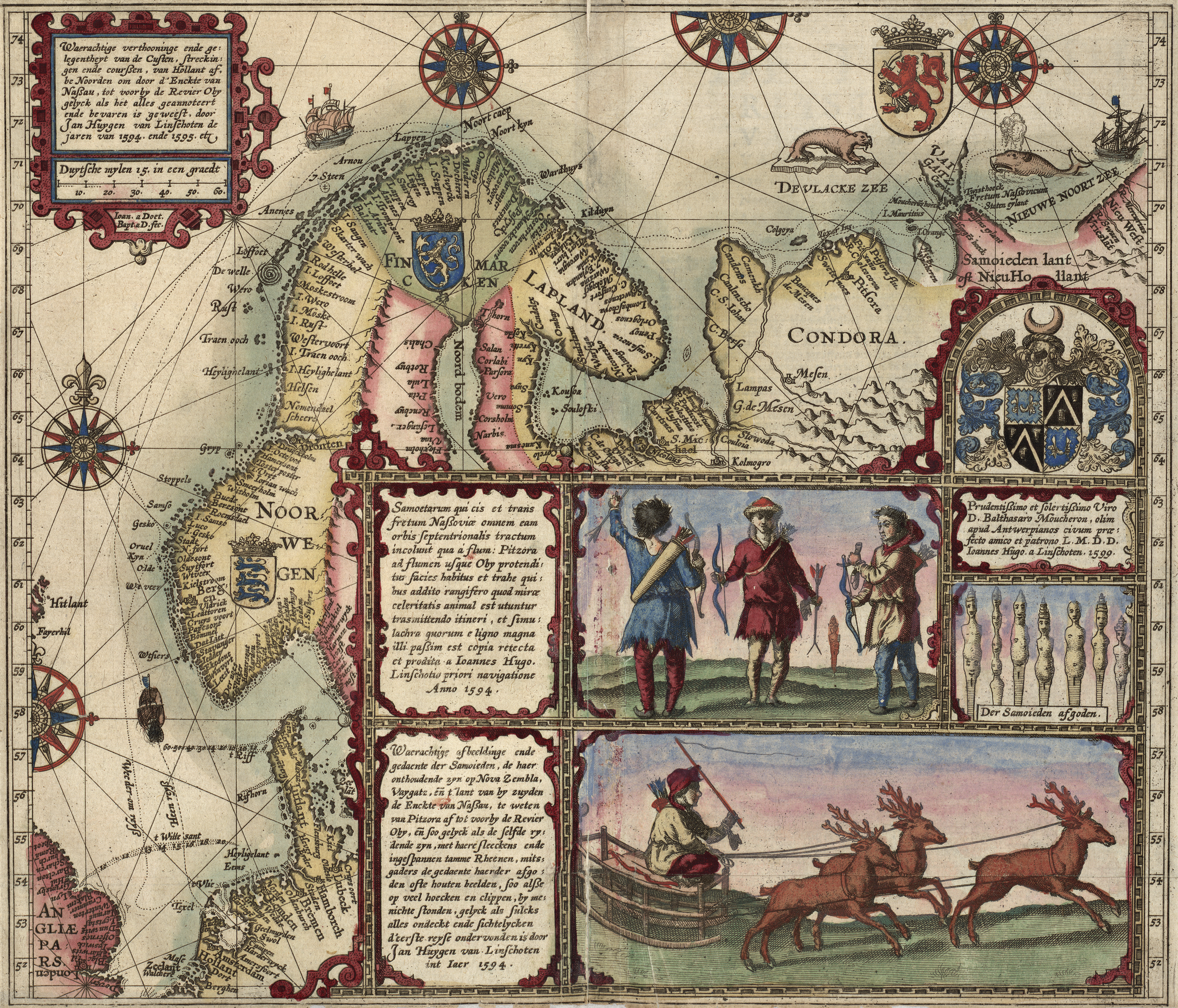
English: Latin Title: Samoetarum qui cis et trans fretum Nassouviae omnem eam orbis Septentrionalis tractum incolunt qua a flum: Pitzora ad flumen usque Oby protenditur facies habitus et trahe quibus addito rangifero quod mirae celebritatis animal est utuntur tra[n]smittendo itineri, et simulachra quorum e ligno magna illi passim est copia retecta et prodita a Ioannes Hugo. Linschotio priori navigatione Anno 1594.
Dutch Title: Waerachtige afbeeldinge ende gedaente der Samoieden, de haer onthoudende zyn op Nova Zembla, Vaygatz, en p lant van by zuyden de Enckte van Nassau, te weten van Pitzora af tot voorby de Revier Oby, en soo gelyck als de selfde rydende zyn, met haere sleeckens ende ingespannen tamme Rheenen, mitsgaders de gedaente haerder afgoden often houten beelden, soo alsse op veel hoecken en clippen, by menichte stonden, gelyck als sulcks alles ondeckt ende sichtelycken d'eerste reyse ondervonden is door Jan Huygen van Linschoten int Iaer 1594. Norsk bokmål: Trykket og håndkolorert kart i Linschotens reisebeskrivelse Voyagie, ofte Schip-Vaert som omhandler Willem Barents ekspedisjoner i nordområdene. |
| Date | Drafted 1590s, engraved 1599, printed 1599 or 1601 |
| Source | Norwegian National Library Flickr account, from a reprint—dated 1601 and placed at Franeker for no apparent reason—of a map originally printed for inclusion in the 1599 Latin version of Jan Huyghen van Linschoten's Itinerario (printed at the Hague by Albert Henri de Sallengre as "Alberti Henrici"), which included Linschoten's translation of Gerrit de Veer's journal of Willem Barentsz's voyages to the north in the 1590s, which Linschoten also took part in. |
| Author | Joannes van Doetecum and Baptista van Doetecum |
| Permission (Reusing this file) |
At the time of upload, the image license was automatically confirmed using the Flickr API. For more information see Flickr API detail. |
| Other versions |
|
| Flickr sets |
|
| Flickr pools |
|
| Flickr tags |
|
| Flickr posted date | 21 January 2014 |
_(2).jpg)


.jpg)
Licensing
This image was taken from Flickr's The Commons. The uploading organization may have various reasons for determining that no known copyright restrictions exist, such as:
More information can be found at https://flickr.com/commons/usage/. Please add additional copyright tags to this image if more specific information about copyright status can be determined. See Commons:Licensing for more information. |
| This image was originally posted to Flickr by National Library of Norway at https://flickr.com/photos/48220291@N04/12067624705. It was reviewed on 25 July 2015 by FlickreviewR and was confirmed to be licensed under the terms of the No known copyright restrictions. |
| Annotations | This image is annotated: View the annotations at Commons |
File history
Click on a date/time to view the file as it appeared at that time.
| Date/Time | Thumbnail | Dimensions | User | Comment | |
|---|---|---|---|---|---|
| current | 11:22, 22 March 2016 | | 4,037 × 3,455 (22.29 MB) | Alonso de Mendoza | Cropped 8 % horizontally and 4 % vertically using CropTool with precise mode. |
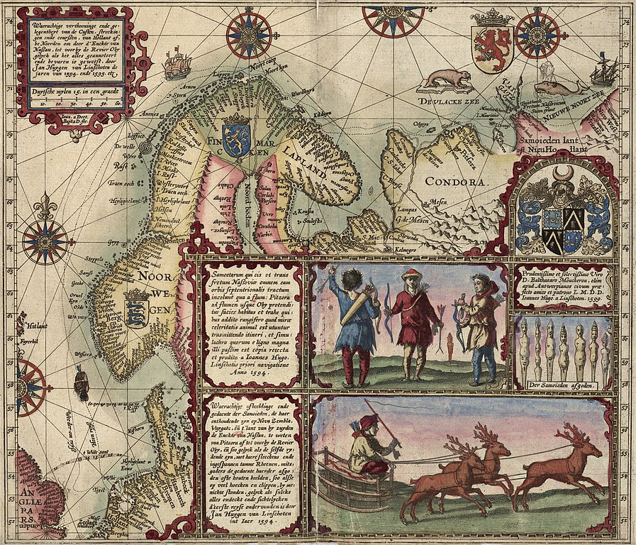
| 12:59, 25 July 2015 |  | 4,400 × 3,609 (22.96 MB) | Fæ | == {{int:filedesc}} == {{subst:chc}} {{information |description={{en|1='''Tittel / Title:''' Waerachtige verthooninge ende gelegentheyt van de Custen, streckingen ende<br> courßen, van Hollant af, be Noorden om door d'Enckte van Naßau, tot voorby<br>... |
File usage
Global file usage
The following other wikis use this file:
- Usage on ar.wikipedia.org
- Usage on ast.wikipedia.org
- Usage on ca.wikipedia.org
- Usage on da.wikipedia.org
- Usage on de.wikipedia.org
- Usage on es.wikipedia.org
- Usage on it.wikipedia.org
- Usage on kk.wikipedia.org
- Usage on la.wikipedia.org
- Usage on nl.wikipedia.org
- Usage on no.wikipedia.org
- Usage on oc.wikipedia.org
- Usage on ru.wikipedia.org
- Usage on sl.wikipedia.org
- Usage on sr.wikipedia.org
- Usage on zh.wikipedia.org
.jpg)