
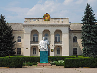
File:Liberal Arts College Dubăsari, Transnistria (14804623417).jpg

Original file (4,510 × 3,382 pixels, file size: 14 MB, MIME type: image/jpeg)
| This is a file from the Wikimedia Commons. Information from its description page there is shown below. Commons is a freely licensed media file repository. You can help. |
.jpg)
Summary
| Description |
Dubăsari and its suburbs were the site of major conflict during 1990-1992, that eventually degenerated into the War of Transnistria (1992). Since then, it has been controlled by the breakaway administration of Transnistria. Transnistria (also called Trans-Dniestr or Transdniestria) is a breakaway state located mostly on a strip of land between the River Dniester and the eastern Moldovan border with Ukraine. Since its declaration of independence in 1990, and especially after the War of Transnistria in 1992, it is governed as the Pridnestrovian Moldavian Republic (PMR, also known as Pridnestrovie) a state with limited recognition that claims territory to the east of the River Dniester, and also to the city of Bender and its surrounding localities located on the west bank, in the historical region of Bessarabia. The terms "Transnistria" and "Pridnestrovie" both reference the Dniester River. Pridnestrovie retains a strong pride in it's Russian and Soviet heritages. |
| Date | |
| Source | Liberal Arts College Dubăsari, Transnistria |
| Author | Clay Gilliland |
| Camera location | | View this and other nearby images on: OpenStreetMap |
|---|
.jpg¶ms=047.274886_N_0029.146480_E_globe:Earth_type:camera_source:Flickr_&language=en)
Licensing
- You are free:
- to share – to copy, distribute and transmit the work
- to remix – to adapt the work
- Under the following conditions:
- attribution – You must give appropriate credit, provide a link to the license, and indicate if changes were made. You may do so in any reasonable manner, but not in any way that suggests the licensor endorses you or your use.
- share alike – If you remix, transform, or build upon the material, you must distribute your contributions under the same or compatible license as the original.
| This image was originally posted to Flickr by Clay Gilliland at https://www.flickr.com/photos/26781577@N07/14804623417. It was reviewed on 29 April 2015 by FlickreviewR and was confirmed to be licensed under the terms of the cc-by-sa-2.0. |
File history
Click on a date/time to view the file as it appeared at that time.
| Date/Time | Thumbnail | Dimensions | User | Comment | |
|---|---|---|---|---|---|
| current | 11:55, 29 April 2015 | | 4,510 × 3,382 (14 MB) | Butko | Transferred from Flickr via Flickr2Commons |
File usage
Global file usage
The following other wikis use this file:
- Usage on cs.wikipedia.org
- Usage on es.wikipedia.org
- Usage on et.wikipedia.org
- Usage on fr.wikipedia.org
- Usage on id.wikipedia.org
- Usage on ja.wikipedia.org
- Usage on nl.wikipedia.org
- Usage on pl.wikipedia.org
- Usage on ro.wikipedia.org
- Usage on sr.wikipedia.org
.jpg)