
File:Lewis and Clark NRW Map.png
Size of this preview: 800 × 567 pixels. Other resolutions: 320 × 227 pixels | 640 × 453 pixels | 1,024 × 725 pixels | 1,280 × 907 pixels | 2,560 × 1,813 pixels | 3,600 × 2,550 pixels.
Original file (3,600 × 2,550 pixels, file size: 5.65 MB, MIME type: image/png)
| This is a file from the Wikimedia Commons. Information from its description page there is shown below. Commons is a freely licensed media file repository. You can help. |
Summary
| Description |
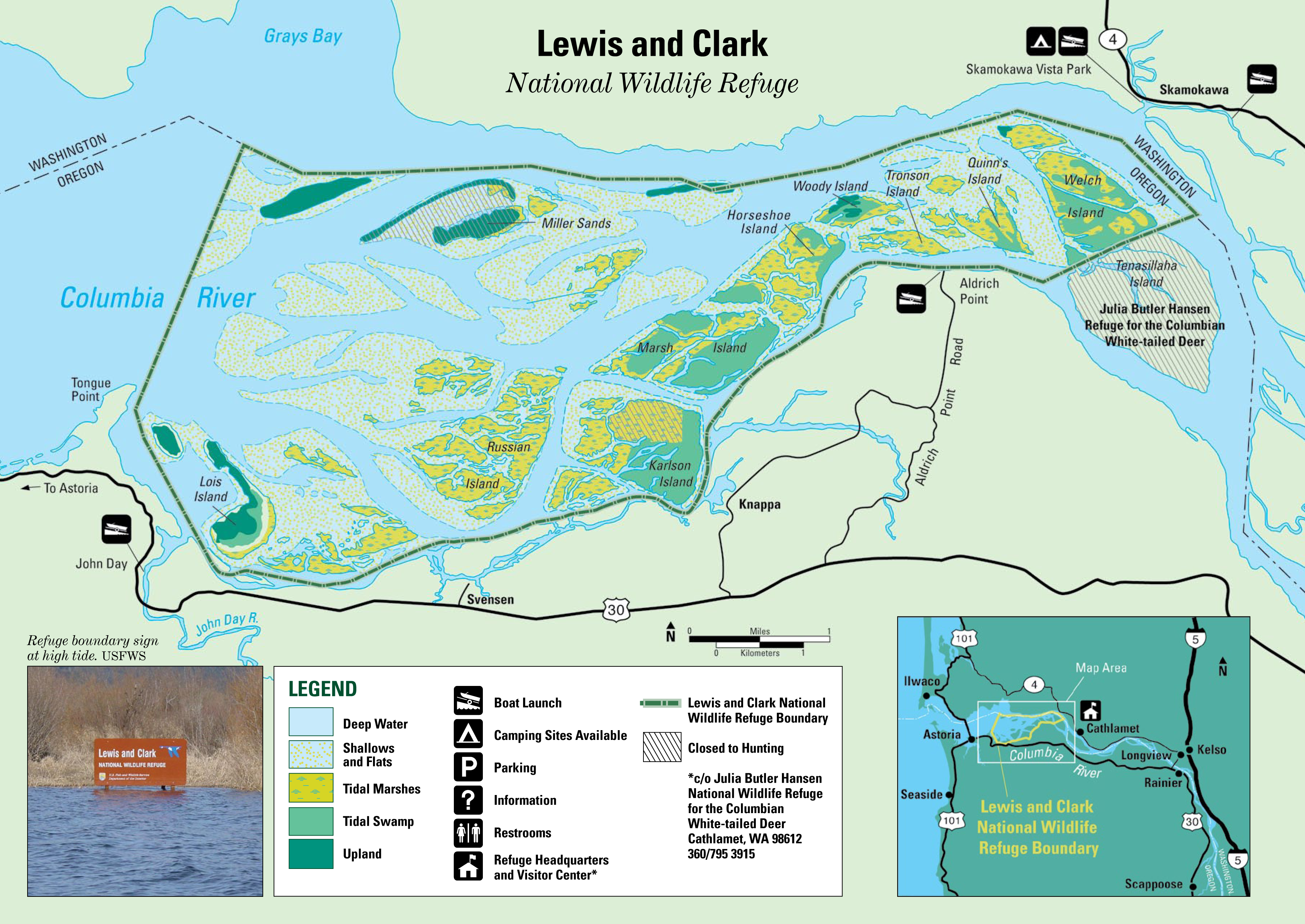
English: Map of the Lewis and Clark NRW in Oregon and Washington |
| Date | |
| Source | http://www.fws.gov/lc/PDF/L&C%20NWR%20Map.pdf |
| Author | Assumed to be an employee of the federal government |
Licensing
This image or recording is the work of a U.S. Fish and Wildlife Service employee, taken or made as part of that person's official duties. As a work of the U.S. federal government, the image is in the public domain. For more information, see the Fish and Wildlife Service copyright policy.
|
 |
File history
Click on a date/time to view the file as it appeared at that time.
| Date/Time | Thumbnail | Dimensions | User | Comment | |
|---|---|---|---|---|---|
| current | 23:37, 29 March 2012 | | 3,600 × 2,550 (5.65 MB) | Droll |
File usage
The following pages on the English Wikipedia use this file (pages on other projects are not listed):
Global file usage
The following other wikis use this file:
- Usage on ceb.wikipedia.org
- Usage on cs.wikipedia.org
- Usage on www.wikidata.org